Connecting disaster risks, climate and biodiversity: insights from the Second GEO Open House Webinar
I had the pleasure of co-organising and moderating the second GEO Open House Webinar in my role as co-chair of the Disaster Risk Reduction & Adaptation Working Group (DRRA-WG).
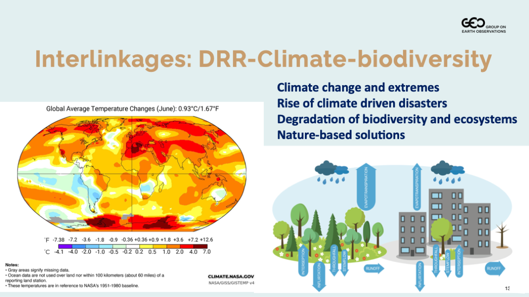
A central message from the discussion was that disaster risk, climate change, and biodiversity loss are deeply interconnected and must be addressed together. As climate change accelerates, hazards such as droughts, floods, and wildfires are becoming more frequent and intense, while ecosystem degradation is increasing vulnerability to these risks.
At the same time, ecosystems provide part of the solution as buffers to reduce impacts and support resilience. This is where nature-based solutions become essential, and where Earth observations play a critical role in understanding, monitoring, and informing action.
Operationalising the DRR–climate–biodiversity nexus
The five GEO activities presented demonstrate how this nexus is addressed in practice.
- GEO-LDN showed how land degradation is both a driver and consequence of climate risks. By supporting countries with tools and data for land monitoring and restoration planning, it contributes directly to reducing vulnerability while strengthening ecosystem resilience.
- GEO-TREES is building a global forest biomass reference system by combining satellite data with in-situ tree-by-tree measurements. This strengthens the credibility of Earth observations for climate, biodiversity, and risk-informed land management, and highlights the importance of sustained ground-based observations.
- GEOARC focuses on integrating fragmented ecosystem and environmental datasets across domains, helping to better understand how environmental change translates into risk. This supports more coherent analysis across climate, biodiversity, and hazard dynamics.
- Digital Earth Africa provides operational, analysis-ready data and platforms that support routine monitoring of land and water systems. This enables countries to move from data access to decision-making, including in rapidly changing and risk-prone urban environments.
- GEO Indigenous Alliance brings an essential perspective by linking Earth observations with Indigenous knowledge systems and governance. The Alliance links Earth intelligence with Indigenous governance, place-based knowledge, and stewardship, and provides tools such as an Ethical Toolkit for biodiversity data and AI.
Three priorities emerged from the discussion.
- First, risks such as drought and ecosystem degradation are connected challenges, not separate problems. Addressing them requires integrated approaches across climate, biodiversity, and disaster risk reduction.
- Second, in-situ observations are fundamental to making this nexus operational. Without strong ground-based data, satellite observations cannot fully support reliable decision-making.
- Third, the nexus must be translated into real-world decision contexts, including urban environments where risks, exposure, and vulnerability are increasingly concentrated.
From discussion to collaboration
This webinar helped us identify where collaboration is needed.
Insights will feed into an upcoming Joint GEO Working Groups community event at the GEO Symposium, where the DRRA-WG will work with the Resilient Cities and Human Settlements and Data and Knowledge Working Groups, together with relevant GEO Work Programme activities, to define a small set of concrete collaborative actions.
This includes strengthening the urban dimension of ongoing work, advancing the implementation of the GEO In-situ Data strategy, and improving how Earth Intelligence supports decision-making across the DRR–climate–biodiversity nexus.
The connections are already clear. The next step is to act on them together.
All materials from the GEO Work Programme Open House Webinar #2, including the presentations, are available on the GEO Knowledge Hub. This blog is part of a series based on the presentations made during the webinar, including a summary by the Programme Board co-chair, and entries covering GEO-TREES, GEO-LDN, GEOARC, Digital Earth Africa, and GEO Indigenous Alliance.