GEO Global Water Sustainability
GEOGLOWSFlagshipAddresses global water sustainability through Earth observation-based solutions.
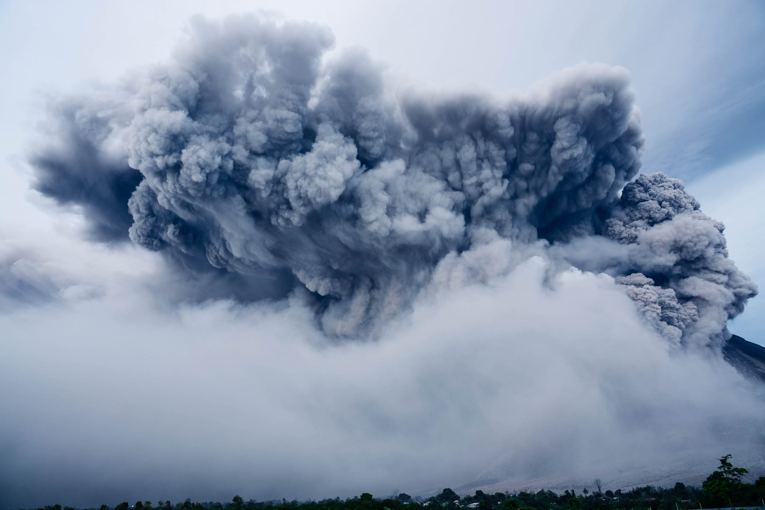
Weather, Hazard and Disaster Resilience is a key priority, as hazards such as severe weather, pandemics, and security threats hinder economic and social progress. Building systems to anticipate, respond to, and recover from such events is essential for sustainable development.
GEO supports this by coordinating data from satellites, radars, and other sources when manual collection is difficult, providing critical insights for prediction, impact reduction, and recovery, and strengthening decision-making and resilience.
Using Earth Intelligence, GEO activities such as GEOGLOWS, Geohazard Supersites and Natural Laboratories and Global Wildfire Information System support:
Addresses global water sustainability through Earth observation-based solutions.
Monitors geohazards to reduce risks and enhance preparedness.
Enhances wildfire monitoring and risk assessment using Earth observations.
Enhances disaster resilience through Earth observations.
Monitors night-time light to assess socio-economic activities.
An autonomous decision-making system for slope risk assessment and landslide mitigation based on multimodal large models.
Uses Earth observations for enhancing security applications.
This work advances:
GEO will continue to strengthen partnerships, expand community engagement, and enhance the application of Earth Intelligence in building disaster-resilient societies worldwide.
Focuses on Earth observations for cryosphere monitoring and research.
Maps human presence to inform sustainable development strategies.
Advances Earth observations for monitoring mountain ecosystems.
Monitors vegetation health for early pest and disease detection.
Innovative service using Earth Intelligence to identify heat risks, support cooling strategies and enhance resilience in urban areas.
Hydrometeorological data in Africa should be publicly available, open, and free, but there is a lack of resources to realize this.
Focuses on global water quality monitoring and management.
Addresses environmental challenges unique to the Arctic.
Focuses on ocean and coastal observations to support sustainable use.
Monitors impacts of climate on urban heritage sites.
Provides accessible Earth observation data to support sustainable development in Africa.
Advancing and operationalizing Digital Earth, at an initial stage, through the Earth Observation (EO) Data Cubes efforts, with a focus on implementing global principles in local contexts
Provides tailored Earth observation solutions for Pacific Island nations.
Strengthens Earth observation capacities across the region.
GEO-IA contributes to a more inclusive, equitable, and sustainable approach to Earth observation initiatives that benefit Indigenous communities, the scientific community, and global efforts to harmoniously coexist with our planet.
A step toward realizing the massive untapped potential for GEO and GEO Youth to mutually benefit from critical, deliberate engagement with one another.
Fostering collaboration and strengthening the networks of women’s participation in marginalized communities within these fields is essential for building a collaborative, accessible Earth data ecosystem
An international community focused on the value and socioeconomic impacts of geospatial information for decision-making