
GEO Land Degradation Neutrality
Challenge
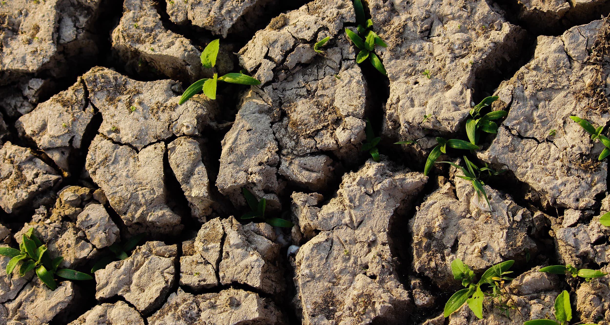
Up to 40% of the world’s land is degraded, affecting half of humanity and having dire consequences for our climate, biodiversity, and livelihoods. We are degrading 100 million hectares of healthy and productive land each year. If current trends continue, restoring 1.5 billion hectares of land by 2030 will be necessary to achieve a land degradation-neutral world.
Global voluntary commitments to restore degraded land have reached one billion hectares by 2030, but this will require the ability to map and monitor land degradation at the national level across all land types. Without this information, investments, policies, and interventions will be ineffective.
Solution
The GEO Land Degradation Neutrality (GEO-LDN) Initiative aims to improve land degradation monitoring and mapping while also contributing to land degradation neutrality (LDN).
GEO-LDN does this through four key services: facilitating access to space-based information and in situ measurements; providing expertise, tools, and training to build national capacities; assisting with the further development of international standards for geospatial indicators; and supporting robust Earth observation value chains that provide co-designed Earth insights and intelligence for decision-making.
Intended Socioeconomic and Environmental Impact
The ultimate goal of GEO-LDN is to reduce the extent of degraded land and support the achievement of land degradation neutrality by 2030 (SDG target 15.3) by strengthening countries’ capacity to utilize coordinated, comprehensive, and sustained Earth observations for integrated land use planning, evidence-based decision-making, as well as monitoring and reporting of progress towards national and global restoration commitments. Optimizing how land is used and managed across the landscape can contribute to climate and biodiversity targets, close the food gap, and promote human health, economic growth, prosperity, and well-being. In fact, healthy land can accelerate the achievement of all 17 Sustainable Development Goals.
Objectives for 2025–2030
The GEO-LDN Flagship will continue to be a close partner for the UNCCD in the coming five years, fulfilling its mandate received through decisions of previous UNCCD Conference of the Parties (COP). Current efforts are the creation of higher-resolution, multi-decadal time series of satellite data for the SDG 15.3.1 sub-indicators, especially for small countries, including SIDS. GEO-LDN will also improve support for other geographies and landscapes where existing methods and data availability are not ideal, such as mountainous, tropical areas and desert landscapes.
Building on developed minimum quality standards, a standard for geospatial reporting indicators will be established through the Open Geospatial Consortium (OGC), benefiting all SDG indicator reporting.
Further global and regional dialog formats and the expansion efforts of Working Group 4 (“Decision support”) aim to double our capacity for outreach and engagement.
The close contact with implementing government authorities and national experts in countries affected by land degradation worldwide enables GEO-LDN to provide recommendations to UNCCD, also for the post-2030 agenda and the reframing of the SDGs.
Additional efforts will be made to leverage synergies between the three Rio Conventions and to collaborate and exchange with the GEO activities supporting those conventions. An example is the connection with UNCBD and GEO BON regarding targets of the Kunming-Montreal Global Biodiversity Framework (GBF). SDG Indicator 15.3.1, which underpins the UNCCD LDN framework, has been endorsed by the Subsidiary Body on Scientific, Technical and Technological Advice (SBSTTA) of the CBD as a component indicator under Target 2. Minimizing the reporting burden is a key feature of the SDG process, and the dual use of SDG indicator 15.3.1 to underpin LDN and the GBF is a great example for synergies between UNCCD and UNCBD, further extending our opportunity for outreach.
Collaboration with GEOGLAM will be enhanced at both the national and regional levels. National entry points for GEOGLAM products and services in LDN interventions will be identified and tested in at least one pilot country. The two Flagships will collaborate at the regional level to develop GEO Helpdesks as a readily accessible entry point for countries to get technical advice on using EO data for their specific challenges.
GEO-LDN will continue to develop the LDN toolbox as an easily accessible, user-oriented entry point to Earth observation and decision-support tools for experts and non-experts alike. New tools will be added as they become available or are co-created according to demand. Particular attention is paid to increased federation of content and the underlying interoperability of toolbox elements. The potential of the GEO Knowledge Hub to host documentation of use cases and workflows, and possibly the toolbox itself, is being assessed at this time.
How We Work
The governance structure of GEO-LDN consists of four structural elements:
The Group of Members represents key stakeholder groups of the network. It validates and legitimizes strategic decisions of the Flagship through the election of members of the Leads Group.
The Leads Group oversees resource allocation and provides strategic guidance to the Working Groups. It consists of 12 members from the Working Groups and other relevant institutions.
The four Working Groups carry out the operational work of GEO-LDN and provide thematically organized services to the network.
The Secretariat coordinates operations and supports the Leads Group and the Working Groups.
Donors
Partners
GEO Members
GEO Participating Organizations
Points of Contact

Australia, Commonwealth Scientific and Industrial Research Organisationthe.neil.sims@outlook.com
Secretariat of the United Nations Convention to Combat Desertificationsminelli@unccd.int

National Center for Vegetation Cover Development and Combating Desertificationnsims@ncvc.gov.sa