Night-Time Light Remote Sensing for Sustainable Development Goals
Challenge
GEO Night Light, a Pilot Initiative of the GEO Work Programme 2023-2025, was set up to support the 2030 Sustainable Development Goals by using night-time light remote sensing. It has achieved significant international impact, attracting more scientists and users to join and build a wider network. However, the current GEO Night Light team is small, with China and the United Nations Satellite Centre as its two major members, and this limitation has hindered wider applications of GEO Night Light because its channels to deliver products and receive requests are narrow. Therefore, it is urgent to upgrade GEO Night Light team with more participants and greater diversity.
Solution
We aim to upgrade GEO Night Light from a Pilot Initiative to an Initiative in the Post-2025 Work Programme. During the post-2025 period, we will make GEO Night Light more actionable and more beneficial to users.
Firstly, new participants will include international organizations, such as UNOOSA and UN-Habitat, which are also users of GEO Night Light. Secondly, the participants will be much more regionally representative, especially in the Global South. Lastly, we will add experts from well-known global institutes (e.g., NASA and CBAS), who are able to provide high-quality night-time light data and related products.
Intended Socioeconomic and Environmental Impact
GEO Night Light is expected to make (but not limited to) the following impacts. Firstly, disaster products from night light data will help humanitarian relief organizations provide more efficient aid and, thus, may save lives. Secondly, light pollution maps and reports from night light data will help persuade municipalities and national park managers to control light pollution, which will help save energy and protect local residents and ecosystems from light pollution. Thirdly, wealth index maps from night light data will help development agencies take poverty reduction actions in regions and for populations that need aid the most. Fourthly, the urban living condition evaluation product will help development organizations rehabilitate cities in the Global South.
Objectives for 2025–2030
The following are the four products that will be provided by GEO Night Light in the post-2025 period:
Humanitarian Disaster Evaluation Report:
Activated by users, we will provide power supply evaluation and regional damage reports for major disasters and conflicts each year. The way to produce and release these products is relatively mature within GEO Night Light, but users will be expanded to more international organizations, such IFRC, ICRC, and WFP.
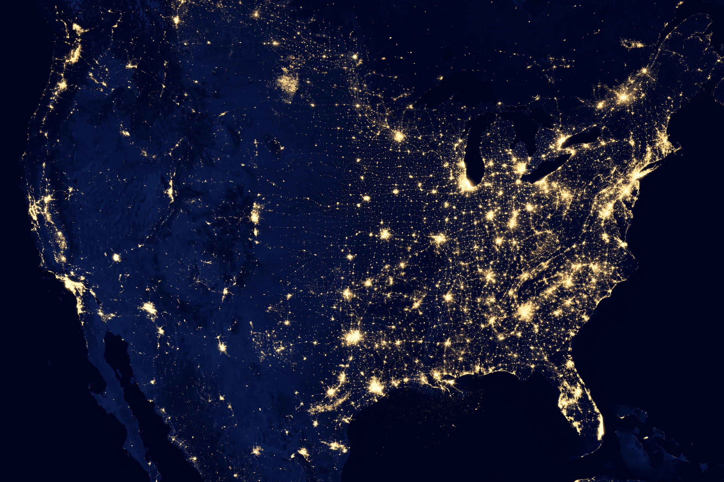
Light Pollution Map and Evaluation Report:
We will produce a global light pollution change monitoring map annually, and we will evaluate the impact of light pollution on biodiversity in cities and ecological protection areas. This product will directly support biodiversity conservation and dark sky protection by controlling light pollution, and users will include UNEP and environmental protection organizations.
Wealth Index Map:
The Wealth Index is the foundation for estimating poverty and economic development for the SDGs. Currently, Wealth Index data consists of sparsely available ground-survey data. Our product will be at 500-meter resolution over the African Continent, Southeast Asia, and Latin America, as well as other regions in need of assessment, and it will be updated annually. In this product, there will be a special subproduct for indigenous settlements, for which the production process will incorporate indigenous knowledge. It will help users, such as UNDP and the Asian Development Bank, make more accurate decisions on poverty reduction.
Urban Living Condition Report:
The comprehensive living conditions, considering lighting infrastructure and other factors, such as greenery, will be evaluated for cities with more than five million people in the Global South. This kind of evaluation report will add knowledge to the World Cities Report produced by UN-Habitat.
How We Work
GEO Night Light will have more than 30 individual participants, and the organizational structure is simple. Each lead, with a strong technical background in night-time light remote sensing, will direct one or two sub-teams of GEO Night Light. Each lead or other core member will be connected to one or more users/stakeholders and will discuss with them to design and deliver appropriate products. Some of the GEO Night Light participants are also users, such as experts from UN-Habitat, who not only work on providing products but also use and share the products with their colleagues in UN-Habitat.
Donors
Partners
GEO Members
GEO Participating Organizations
Non-affiliated
Points of Contact