
United States, National Oceanic and Atmospheric Administrationangelica.gutierrez@geoglows.org
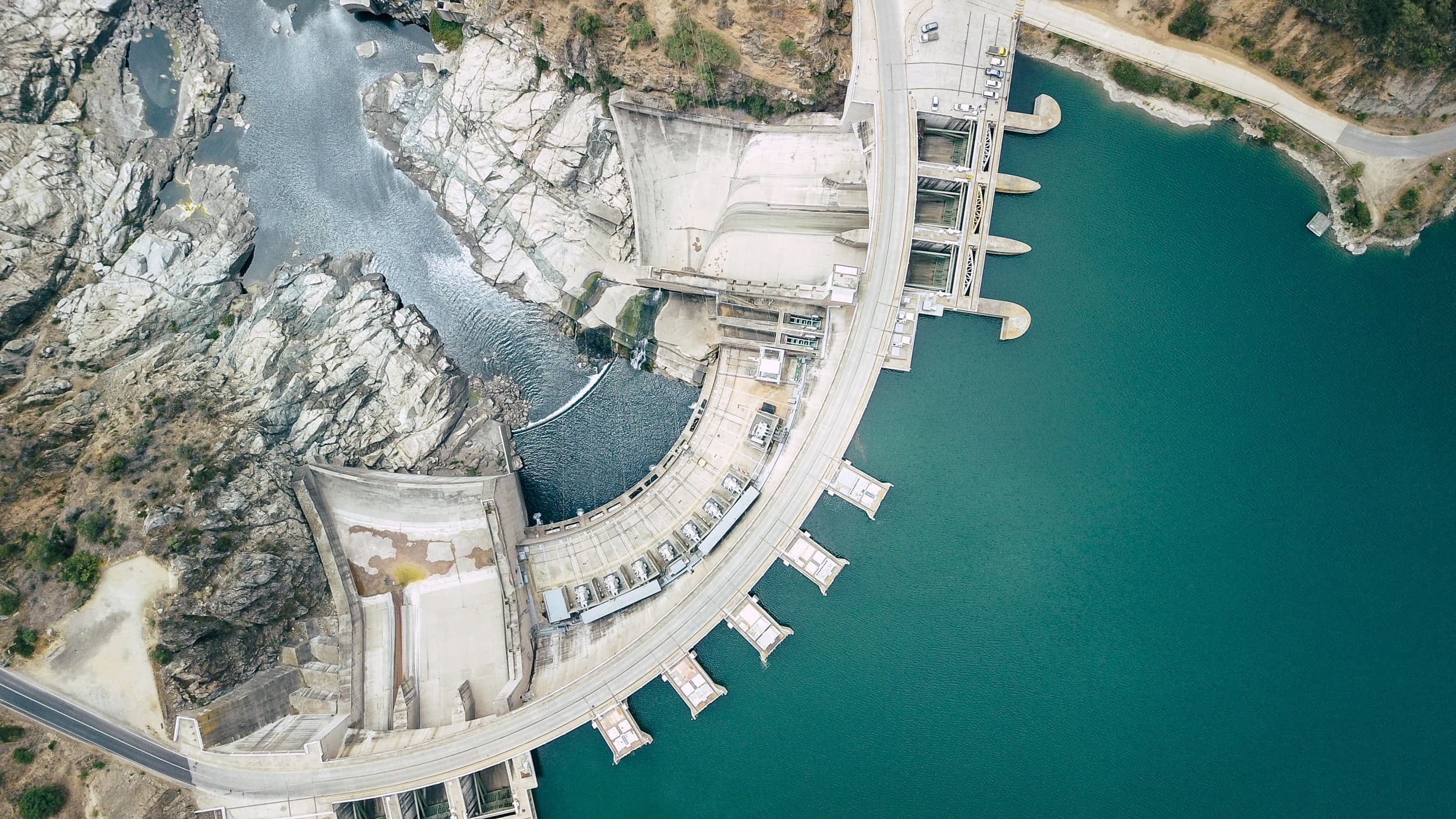
Water security, a global issue with significant political, economic, social, and environmental implications, is not just a crucial factor but a fundamental necessity for maintaining stability across the world. Its importance cannot be overstated.
Many countries face the urgent task of maintaining monitoring networks and developing and providing information critical for protecting lives and property while supporting economic prosperity. The repercussions of insufficient water information and forecasting can be dire, especially for vulnerable regions and communities that may not receive timely warnings about potential flooding. The lack of water information leads to increased damage and loss of life. It disrupts planning for water resource allocation in agriculture, hydropower generation, and domestic use.
A critical challenge in achieving global water security is the fragmentation and inconsistency of water data infrastructure across different regions, organizations, and scales. However, the potential for significantly improved decision-making with unified data systems is a beacon of hope in this scenario. While vast amounts of water data exist globally, they often remain siloed, using different identifiers, formats, and access methods. This creates significant barriers to discovering and integrating relevant water data across jurisdictional boundaries, especially during critical events that affect multiple regions. The lack of a unified, standards-based approach to water data publication and discovery means valuable information about water resources often remains hidden or underutilized, hampering effective water management and response to water-related challenges, especially in developing accurate hydrological forecasting.
The lack of actionable information poses significant risks to infrastructure and disrupts economic activities due to unexpected flooding or droughts. Without timely information, policymakers are left grappling with the challenges of planning and mitigating droughts or floods, leading to inefficient resource management and heightened costs. Initiatives such as the United Nations’ Early Warnings for All underscore the critical need for timely and actionable water data to enhance decision-making and reduce crisis vulnerability.
Equity is the cornerstone of GEOGLOWS, ensuring fair treatment and equal opportunities for all users, regardless of their individual circumstances. GEOGLOWS provides global, free, open access to high-quality information on streamflow forecasts, historical streamflow data, and other related products, thereby connecting stakeholders from all corners of the world in the shared goal of effective water resource management.
Since its inception, GEOGLOWS has been a groundbreaking technology that revolutionizes the generation of hydrologic information. It is distinct for its unique approach to providing tailored hydrologic data services, which help bridge global knowledge and information gaps. Through a user-driven approach, GEOGLOWS ensures that stakeholders are integral to its success, identifying cost-effective and trustworthy EO components that improve the service to meet policy and decision-making needs. GEOGLOWS integrates EOs, models, and cutting-edge technologies to provide Earth Intelligence on water security.
The benefits of water information and forecasting are significant for water resources management, including more efficient resource allocation and reduced economic costs. However, the most crucial benefit is the potential to save lives. GEOGLOWS provides reliable 15-day ensemble forecasts and 80 years of historical streamflow data for every river in the world through a free and open web service. GEOGLOWS has been recognized by the WMO as an important initiative contributing to the objectives of the UN Secretary-General’s call to ensure the implementation of “Early Warnings for All” by 2027.
GEOGLOWS has been designed as a supportive tool for local forecasters, with an emphasis on the crucial role of local knowledge and monitoring networks. In situ water data is part of the downscaling process from global to local information and the cornerstone of accurate streamflow forecasting. This collaborative approach ensures that GEOGLOWS is not just a global flagship but one that is deeply rooted in local expertise and understanding.
The Geoconnex system, currently operating in the United States, could provide a foundational data infrastructure solution supporting GEOGLOWS if extended to a global scope by creating a globally scalable infrastructure for water feature and monitoring data discovery and integration. Geoconnex enables discovery and linking of water-related geospatial features—like rivers, watersheds, aquifers, monitoring locations, and water infrastructure facilities—by establishing persistent identifiers for these features and standardized metadata publishing patterns. HydroServer complements this by providing the infrastructure to collect, store, manage, and share time series observations (like streamflow, water quality, or groundwater levels) from monitoring locations that can be linked to the features indexed in Geoconnex.
Together, these platforms support GEOGLOWS by providing the linking infrastructure needed to connect GEOGLOWS forecasts with both the social and hydrologic context for any given river reach of interest and the local observational data that can feed or benchmark forecast models. For example, a monitoring location identified in Geoconnex can be linked to both its position on a specific river reach and to its historical streamflow observations stored in HydroServer, allowing GEOGLOWS forecasts to be evaluated and bias-corrected using local data. The Geoconnex approach of using linked data principles and community reference features allows organizations to maintain sovereignty over their data while making both water features and their associated observations discoverable and interoperable within a global context.
The GEOGLOWS Flagship is poised to transform water security by delivering critical Earth Intelligence to local stakeholders. Through enhanced data access and global hydrologic modeling, we aim to mitigate the socioeconomic impacts of floods and droughts, thereby reducing loss of life and economic hardship.
GEOGLOWS, in collaboration with the Lincoln Institute of Land Policy, the USGS, and Utah State University, is expanding its infrastructure capabilities to include Geoconnex, a community open-source project using persistent HTTP Uniform Resource Identifiers (URI) and associated web resources for spatial features that are meaningful to environmental science, and HydroServer, a comprehensive platform for water data collection, management, and sharing. This collaborative approach empowers vulnerable communities to implement effective water management practices, paving the way for sustainable development and resilience against climate impacts.
The expansion of Geoconnex to a global scope and its integration with GEOGLOWS, along with capacity development for data publication software suites such as HydroServer, would enable innumerable water data providers and users worldwide to place their data in local and regional contexts while enriching global forecasts with additional observational data.
For example, during transboundary flood events, emergency managers in shared river basins like the Mekong could rapidly discover and access information about flood control structures, port facilities, and power infrastructure from multiple countries alongside GEOGLOWS forecasts, improving response coordination. Agricultural planners could integrate local groundwater monitoring with regional streamflow and global drought forecasts to better manage irrigation scheduling. Dam operators along major rivers could combine upstream monitoring data from multiple agencies with forecast products to optimize reservoir operations while meeting downstream ecological flow requirements. Water quality managers could link point source monitoring data with watershed characteristics and streamflow predictions to better understand and manage pollution risks.
By providing the digital infrastructure to link water data across borders, Geoconnex and HydroServer will amplify the impact of the GEOGLOWS streamflow service by connecting their outputs with the entire ecosystem of water information. This would create a more complete and nuanced understanding of water resources globally while respecting the autonomy and expertise of local data providers, ultimately enabling more informed and coordinated water management decisions at all scales.
We aim to reach a high level of maturity and independence while remaining open to permanent innovation in delivering actionable information through open data and services using a global hydrologic model. GEOGLOWS will seek to empower local decision-makers, making them integral to solving the interconnected issues of water security and achieving the objectives of EW4ALL. GEOGLOWS seeks to remain in the GWP as a Mature Flagship, maintain the GEO brand, and exploit further opportunities for advancement and synergy.
Looking ahead to activities post-2025, we aim to strategically expand our collaborations to include essential elements of the service, such as flood mapping, groundwater information, infrastructure for data management, and satellite water altimetry data. To achieve these objectives, we will connect projects sponsored by programs supporting innovation and co-creation development to advance water prediction and thus build community resilience to water-related challenges. Sharing data and expertise with other countries, particularly through organizations like the World Meteorological Organization (WMO), can significantly enhance our collective ability to provide accurate hydrological forecasts.
We will also integrate the theory of change in our capacity development initiatives to adequately measure the comprehensive impact of GEOGLOWS on climate change and adaptation, and to build confidence by effectively responding to stakeholder needs. Importantly, we are committed to continuously enhancing our service’s functionality, ensuring it remains adaptable and future-ready by incorporating additional internet technologies for improved data access.
The GEOGLOWS Steering Committee provides strategy, policy, and technically related advice and recommendations to GEOGLOWS and to GEO when and as necessary and assesses progress on GEOGLOWS activities.