From GeoAI innovation to impact: the GEO community at AI for Good 2026
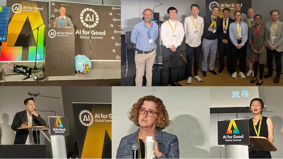
The GEO community showed up in force at this year's AI for Good Global Summit in Geneva, putting Earth observations at the heart of discussions about the use of AI in tackling critical global challenges, from healthcare and education to climate action and disaster response.
Organised by International Telecommunication Union (ITU) in partnership with more than 50 UN agencies and co-convened by Switzerland as part of Geneva Digital Week, the Summit is the leading United Nations platform for identifying practical applications of AI to advance the Sustainable Development Goals and Global Digital Compact.
Building on GEO’s participation in 2024 and 2025, GEO community members contributed across three interconnected areas: advancing GeoAI, strengthening Early Warnings for All and engaging young people in climate action.
Advancing GeoAI for people and the planet
At "GeoAI for our shared future: Geospatial foundation models and generative intelligence for people and the planet" members of GEO’s AI for Earth Observations (AI4EO) community explored emerging GeoAI capabilities and the conditions needed to use them responsibly.
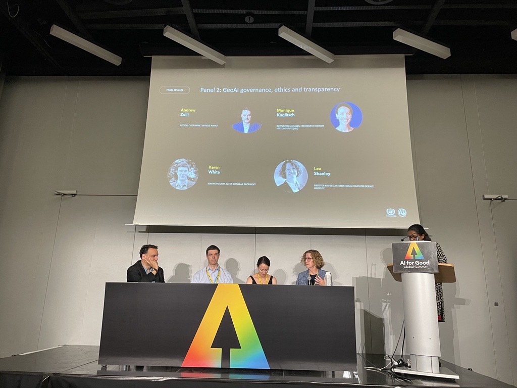
Lea Shanley, a member of GEO AI4EO and GEO’s Data and Knowledge Working Group (DK-WG), contributed perspectives on GeoAI governance, ethics and transparency, highlighting the importance of responsible approaches as increasingly powerful AI models are applied to geospatial information.
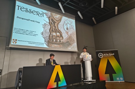
The session also showcased emerging technical applications. Gregory Giuliani, active in AI4EO, DK-WG as well as the GEO Infrastructure Development Task Team (GIDTT), presented work using geo-embeddings to improve environmental descriptors for land-cover mapping, while Zhengpeng Feng (also from AI4EO) introduced TESSERA, a geospatial foundation model for label-efficient and multimodal Earth observation applications.
Wenbo Chu of the GEO Secretariat presented the results of the "Reaching new heights with GeoFM embeddings Challenge", led by the European Space Agency with support from GEO, ITU and other partners. The challenge invited participants to develop applications using embeddings generated by geospatial foundation models, with winning teams presenting their solutions at the Summit after Wenbo’s introduction.
Bringing AI into Early Warnings for All
Practical application was central to the "AI for Early Warnings for All: From innovation to impact" session.
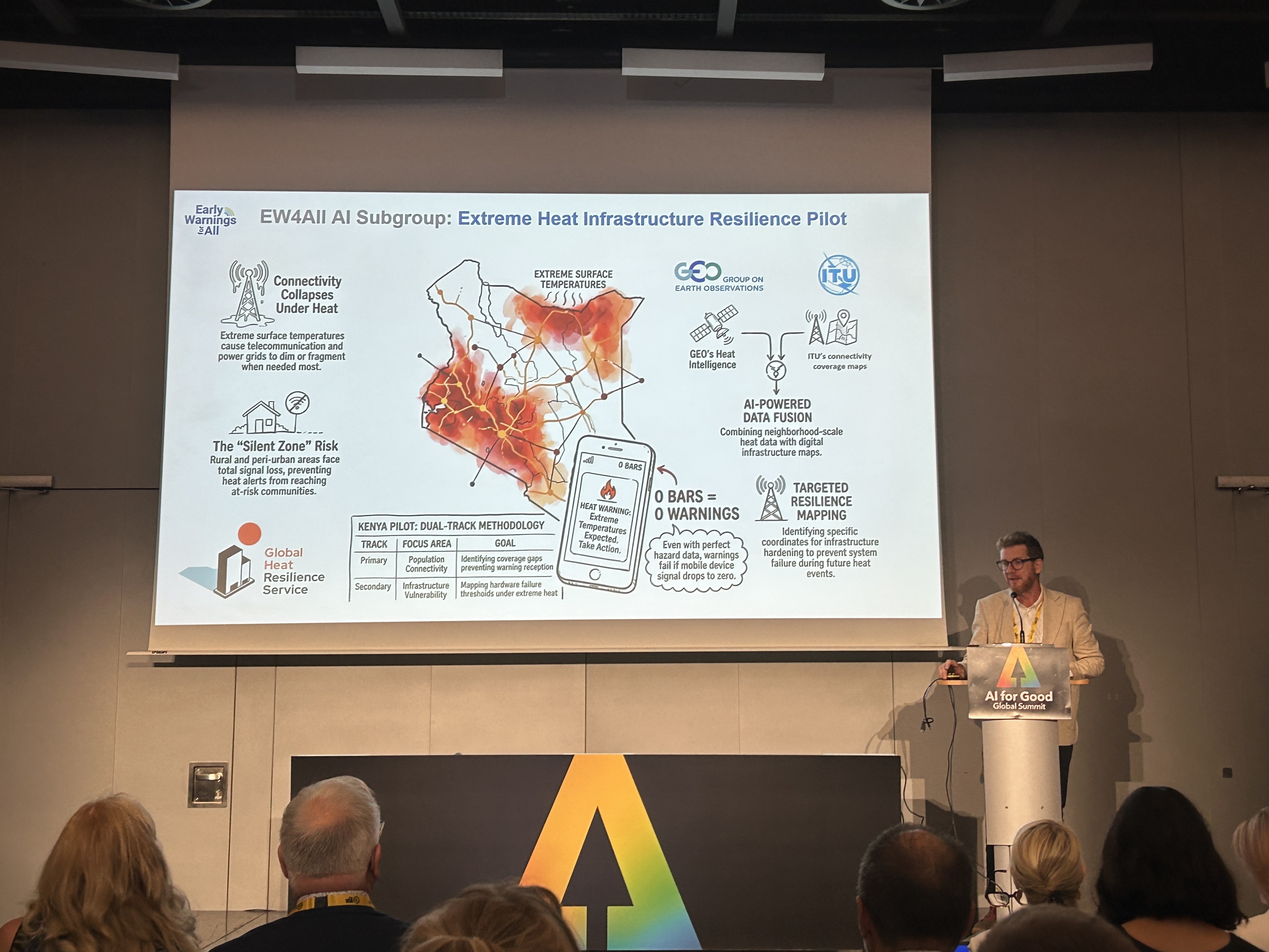
Martyn Clark of the GEO Secretariat introduced an upcoming ITU-GEO project in Kenya on extreme heat and critical infrastructure resilience, as an official pilot of the Early Warnings for All AI subgroup and leveraging experience from the Global Heat Resilience Service (GHRS).
The proof-of-concept will explore how AI and AI foundation models can be used to downscale weather and climate data and combine it with infrastructure and telecommunications network information. This actionable intelligence can help national meteorological and hydrological services, disaster management agencies and other actors identify gaps and better reach vulnerable communities.
GHRS and other GEO Work Programme activities were also featured in the AI Solutions Catalogue launched alongside new work on AI for Early Warnings for All.
Jumpei Takami of UNOOSA/UN-SPIDER, a member of the Earth Observations for Disaster Risk Management (EO4DRM) initiative, presented AI-enabled asset mapping and scenario modelling for coastal risk intelligence in Tonga, a use case featured in the subgroup's "Leveraging AI to Enhance Multi-Hazard Early Warning Systems" report.
Shaping the future of GeoAI
At "Planet protectors: GeoAI heroes for climate action", Marta Koch, Programme Co-Lead of the GEO Youth Community of Practice, led young participants through game-based model building and training using GeoAI, combining AI and digital maps to explore and address climate challenges in extreme environments.
GEO partners also took part in the Summit’s main-stage discussions, including Will Marshall of Planet and Wang Jian of Zhejiang Lab and Alibaba Cloud, bringing perspectives from the wider Earth observation and technology community to discussions on the future of AI for good.
Across these contributions, there was agreement that AI capability alone does not create impact. GeoAI needs trustworthy governance, connections to operational needs, integration across different data sources, and pathways that bring useful information to institutions and communities.
-----
This is the first in a three-part GEO blog series on the AI for Good Global Summit 2026. Forthcoming blogs about in-depth stories behind the presentations by Jumpei Takami and Marta Koch. The authors wish to thank Dr Andrea Manara, Dr Rosie McDonald, Prof Maria Antonia Brovelli, Mr Guillem Martínez Roura, for making the above-mentioned AI for Good Global Summit workshops and sessions possible.