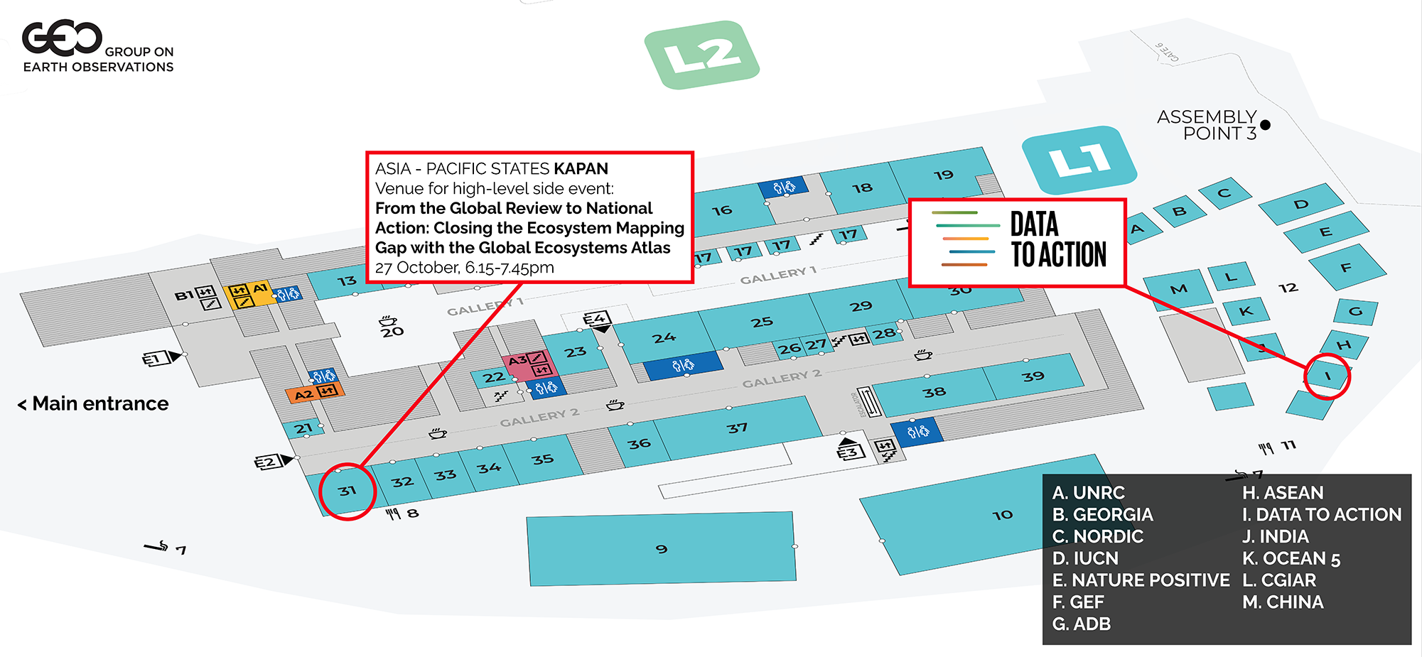
High-level side event
From the Global Review to National Action: Closing the Ecosystem Mapping Gap with the Global Ecosystems Atlas
Join the Group on Earth Observations and partners at the UN Biodiversity Conference (COP17) in Yerevan, Armenia for an official side event to explore what the global stocktake has revealed about ecosystem monitoring, and how the Global Ecosystems Atlas can help.
Speakers will include country champions, both those who have contributed national maps and those who have developed maps with support from the Global Ecosystems Atlas, alongside partners whose contributions make this work possible.
- Astrid Schomaker, CBD Secretariat, Executive Secretary (opening remarks)
- Inger Andersen, UN Environment Programme, Executive Director (TBC) (keynote)
- Dr Grethel Aguilar, International Union for Conservation of Nature, Director General (closing – call to action)
- Yana Gevorgyan, GEO Secretariat, Director (host)
- Sean Breyer, Esri, GIS Engineering Director, ArcGIS Living Atlas of the World
- Professor Anjali Goswami, Defra, Chief Scientific Adviser and Director General for Science, Data and Analysis
- Maria Cecilia Londono, Alexander von Humboldt Biological Resources Research Institute, Indicators Lead
- Lene Jeanette Lothe, Norad, Assistant Director, Department for Climate, Nature and the Private Sector
- Marc Paganini, European Space Agency, Technical Officer
- Diego Mesa Puyo, GEF, CEO (TBC)
- Ted Schmitt, Ai2, Senior Director of Conservation
- Ahmed Shan, Ministry of Tourism and Environment,Maldives, Director
- Andrew Skowno, Global Ecosystems Atlas, Implementation Lead
COP17 marks the first global stocktake of progress towards the Kunming-Montreal Global Biodiversity Framework, drawing on Parties’ 7th national reports. That review made clear how much of the world’s ecosystems remain unmapped: many countries do not yet have the ecosystem maps they need to plan, report on, and act on their commitments. Goal A and the Framework’s ecosystem-related targets cannot be implemented, tracked, or verified without this foundational data.
The Global Ecosystems Atlas, convened by the Group on Earth Observations (GEO) in collaboration with the CBD Secretariat and IUCN, exists to help close that gap. Launched as a proof of concept at COP16 in Cali, it has since established the methods, partnerships, and capabilities needed to make consistent, trusted ecosystem data available to countries and to integrate national ecosystem maps into a harmonized global reference for ecosystems.
For governments, the Atlas offers two forms of support. Where national ecosystem maps do not yet exist, it provides data that countries can use now for national reporting, spatial planning, and decision-making. Where countries want to map their own ecosystems, it offers the methods, tools, and technical support – developed with partners and aligned to the IUCN Global Ecosystem Typology, as recommended by the CBD – to help them do so. National maps are themselves the foundation of the Atlas: every country that contributes strengthens the shared global reference, and benefits from it in return.
These capabilities draw on ecosystem mapping methods and Earth observation tools and expert-annotated training data built for the purpose. The Atlas also works alongside the IUCN Red List of Ecosystems and others to strengthen ecosystem-science capacity within countries.
This event will bring together governments, partners, the private sector, and the scientific community to consider what the stocktake revealed about ecosystem monitoring, and how the Global Ecosystems Atlas can help. It will:
- review the gaps in ecosystem monitoring surfaced by the global stocktake;
- show progress in the Global Ecosystems Atlas since COP16;
- demonstrate how it is being used for ecosystem management, reporting, and policy;
- open opportunities for countries to contribute to, and benefit from, the Global Ecosystems Atlas.