GEO Principals
Jiachang Chen
GEO PrincipalCSTECGEO Principal AlternateIGSNRR Xiang Gao
GEO Principal AlternateCSTECFocal Points
GEO China Secretariat
GEO Focal PointEngagement History with GEO
- China is a founding member of GEO and has served as Co-Chair in the Executive Committee, representing Asia-Oceania interests in global governance since 2005.
- China is one of GEO's contributors and has supported the GEO Trust Fund with annual voluntary contributions.
- China has also provided substantial extra budgetary funding for capacity building programmes, hosting international workshops, and supporting developing country participation through South-South cooperation mechanisms. China has also assisted the Secretariat with second staff.
- The lead ministry that engages with GEO is the Ministry of Science and Technology (MOST) with the China Science and Technology Exchange Center (CSTEC) serving as the key focal point.
- Chinese participation in GEO involves an inter-ministerial mechanism including multiple government ministries and institutions including:
- China Meteorological Administration (CMA)
- China National Space Administration (CNSA)
- Chinese Academy of Sciences (CAS)
- Ministry of Natural Resources (MNR)
- Ministry of Foreign Affairs (MFA)
- National Development and Reform Commission (NDRC)
- Ministry of Education o Ministry of Ecology and Environment (MEE)
- Ministry of Housing and Urban-Rural Development Ministry of Water Resources Ministry of Emergency Management (MEM)
- Ministry of Agriculture and Rural Affairs (MARA)
- National Forestry and Grassland Administration
Participation in GEO Work Programme 2025 Onwards
China actively participates in several GEO Work Programme activities, with a focus on disaster risk reduction, agricultural monitoring, water and land sustainability, and water resources management.
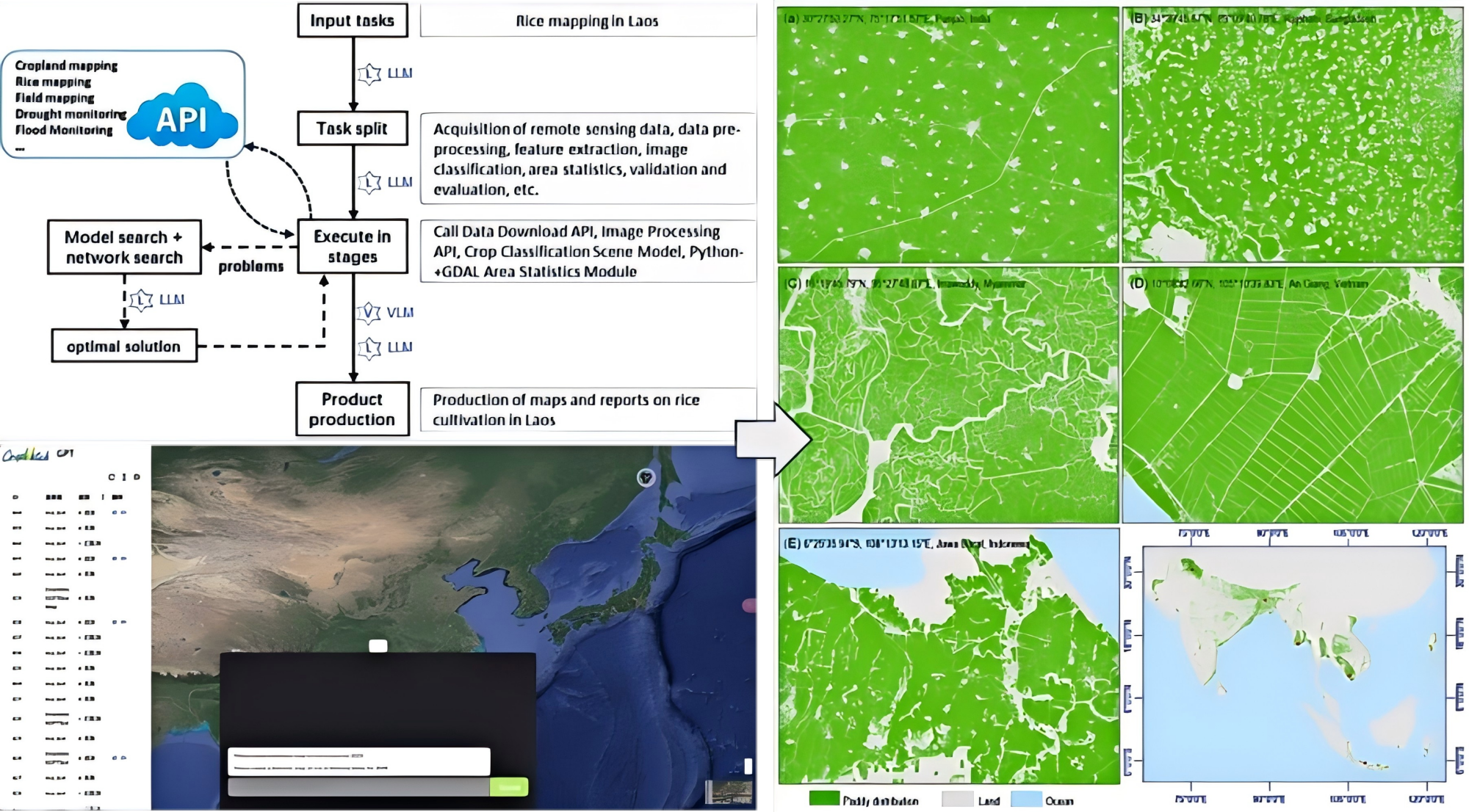
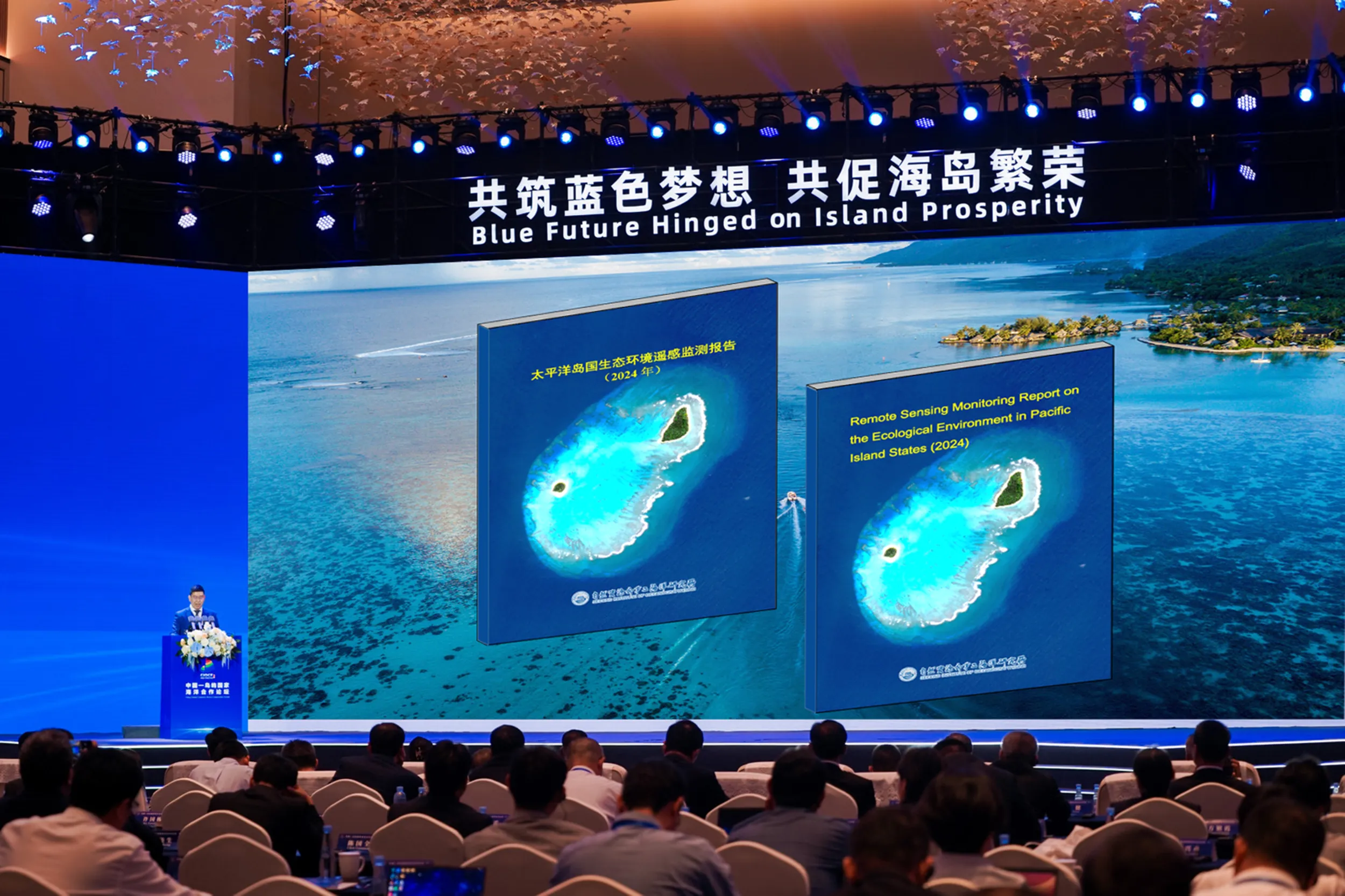
China plays a co-leading role in the GEO Global Agricultural Monitoring (GEOGLAM) flagship, significantly advancing global crop monitoring capabilities for food security and agricultural drought early warning. Through the CropWatch Cloud developed by the Chinese Academy of Sciences (CAS), China supports near-real-time crop assessments worldwide, substantially improving transparency in crop production information. A cornerstone of China's contribution is its extensive capacity-building initiatives across 26 countries, particularly in Africa and Asia, where it conducts technical training workshops and provides customized system to enable independent crop monitoring capabilities. This empowerment enables participating nations to produce their own independent crop monitoring reports, reducing reliance on external sources and enhancing local decision-making. Moreover, CropWatch offers over 60 APIs, allowing users to access and customize crop monitoring services by reducing technical and financial constraints. This approach democratizes advanced technology by providing modular, scalable tools that support everything from local farming communities to national ministries, thereby bridging the digital divide and fostering equitable access. These efforts collectively strengthen global food security, advance the "Zero Hunger" goal, and align with the Early Warnings for All initiative by building resilient, self-sustaining crop monitoring systems worldwide.
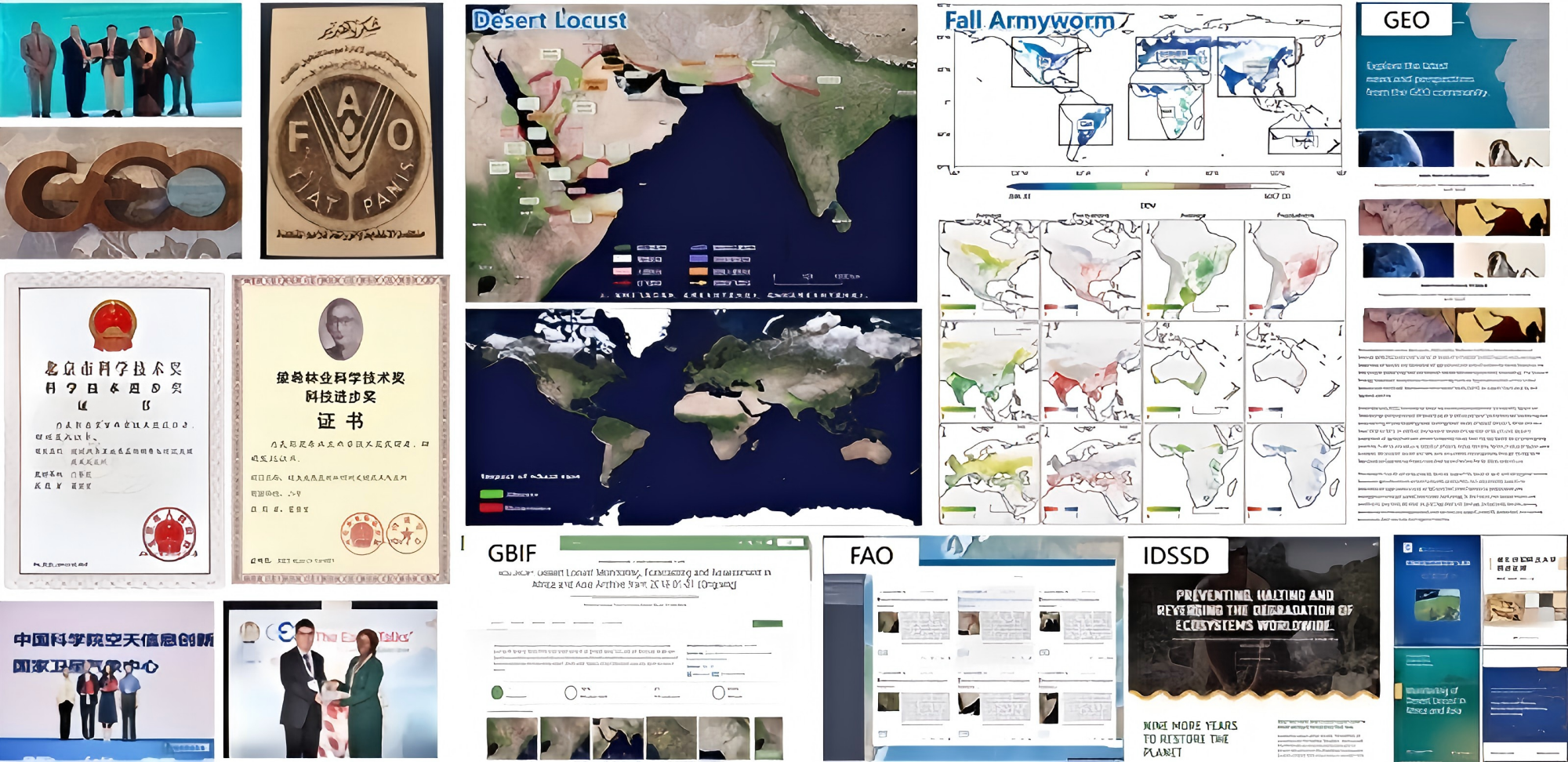
China also leads GEO-PDRS initiative. Coordinated by Chinese Academy of Sciences (CAS) with support from FAO, GBIF, CABI et al., GEO-PDRS develops a scalable framework for dynamic monitoring, risk analysis, and early warning of major vegetation pests and diseases. By integrating multi-source remote sensing with AI-driven models, the initiative targets over 85% accuracy in habitat monitoring and provides warnings at least ten days in advance. Its open data, user tools, and softwares enhance food security, reduce pesticide dependence, and protect biodiversity, directly supporting SDG 2, SDG 13, and the Sendai Framework.
China also plays a leading role in Night-Light initiative, which plans to provide four types of public products to global users using night-time light remote sensing technology which is an efficient way to record human activities from outer space. These products are Humanitarian Disaster Evaluation Report, Light Pollution Map and Evaluation Report, Wealth Index Map, Urban Living Condition Report. The products will support ground operations to achieve SDGs by connecting GEO participants, users and stakeholders. The initiative is led by Wuhan University and other research institutions.
China also engages in GEO Cold Regions Initiative (GEOCRI) strengthening monitoring in snow, ice, and permafrost environments, led by the Chinese Academy of Sciences (CAS) with contributions from its meteorological agency (CMA). In addition, China participates in the Human Planet Initiative (HPI), enhancing global exposure and vulnerability mapping. Further underscoring its leadership, a prominent Chinese expert is a co-chair the Disaster Risk Reduction and Resilience (DRRA) Working Group leading efforts to highlight the critical DRR-Climate-Biodiversity nexus and integrate Earth observations across multiple risk domains.
Role of Private Sector in GEO
China through China GEO, promotes public-private partnerships and the involvement of the private sector to foster EO solutions, and achieve Earth Intelligence for All.
China GEO encourages companies in the EO and related tech fields to participate in GEO activities, such as Global Forum, GEO Symposium, and other thematic workshops; this not only provides a platform for private-sector voices to be heard in GEO’s global dialogue but also fosters collaboration between private sector and GEO governance, and other stakeholders. And also, domestic companies who meet conditions are encouraged to join GEO community as associates, thus to formally participate in GEO’s cooperative mechanisms and contribute industry expertise to global EO initiatives. In addition, China has supported private sector in developing public goods under GEO framework, such as projects related to global environmental monitoring, climate resilience tools, and EO data service platforms, which would be shared on GEO platforms.
Participation in Regional Caucus - AOGEO
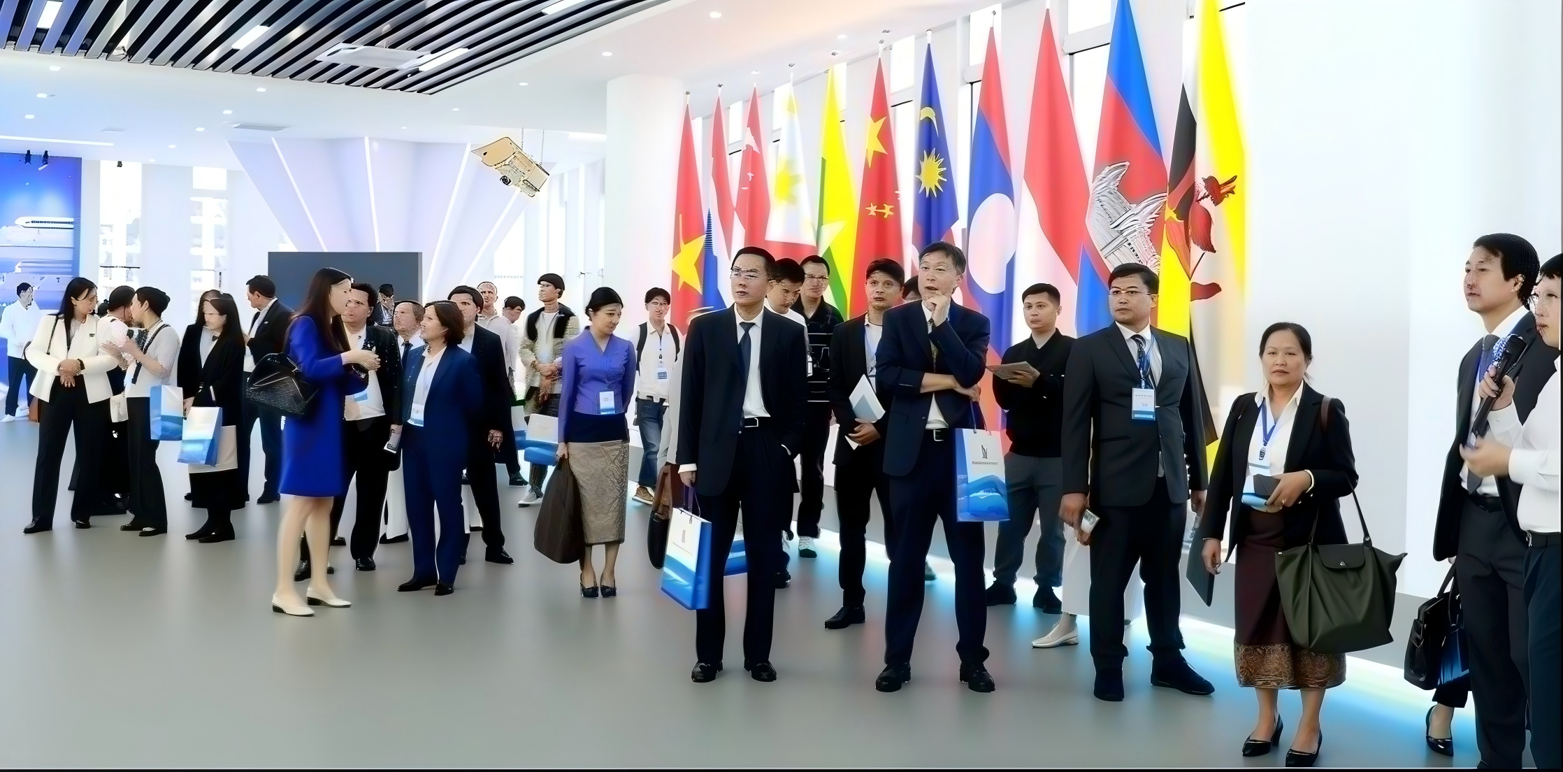
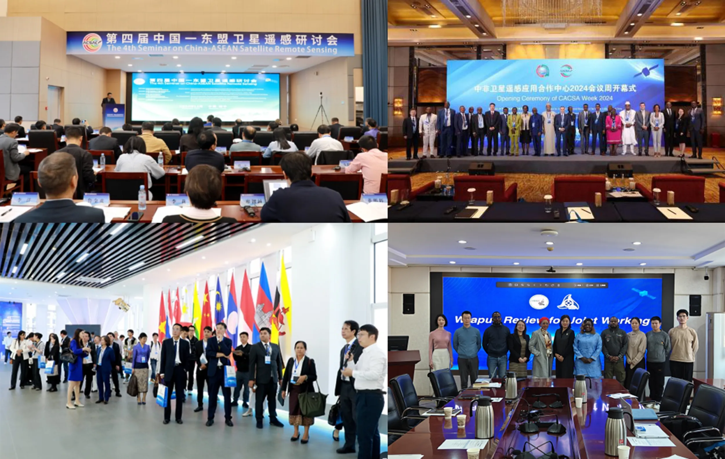
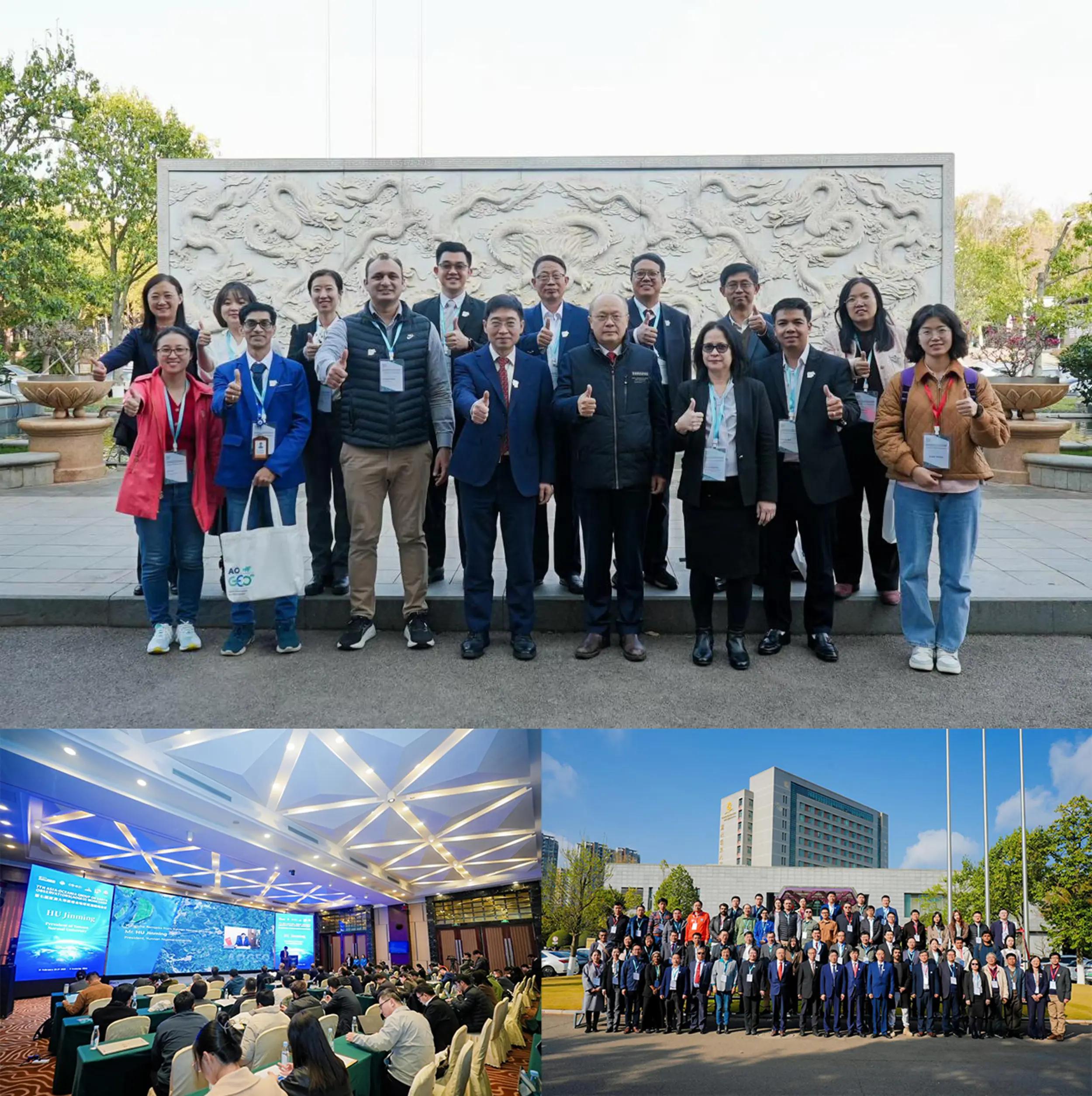
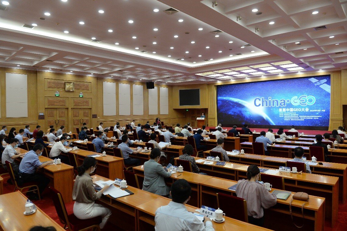
China is an active member and a Co-Chair within the AOGEO regional caucus and plays a critical role in coordinating regional EO activities. It plays a key role in regional capacity building and international cooperation through AOGEO by hosting major GEO events, like the AOGEO Workshops since 2019, covering areas such as spectral earth data fusion, global ecological and environmental monitoring, agricultural and food security, urban resilience, data sharing and regional capacity building.
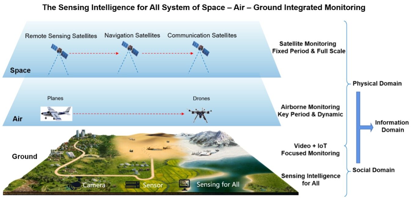
Earth Observations Capabilities
China has developed comprehensive Earth observation capabilities, including:
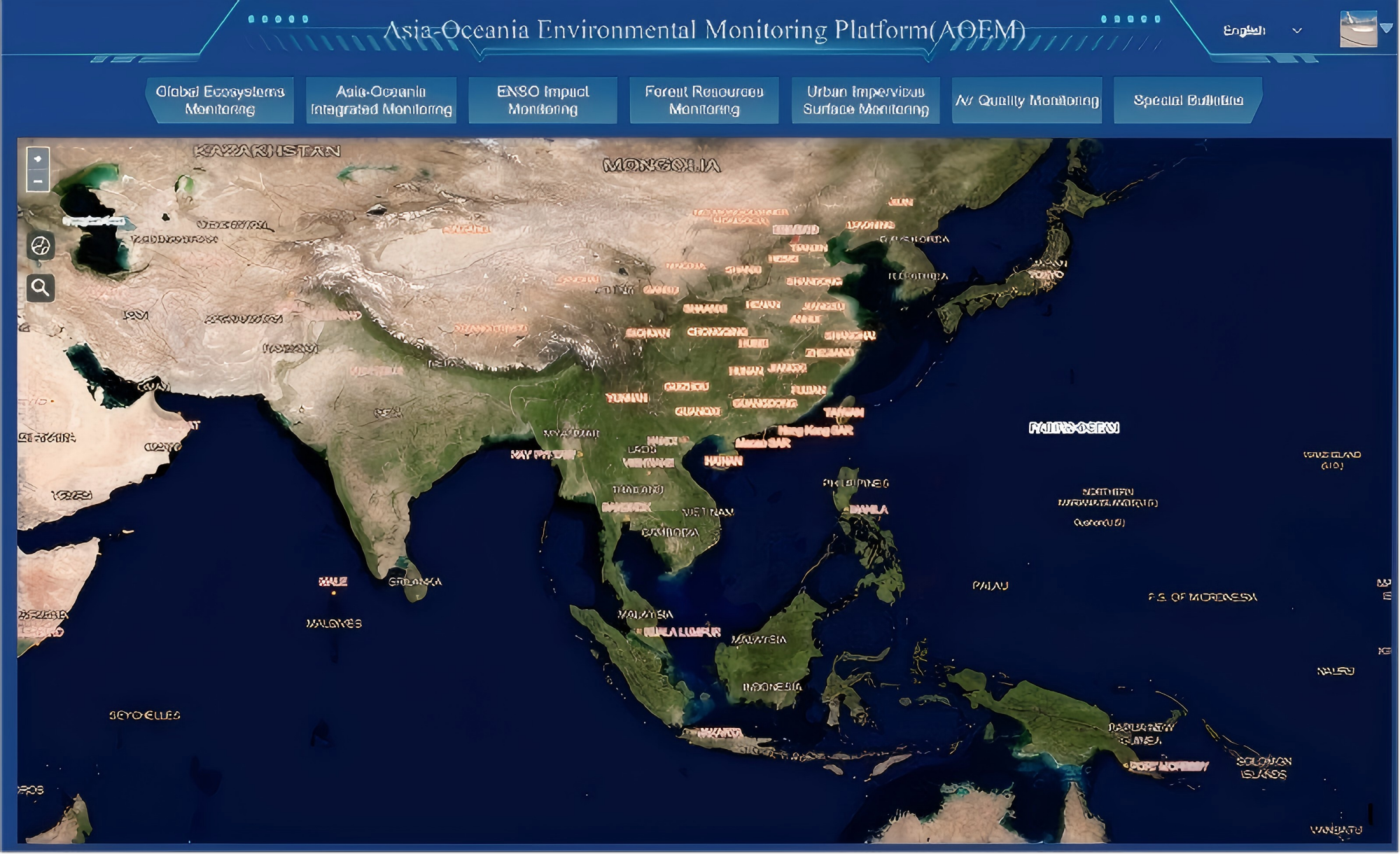
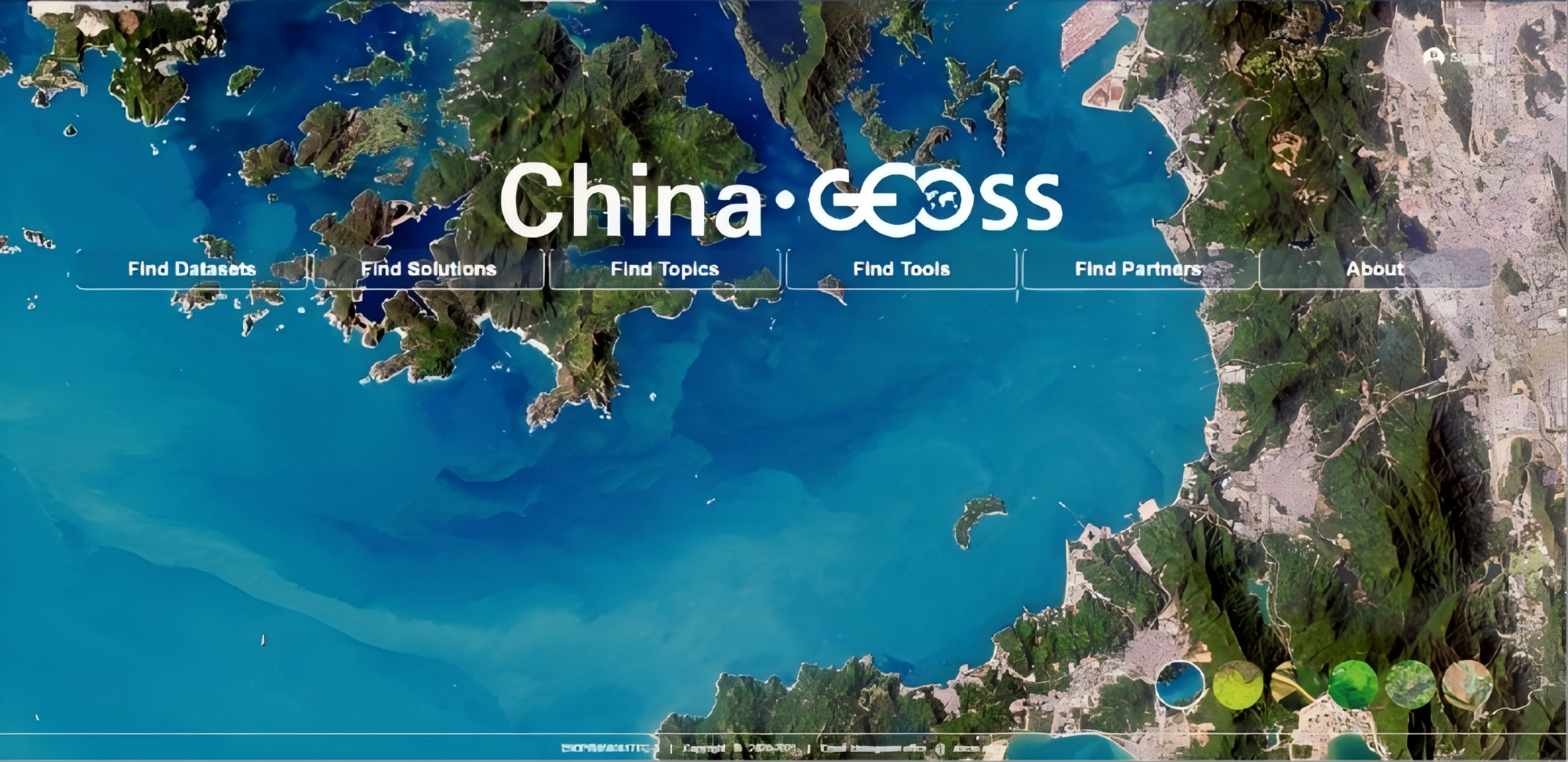
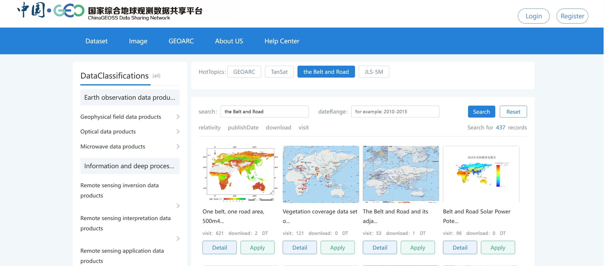
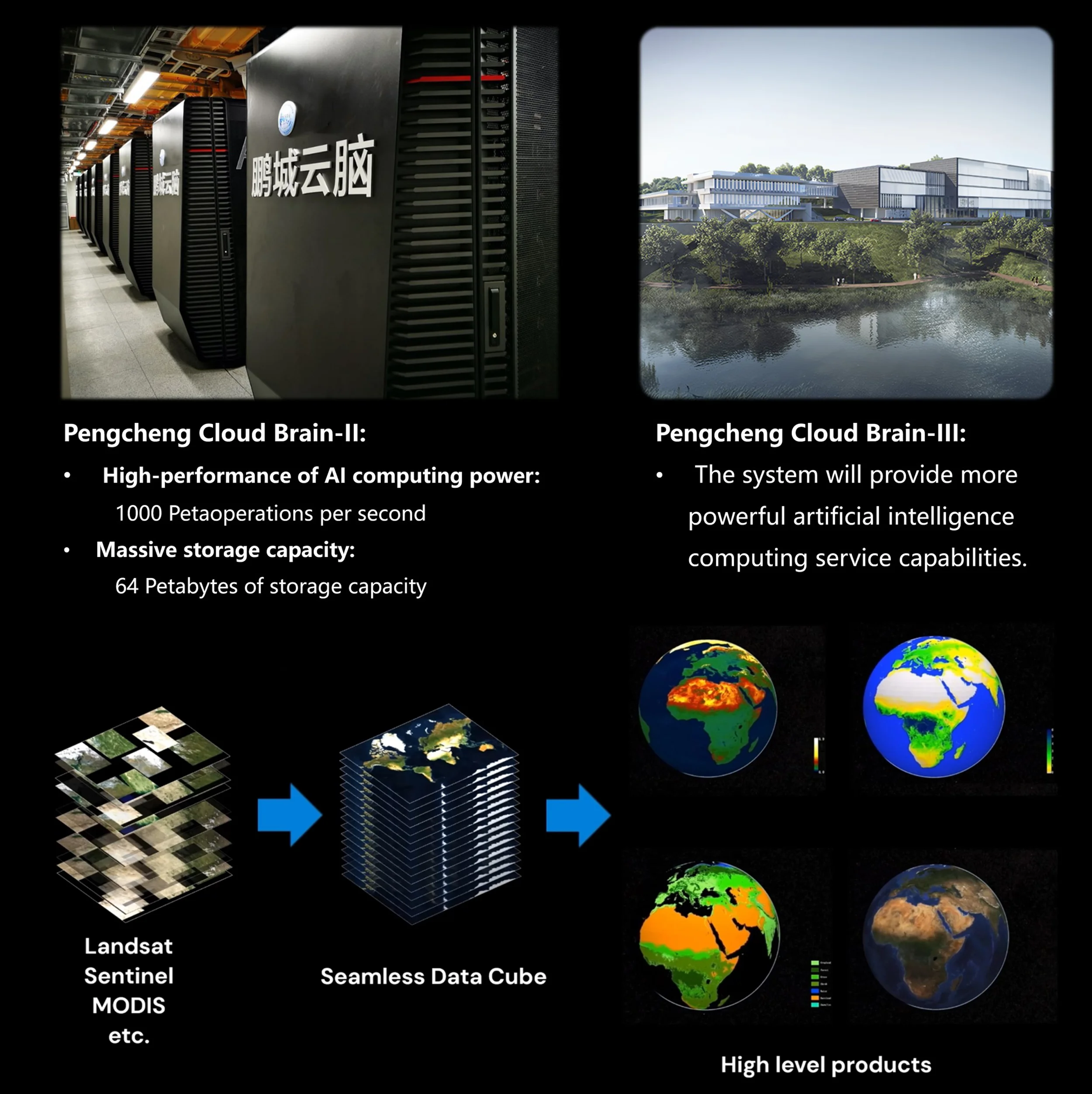
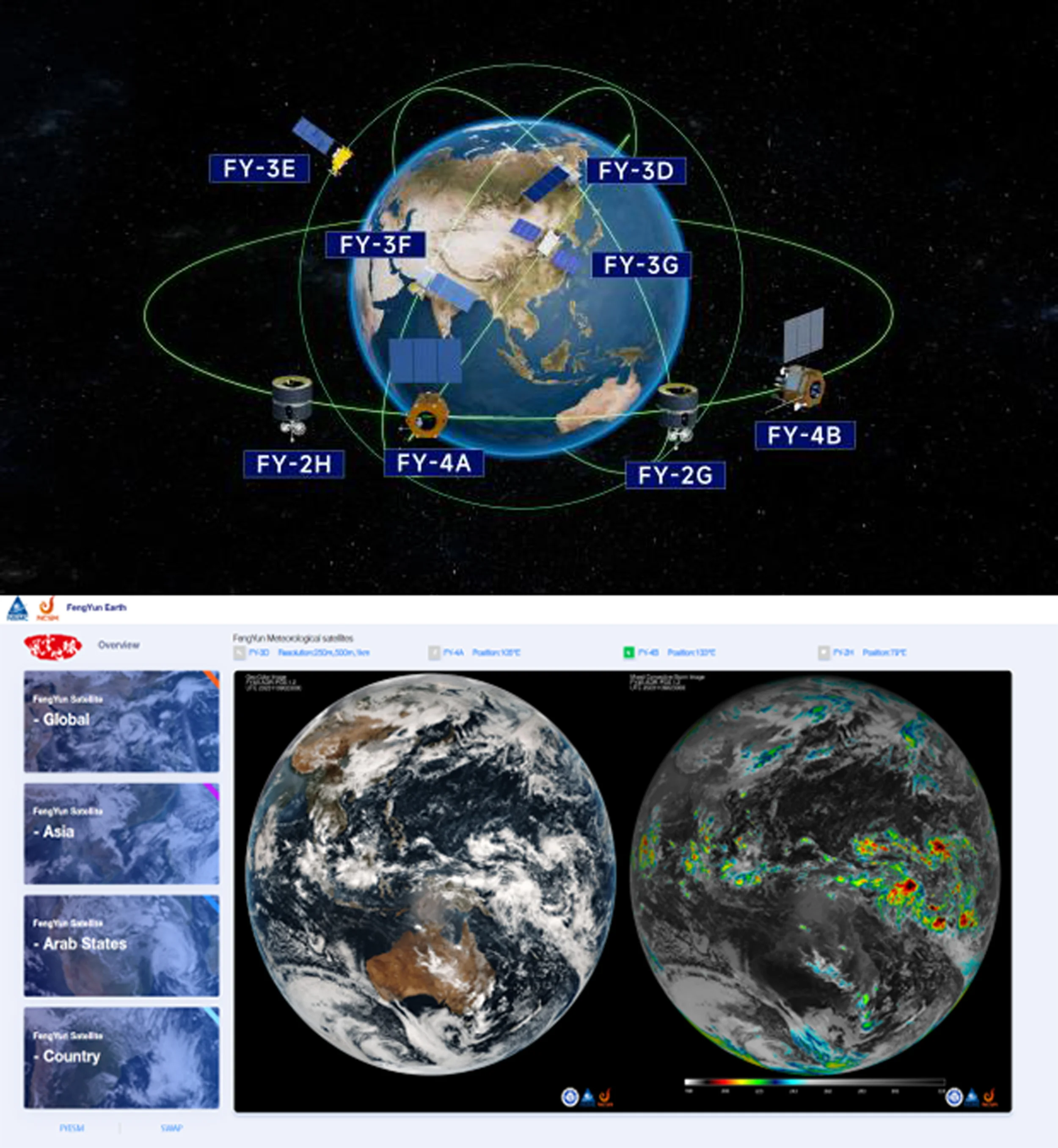
- ChinaGEOSS Data Sharing Network (ChinaGEOSS DSNet) - A comprehensive national-level GEOSS infrastructures to integrate large number of archived satellite data, AI-ready data, scientific paper data and in-situ data. Facing the GEO engagement priorities, it provides more than 5300 datasets to international users through a unified data portal, ensuring easy and seamless access to a wide range of China’s Earth observation resources. It is also the main channel for domestic and international data exchanges, ChinaGEOSS completely shared 5.68 million data to GEOSS Portal from 2016 to 2024 and made a significant contribution to the implementation of AOGEO IPS project.
- CropWatch - provides open access to crop monitoring data and reports for over 160 countries, enabling nations to independently verify and utilize agricultural information. This transparency helps reduce market speculation and price volatility by supplying reliable, impartial data. By serving as a public platform that promotes equity, self-reliance, and accessible technology of crop monitoring, CropWatch helps narrow the agricultural digital divide by reducing technical and financial constraints and directly contributes to achieving Sustainable Development Goals (SDGs).
- ETWatch - delivers accurate, spatially explicit estimates of evapotranspiration for user-defined regions, facilitating detailed assessment of water availability and consumption across multiple sectors and user groups. This capability enables more efficient water resource evaluation and optimized irrigation scheduling, particularly in drought-prone and water-scarce regions, thereby enhancing resilience and supporting sustainable water management.
- DroughtWatch - a specialized drought monitoring platform designed to empower local agencies and stakeholders to implement and maintain drought monitoring operations independently such as in Mongolia and other regional applications. DroughtWatch customization fosters a strong sense of user ownership, as local experts and institutions actively participate in system configuration, validation, and decision-making, creating a tailored and trusted tool that aligns with regional needs. DroughtWatch enhances adaptive capacity in the face of increasing climate variability.
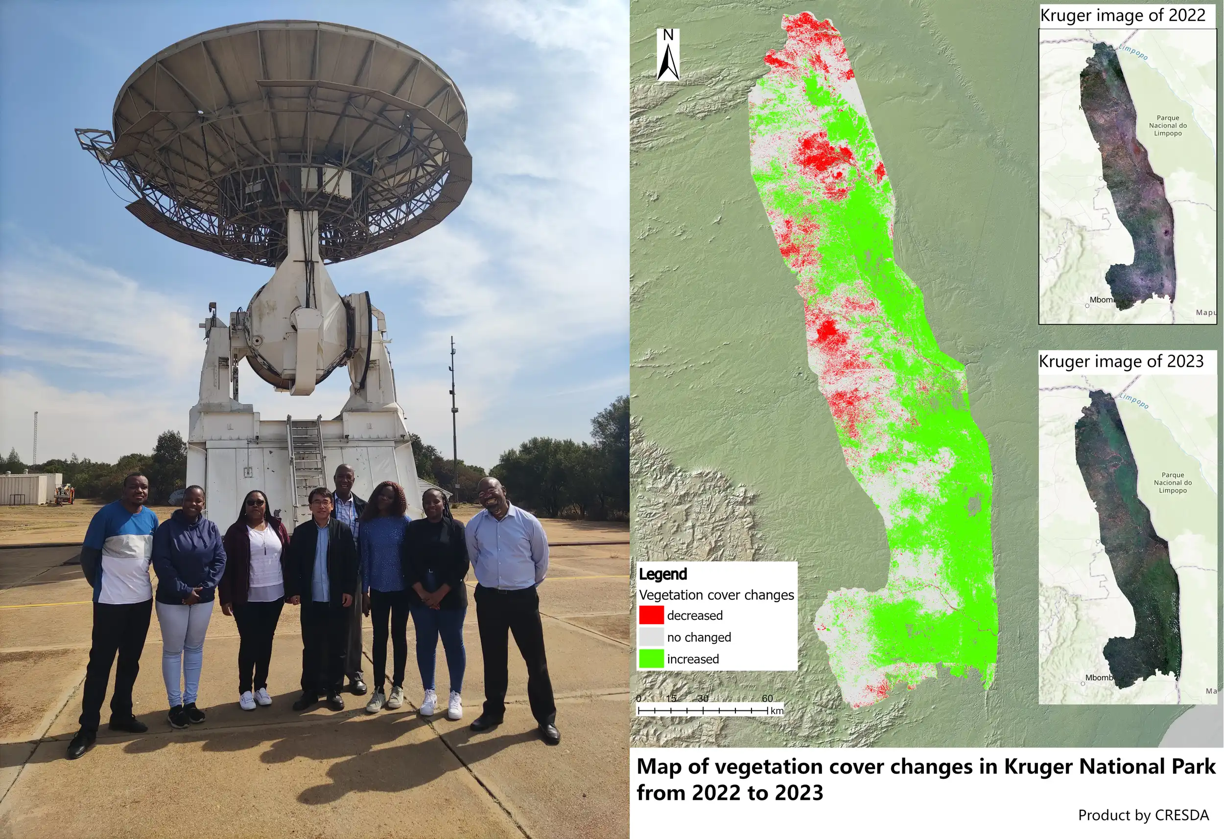
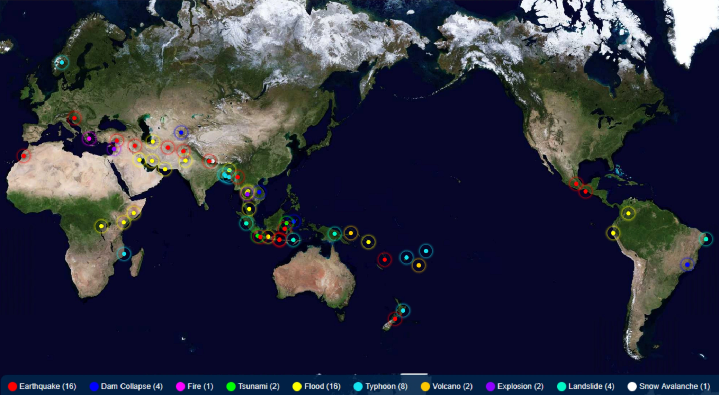
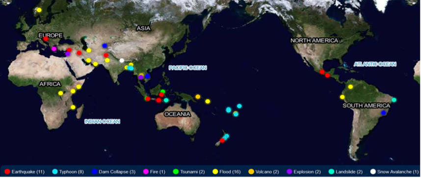
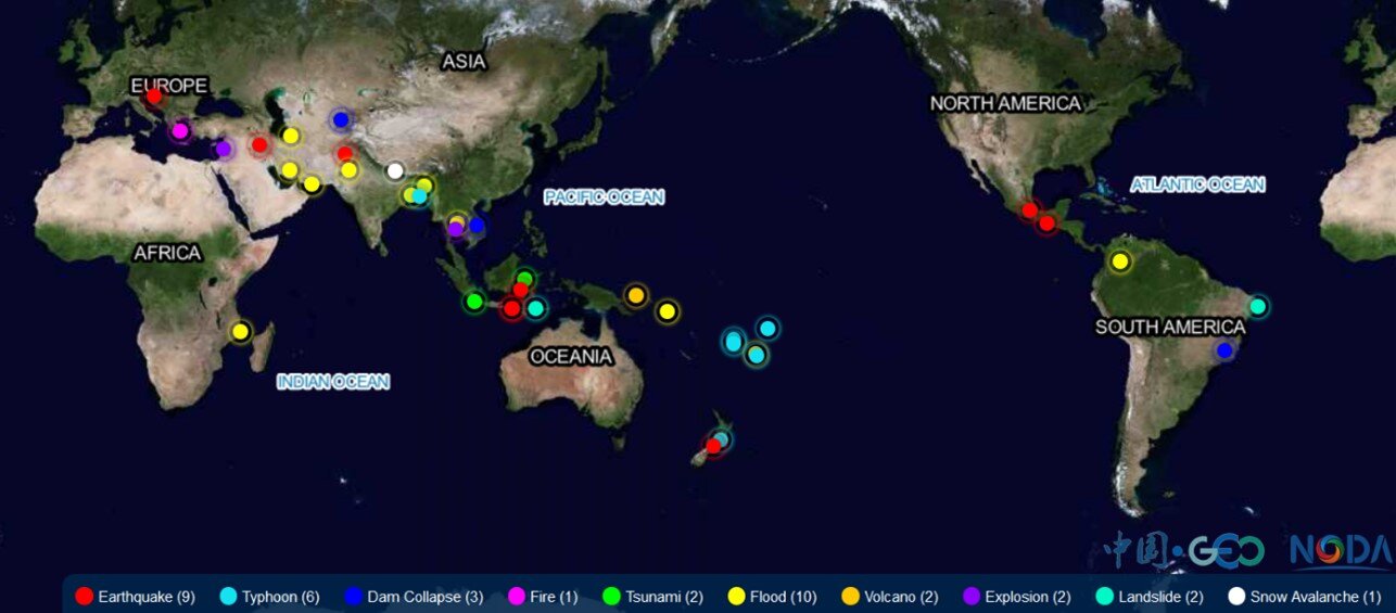
- Collaborative network of Disaster Data Response (CDDR) - GEO China initiated the Collaborative Network of Disaster Data Response (CDDR) in 2016 in response to the GEO's call for global coordinated disaster risk reduction. The CDDR mechanism has a membership of 34 china's satellite agencies and 9 international organizations, which contributes to the implementation of the UN 2030 Sustainable Development Goals. As of 2024, it had integrated 30 high resolution optical, radar, and hyperspectral satelites to cope with 56 major disaster emergency events such as New Zealand earthquake, Thailand flood, Indonisia Iandslide, Nepal snow avalanche and Tonga volcanic eruption in 37 countries.
- Vegetation Pest and Disease Remote Sensing Monitoring and Forecasting System – An operational system that has produced continuous monitoring and forecasting products for 19 major crop pests and diseases across 38 countries. The system has significantly improved pest and disease forecasting efficiency, monitoring accuracy, and service effectiveness. It has been applied in countries such as Kenya, Somalia, Yemen, Ethiopia, Pakistan, India, and Nepal, supporting scientific prevention and control over more than 20 million hectares, effectively ensuring food security and regional stability.
- Disaster Monitoring Systems - Specialised systems including snow disaster monitoring for Mongolia and other regional application.
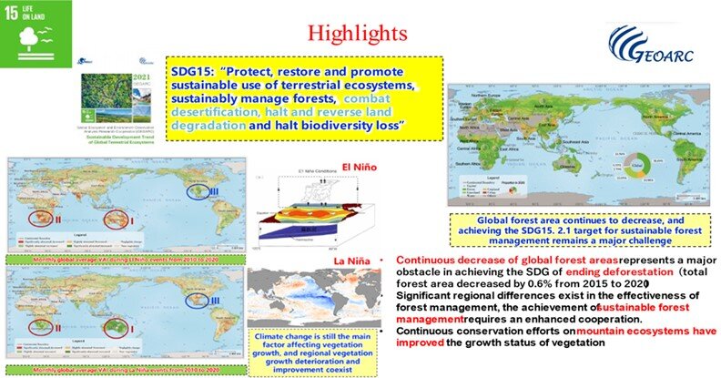
- GEOARC – The Ecosystem and Environment Observation Analysis Research Cooperation (GEOARC) has been carried out since. GEOARC has been continuously performing ecosystem and environment monitoring and analysis, producing easy-reading annual reports and user-oriented datasets. GEOARC devotes to support decision making, science research and capacity building on sustainable development, climate change, disaster risk reduction, urban resilience, etc., and to provide public goods for the international society, and the GEO members in particular.
National Policy Implementation Priorities
Development Cooperation Priorities
China's development cooperation priorities focus on:
- South-South Cooperation which focuses on providing technical assistance and capacity building to developing countries through Earth observation technologies
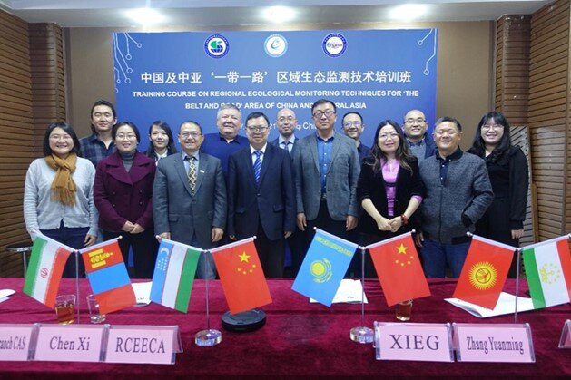
- Belt and Road Initiative Integration that focuses on food security and agricultural water security needs within the BRI framework countries
- Regional Sustainable Development that supports sustainable development through Earth observations in the Asia-Oceania region, with emphasis on Integrated Priority Study areas
- Capacity Building and Training, which aims to nurture young talent through international training programs and workshops
- Technology Transfer to share Earth observation technologies and expertise with other developing nations
- China demonstrates significant commitment to international training and capacity development through initiatives such as the International Training Workshop on Earth Observation for Sustainable Development in Developing Countries, which attracted over 570 young scholars from 37 countries across Asia, Europe, and the Americas in 2023.
Policy Priorities on Environment and Climate
China's key environmental policy priorities include:
- Sustainable Development Goals Implementation - Closely aligning Earth observation applications with the 2030 Agenda for Sustainable Development
- Food Security and Agriculture - Integrating artificial intelligence and cloud computing with Earth observation for food and water security
- Disaster Risk Reduction - Providing emergency response services and early warning systems for natural disasters • Ecological and Environmental Monitoring - Supporting global ecological monitoring and environmental assessment through advanced Earth observation technologies
- Climate Change Adaptation - Supporting climate adaptation efforts through comprehensive monitoring and assessment capabilities
- Water Resources Management - Developing advanced systems for water resource monitoring and management
Technical Cooperation Projects
China is actively engaged in various technical cooperation projects related to Earth observations that extend beyond the GEO Work Programme. These include:
- AOGEO Regional Training Programs - Comprehensive training initiatives focusing on glaciers, water resources, ecological environment, agricultural resources, and disaster monitoring in mountainous regions
- International Capacity Building Workshops - Annual training programs attracting hundreds of participants from dozens of countries across multiple continents
- Bilateral Technical Cooperation - System customisation and capacity building programs with countries including Thailand, Laos, Cambodia, and Mongolia
- Collaborative network of Disaster Data Response - International disaster response services providing critical Earth observation data for emergency situations
- Regional Monitoring Networks - Collaborative monitoring systems for the Himalayan-Hindu Kush and island regions, focusing on disaster reduction, urban and ecological monitoring
- Data Sharing Initiatives - Comprehensive data sharing through the ChinaGEOSS Data Sharing Network with international institutions and organisations
- The Dragon Programme is the cornerstone of Sino–European Earth observation cooperation. It represents a multi-decadal scientific partnership focused on remote sensing, technology exchange, and training—while individual projects (such as data-sharing under Copernicus or joint initiatives like PANDA) complement and extend the collaboration.
- CropWatch Innovative Cooperation Programme (CropWatch-ICP) leverages EO to enhance crop monitoring capacity and improve food security for developing countries. CropWatch-ICP prioritizes capacity building, open access, and local customization, for empowering developing nations to overcome technical and financial constraints on crop monitoring.