World Day for Glaciers: How GeoAI and satellite data are transforming cryosphere monitoring in climate extreme environments
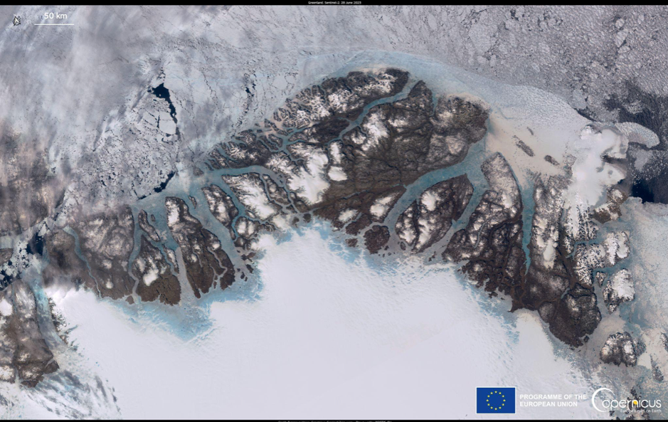
Glaciers across the Arctic, Antarctic and the “Third Pole” in High-Mountain Asia are retreating rapidly as ice that has shaped climates, rivers and livelihoods disappears at a rate faster than our ability to understand the changes. These remote and extreme environments are among the most difficult places to observe, leaving an enormous gap between what we know is happening and our ability to respond.
When the right information fails to reach decision-makers in time, the consequences can be catastrophic. Nowhere is this more urgent than in climate extreme settings, where monitoring is critical for global water security and resilience.
As the world marks the World Day for Glaciers on 21 March – and as the Decade of Action for Cryospheric Sciences enters its second year – it is crucial to think about how we strengthen the systems that allow us to monitor Earth’s frozen regions.
Advances in satellite Earth observation and Geospatial Artificial Intelligence (GeoAI) are transforming how we monitor glacier change, offering new opportunities to turn scientific data into actionable intelligence.
As GEO Youth COP Programme Co-Lead and researcher at Imperial College London, I have a front-row seat to how this technology is developing and the ways the GEO community is rising to meet these challenges.
Technology alone is not enough
Earth observation has transformed our ability to observe glacier dynamics. By combining machine learning with geospatial data, GeoAI helps us detect glacier change, identify emerging glacial lakes and monitor cryospheric hazards in near real time.
GEO-led initiatives such as GEO Mountains and Arctic GEOSS demonstrate how coordinated observing systems can strengthen environmental monitoring across climate extreme settings while integrating scientific, Indigenous and local knowledge.
Yet technological progress alone is not sufficient to solve current monitoring challenges. Governance frameworks and collaborative digital infrastructures are equally important.
Digital public goods - the focus of my work at the International Telecommunication Union - include open satellite data platforms and cloud-based geospatial analysis tools. These expand access to data and support wider participation in infrastructure development.
From fieldwork to policy
My research at Imperial College London has led to the development of a novel methodology for mapping climate technology infrastructures in climate extreme settings. I have learned that it’s key to link technological innovation with local capacity and governance systems.
As a member of UNGSC UN Mappers, a global network of digital mappers, I have also seen how important community mapping initiatives are for effective and targeted satellite observations, AI-driven analysis, and policy implementation.
Combining community asset-mapping workshops with geospatial analysis facilitates the identification of policy frameworks, technology infrastructure and capacity gaps across Arctic municipalities. Integrating local knowledge with geographic information system data layers provides a practical means for identifying where climate technology and infrastructure can be strengthened.
International cooperation, including engaging with scientists like myself via the Global Initiative on Resilience to Natural Hazards through AI Solutions, is now essential to ensure that emerging technologies translate into effective policy tools, standardisation and data-sharing cooperation.
No time to waste
This World Day for Glaciers comes at a time when researchers, technologists and policymakers must work towards strengthening the science-policy interface. The rapid alignment of GeoAI innovation, Earth observation, digital infrastructure and coordinated observing networks is essential for improving how glacier change is monitored and climate risks are communicated to decision-makers.
Research, development and cooperation must urgently be strengthened along with funding to address changes in some of Earth’s most vulnerable regions.