From Vision to Action: AfriGEO Charts a Decade of African Leadership in Earth Intelligence

More than 400 participants gathered in Abuja, Nigeria, from 5 to 8 October for the 10th AfriGEO Symposium, under the theme “Earth Observation for a Resilient Africa." The week marked a key moment for the region as AfriGEO adopted a 10-year Strategic Implementation Plan (2026–2036) aligned with the GEO Post-2025 Strategy.
Shaped through consultation with African GEO Members, Participating Organizations, and regional partners, the Plan sets out how Earth Intelligence for All can deliver tangible benefits for African societies. It focuses on climate resilience, food security, disaster risk reduction, biodiversity, and sustainable resource management, all backed by strong governance and measurable targets.
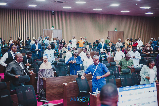
The AfriGEO Secretariat, hosted by the Regional Centre for Mapping of Resources for Development (RCMRD) with support from South Africa, will drive its delivery in coordination with the African Caucus.
Hosted by Nigeria’s National Space Research and Development Agency (NASRDA), the Symposium opened with Nigeria’s Minister of Innovation, Science, and Technology, Dr. Kingsley Tochukwu Udeh; NASRDA Director General Professor Matthew Olumide Adepoju; and senior representatives from the Defence Space Administration. They were joined by leaders from the GEO Secretariat, RCMRD, Digital Earth Africa, the Japan Aerospace Exploration Agency (JAXA), and the European Commission. Nigerian leaders called for stronger continental cooperation and investment to scale African capabilities and apply them to development priorities. The GEO Secretariat highlighted its role in connecting African expertise and leadership with international partners, resources and GEO Work Programme capabilities.
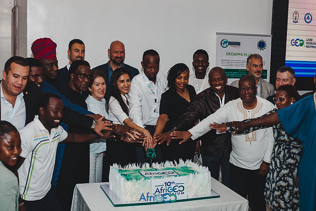
At the AfriGEO Caucus meeting, members agreed to translate the 10-Year Plan into measurable annual priorities focusing on African representation in GEO governance, mobilizing resources, expanding youth and academic engagement, and reinforcing coordination through national focal points.
Putting Earth Intelligence to work
Translating Earth Intelligence into actionable services was a central focus of the Symposium, which opened with hands-on capacity development activities led by GEO Work Programme activities including Digital Earth Africa, GEO Global Agricultural Monitoring Initiative (GEOGLAM) and GEO Global Water Sustainability Initiative (GEOGLOWS), complemented by a GEOGLAM-led Agriculture and Food Security session.
A dedicated discussion led by the GEO Secretariat also explored improving access to very high-resolution satellite imagery in Africa through coordinated procurement, multi-user licensing, and partnerships with commercial providers.
Sessions led by Human Planet Initiative on impact-based early warning examined the integration of hazard, exposure, and vulnerability information to strengthen disaster preparedness and community-level response, while discussions on the Rio Conventions led by GEO Land Degradation Initiative (GEO LDN) highlighted opportunities for GEO Work Programme activities to work together and support national environmental reporting and evidence-based policymaking.
The significance of GEO Work Programme contributions was further recognized with the AfriGEO awards presented to GEOGLAM and Digital Earth Africa i recognition of their outstanding contributions to the region.
Building partnerships beyond regional boundaries
The Symposium reinforced cross-regional cooperation as a cornerstone of AfriGEO’s long-term success. Dedicated engagements involving the Africa–EU Space Partnership Programme (AESPP), JAXA’s AfriGEO investment and partnership discussions, and NASA’s SERVIR Global Collaborative illustrated the value of connecting African priorities with international expertise, technological capabilities and investment opportunities.
These exchanges opened promising avenues for collaboration. The GEO Secretariat also helped connect regional priorities with the wider GEO Work Programme, reinforcing AfriGEO’s role as a platform for turning international cooperation into practical solutions.
The Abuja Statement: A collective commitment to deliver
The Symposium concluded with the Abuja Statement, affirming African leadership and ownership in advancing Earth Intelligence for All. It calls for stronger national coordination, improved access to satellite data, sustained investment, inclusive capacity development, and partnerships capable of delivering lasting benefits.
The next step is to translate these commitments into measurable activities under the 10-year Plan. The country experiences, technical exchanges and partnerships developed in Abuja provide a foundation for that work - and for stronger African contributions to GEO’s global direction.