How Earth Intelligence can help improve air quality and respiratory health
Air pollution is one of the biggest threats to public health, contributing to millions of deaths each year. But traditional air quality monitoring currently leaves gaps in our understanding and response. This is where Earth Intelligence – the use of satellite observations, remote sensing and environmental data – can help.
The GEO Health Community of Practice’s Air Quality, Wildfires, and Respiratory Health Work Group leverages Earth Intelligence to bridge these gaps, offering new ways to monitor pollution, predict risks and protect both human and environmental health.
In this post, we highlight five key ways the group is using Earth Intelligence to help improve air quality and respiratory health.
The One Health approach
Air quality issues intersect human, animal and environmental health, making the One Health collaborative, multidisciplinary approach essential. Poor air quality contributes to one in nine deaths globally, and poor environmental health can exacerbate wildfires and dust storms.
By advancing best practices for harnessing Earth Intelligence to monitor and manage pollutants, the Work Group supports health risk prediction and capacity building among stakeholders.
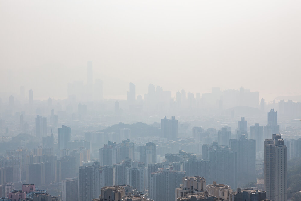
Using satellite data to fill gaps in understanding
Ground-based air quality monitoring networks are sparse globally, limiting our understanding of air pollution. Satellite Earth observation data can fill these gaps by providing regional and global air quality patterns and trends.
These data are also crucial for issuing early warnings about air pollution events including dust storms and wildfires, allowing vulnerable populations to take precautions. Finally, combining satellite Earth observation data with health data helps researchers understand the public health impacts of air pollution and informs effective regulations. The Work Group identifies, collects, and disseminates examples of best practices and new advances in using satellite Earth observations to fill ground-based air quality data gaps.
Making data accessible
Despite the benefits, challenges including data access, interpretation, and validation as well as capacity can limit use of Earth observation data for air quality management. Efforts like the NASA Applied Remote Sensing Training Program address these gaps by providing free online lessons.
The Work Group promotes an inclusive international community of practice to build trust and lower barriers while disseminating the latest capabilities and surveying future opportunities and needs. This includes contributing to tools like the HAQAST resources flowchart.
Promoting solutions
The Work Group promotes successful Earth observation data applications, highlighting innovative uses of Earth observations at the intersection of One Health and air quality.
The group also develops region-specific resource guides and training workshops, such as the Satellite-Derived Air Quality Information workshop for the Americas. These initiatives build local capacity and inspire collaboration between data providers and users.
Building a future together
The Work Group serves as a forum for international engagement, supporting holistic assessments of air quality and One Health. A key initiative is a survey of global data gaps and recommendations for new Earth observation missions and data products.
To learn more about the innovative work being done by the GEO Health Community of Practice’s Air Quality, Wildfires, and Respiratory Health Work Group, be sure to read the full white paper. To get involved, reach out here.