GEO milestones at COP16: Launching the Global Ecosystems Atlas proof-of-concept and championing Earth Intelligence
Director’s note
A short time has passed since COP16 in Colombia, yet the echoes of this historic gathering remain vivid. Amid the energy of the largest biodiversity COP yet, standout achievements—like the establishment of a permanent body for Indigenous Peoples and local communities (IPLCs) and the creation of the “Cali Fund”—signal hope for transformative change in global biodiversity efforts.
COP16 was also marked by formidable challenges. The discussions on the monitoring framework were vital to ensure the success of the Kunming-Montreal Global Biodiversity Framework (KMGBF) agreed at COP15. Negotiators have learned the key lesson from the previous Aichi targets which failed to provide a robust, actionable structure for effective implementation, monitoring, and accountability.
The KMGBF aims to avoid repeating these shortcomings. At COP15, countries decided to establish a more comprehensive and dynamic monitoring framework and to regularly review it, leading to the creation of an ad-hoc expert group that provided recommendations to the COP after multiple meetings. Regrettably, Parties at COP16 remained divided on adopting these recommendations.
While the decision on the monitoring framework is pending, the draft text represents a good basis for further negotiations. It refers to indicators, methodologies and standards like the Global Ecosystem Typology, as well as planning mechanisms and processes for reviewing progress under the KMGBF, all of which are designed to ensure better alignment between national and global efforts.
In this time of significant interest and need around accurate and reliable data, the GEO community contributed to the negotiations by championing the transformative power of Earth observations and cutting-edge technology to develop innovative and inclusive solutions that protect nature. We also gathered around the first-ever GEO pavilion which became a hub for knowledge sharing and partnerships.
The Global Ecosystems Atlas, one of these solutions presented before the Parties, is intended to support countries to track and achieve their targets, turning global commitments into measurable success. Norway’s 2.5 million USD pledge to support the continued Atlas’ development, announced in Cali, underscores its revolutionary potential.
We are proud to lead an information revolution in ecosystem monitoring and we remain committed to ensuring equitable access for all countries and stakeholders. Only by making these advancements universally accessible can we truly harness their transformative power to drive meaningful and measurable change in biodiversity conservation on a global scale.
~ GEO Secretariat Director Yana Gevorgyan
Introduction
It was the world’s largest ever biodiversity summit. Some 23,000 delegates from almost 200 countries gathered in Cali, Colombia, for the 2024 United Nations Biodiversity Conference (COP16).
On paper, the goal was “simple”: find consensus to drive accelerated action on biodiversity following the adoption of the Kunming-Montreal Global Biodiversity Framework (KMGBF) at COP15 in Montreal. In reality, the outcomes from COP16 were complex and, at times, frustrating.
In this high-stakes setting, the Group on Earth Observations (GEO) Secretariat presented a solution to one of the myriad challenges being discussed at COP16:
With the launch of the The Global Ecosystems Atlas proof-of-concept, GEO unveiled a groundbreaking tool for identifying distribution of different ecosystem types, supporting coherent conservation and restoration efforts, informing environmental management decisions and aiding in environmental reporting.
This transformative tool can support global efforts towards achieving KMGBF targets related to halting biodiversity loss, restoring degraded ecosystems and integrating biodiversity into decision making.
GEO’s presence at COP16 underscored a commitment to making Earth Intelligence accessible to all, laying a foundation for a new era in biodiversity monitoring and marking the first major programmatic milestone building on the GEO Post-2025 vision.
Atlas case study: Maldives Accelerator initiative
GEO's Activities at COP16
GEO’s activities at COP16 were built around a number of key milestones:
- Press conference launch: The unveiling of the Atlas proof-of-concept was widely covered in international media, with statements from GEO Director Yana Gevorgyan and CBD Executive Secretary Astrid Schomaker, positioning the Atlas as a breakthrough for biodiversity management.
- Pavilion partnerships: The GEO pavilion – hosted with GEO BON, Esri and Ai2, with support from Maxar – was a buzz of activity, with series of sessions that showcased the GEO community’s ongoing projects and collaborations.
- High-profile side event: "Mapping Nature’s Footprint" brought together leaders from UNEP, the CBD Secretariat, governments and key GEO partners, to tell the story of the Atlas and its critical role in tracking ecosystem health.
Unveiling the Atlas
At the start of COP16, we hosted a press conference to officially launch the The Global Ecosystems Atlas proof-of-concept. During the press conference, CBD Executive Secretary Astrid Schomaker and GEO Secretariat Director Yana Gevorgyan presented the Atlas as a cornerstone of global efforts to protect nature.
Schomaker said that that the Atlas addresses a major data gap, “consolidating data on an unprecedented scale.”
She continued, “The monitoring framework adopted at COP 15 includes the headline indicator for natural ecosystem extent, but the benefits of understanding ecosystem extent go beyond just one indicator. Overlaying ecosystem data with geospatial data on protected areas, pollution, habitat restoration, and human population provides insights into human-ecosystem interactions and highlights how we must change our behavior to protect biodiversity.”
Gevorgyan emphasized the Atlas’s potential to democratise data access, calling on nations to contribute to this “revolution in Earth Intelligence” to meet global biodiversity targets. “The Global Ecosystems Atlas is a transformative tool designed to address the urgent need for consistent and scalable data about ecosystem distribution globally.”
The launch of the Atlas was widely covered in the press, featured by the likes of Forbes, The Financial Times, The National Tribune, Geographical and many more.
The GEO pavilion: championing Earth Intelligence
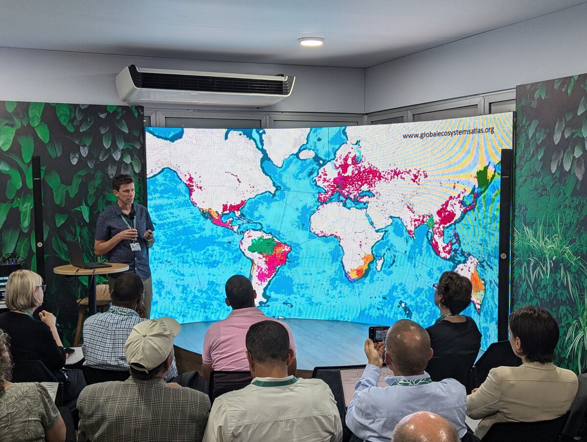
Hosted in partnership with GEO BON, Esri and Ai2, with support from Maxar, the GEO pavilion featured more than 50 sessions, including seven sessions organised by GEO Secretariat.
The pavilion hosted a series of events from all partners addressing key topics in biodiversity and conservation. Sessions included discussions on biodiversity indicators, the integration of artificial intelligence in environmental monitoring, and the application of geospatial technologies for conservation planning.
Other topics focused on community-led conservation strategies, the role of genetic diversity in ecosystem health, and the development of tools for effective biodiversity assessment and reporting.
These sessions underscored the value of Earth observations and collaborative action in achieving global biodiversity goals.
High-level COP outcomes
Overall, COP16 was a pivotal, yet challenging, conference, with significant advances but also a lot of unresolved issues:
- Indigenous and local community participation: The establishment of a new body under enhancing Indigenous and local community participation in biodiversity policies was a welcome outcome.
- Biodiversity-climate synergy: Countries agreed to align biodiversity and climate policies, prioritising ecosystems vital to both.
- Digital sequencing information: Another positive step was the launch of the “Cali Fund” for sharing profits from digitised genetic information with biodiversity stewards.
Despite these commendable signs of progress, negotiations were eventually halted in the early hours of the morning on the final day, with key agenda items on resource mobilisation and monitoring frameworks unfinished, requiring further negotiations to come later next year.
This meant that delegates came away from COP16 without clarity on how 200 billion USD annually by 2030 will be secured to support biodiversity initiatives and targeted capacity building worldwide. Similarly, the creation of a new dedicated global financing instrument linked to the KMGBF Fund remains pending.
The lack of decision on the monitoring framework also leaves countries wondering how to efficiently track progress on the implementation of the KMGBF targets.
How was GEO involved at COP16?
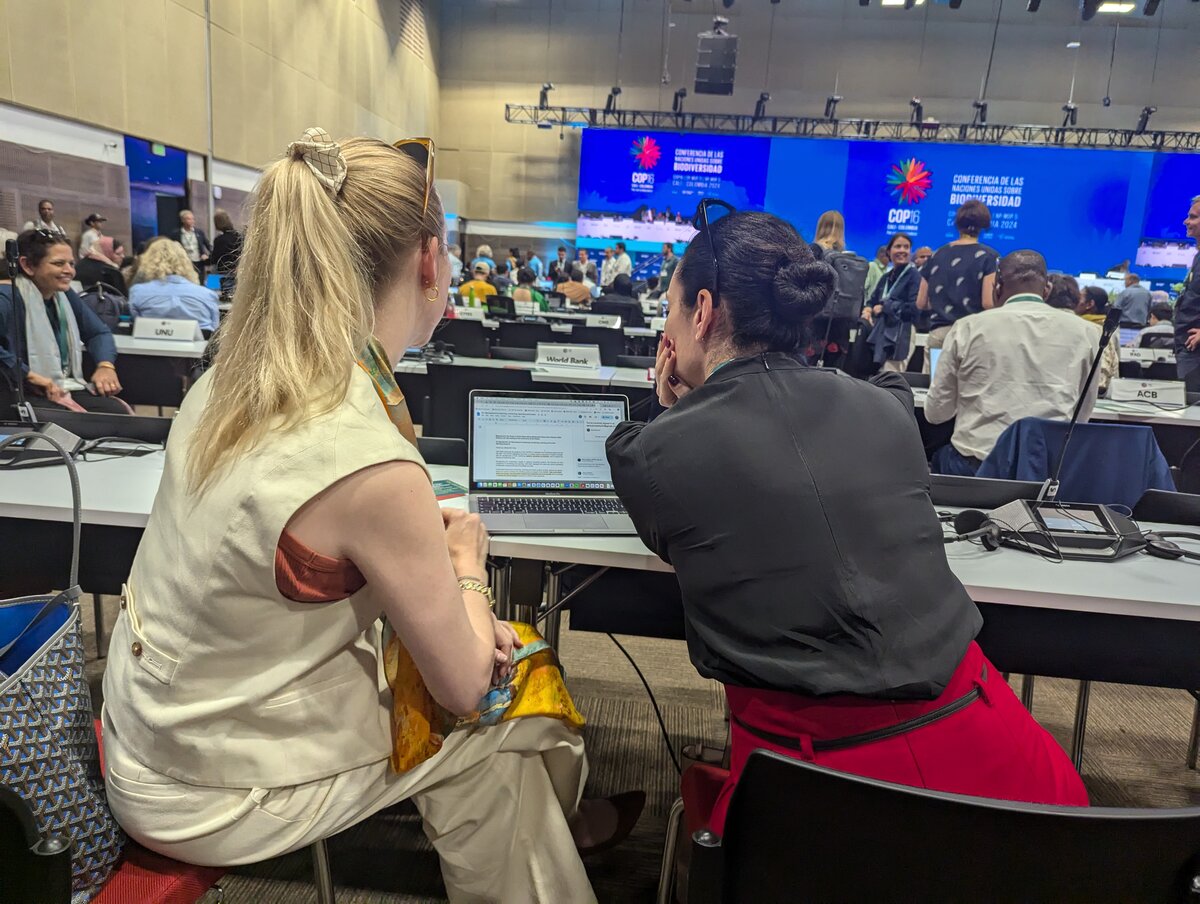
The GEO Secretariat and GEO BON delegates attended the COP16 Plenary, Working Group I and related contact groups on Agenda Item 10 (Mechanisms for planning, monitoring, reporting and review) throughout the COP16 negotiations, consulting with Party delegates and the CBD Secretariat.
We worked primarily behind the scenes with our partner governments to ensure important language around monitoring and ecosystems was retained in the relevant COP decision.
While the COP decision document [PDF] on the monitoring framework currently remains in draft, it opens the doors to a number of sound methodological and institutional developments going forward.
The draft decision welcomes the work of Ad Hoc Technical Expert Group on Indicators, which delivered substantive guidance to Parties on how to implement the monitoring framework and refers to the Global Ecosystems Atlas and GEO BON’s Global Biodiversity Observing System (GBiOS) as key resources and initiatives to be used to monitor and track headline indicators.
Notably, the draft decision document invites Parties to apply the Global Ecosystem Typology or an equivalent methodology and cross-reference their national ecosystem data with levels 2 and 3 of this typology, subject to national circumstances and capabilities, all of which are consistent with and promoted by the design of the Global Ecosystems Atlas.
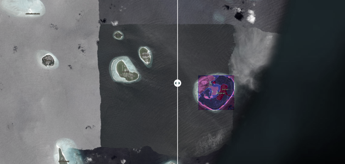
The draft decision also calls for funding to support the development and implementation of biodiversity monitoring systems via the Global Environment Facility, which could provide a means to roll out additional pilots like the Maldives Atlas Accelerator.
Finally, the draft decision also invites the secretariats of multilateral environmental agreements and relevant initiatives to share information on relevant monitoring initiatives with the CBD Executive Secretary. This means that GEO Secretariat could continue informing the negotiations about the Global Ecosystems Atlas’ roll out in due course.
It is likely that the draft text will be adopted swiftly at the next negotiation session.
Next steps for the Atlas
The Global Ecosystems Atlas will be instrumental in providing ecosystem data to support monitoring and reporting for the KMGBF and its headline indicators.
As the first global, interactive, and dynamic platform of its kind, the Atlas will, for the first time, deliver crucial high-resolution spatial data on ecosystems worldwide.
The Atlas will support countries with limited capacity by helping them develop national ecosystem maps, embedding these efforts within their institutions.
High attendance at high-level side event
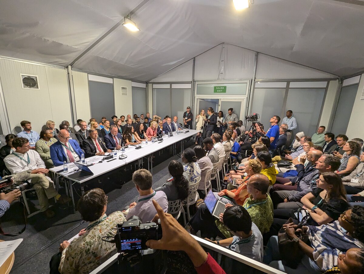
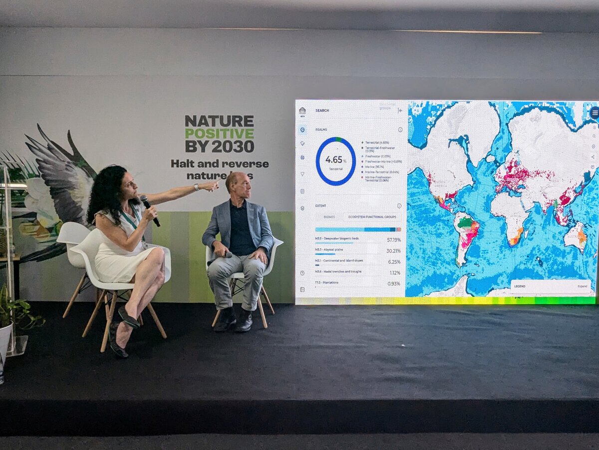
A packed house of 100+ delegates gathered towards the end of COP16 for GEO’s official side event to launch the Global Ecosystems Atlas proof-of-concept.
“Mapping Nature’s Footprint” featured a powerhouse lineup of speakers, including government ministers and leaders from across multiple sectors. The side event illustrated the Atlas’s purpose, beginning with UNEP Executive Director Inger Andersen, who framed the urgent need for ecosystem data in crisis response.
“If we fail to act, then we will lose ecosystems, lose species, lose more genetic diversity. We very much support and understand the need for data-driven tools and to act early, and that's why the Global Ecosystems Atlas is so important. The Atlas provides comprehensive, real time ecosystem data. Never before have we had this. We from UNEP are incredibly proud to be associated with it,” she said.
CBD Head of Monitoring, Review and Reporting Jillian Campbell highlighted current gaps in reporting, before GEO Secretariat Director Yana Gevorgyan provided an inspiring account of the Atlas’s development journey.
After a walkthrough of the platform from Atlas Science Lead Nick Murray, Honourable Narend Singh, Deputy Minister of Forestry, Fisheries and the Environment, South Africa, and H.E. Thoriq Ibrahim, Minister of Climate Change, Environment and Energy, Maldives, shared experiences with ecosystem mapping, stressing its role in empowering countries to tackle unique biodiversity challenges.
Delivered by H.E. Tore O. Sandvik, Minister of Climate and Environment, Norway’s financial pledge of 2.5 million USD for the continued development of the Atlas was another testament to the growing global support for this movement.
There were also rousing words of inspiration from Nature Positive’s Marco Lambertini and key Atlas tech partners Ai2’s Ted Schmitt and Esri’s Sean Breyer.
Looking forward
While COP16 produced notable outcomes, particularly in biodiversity and climate policy alignment, the conference’s suspension left critical decisions on financing and monitoring pending.
This pause highlights the difficulty in coordinating global action for biodiversity. The Atlas, however, stands as a testament to GEO's unique ability to navigate the complex stakeholder landscape to drive progress on delivering an accessible, actionable solution to protect nature,
As we look forward to the reconvening of COP16 and the next COP in Armenia in 2026, GEO is now laser focused on building the Global Ecosystems Atlas through an entirely collaborative approach to ensure nations have the data, tools and expertise needed to protect the planet’s ecosystems.