Digital Earth Africa unveils major advancement in the observation of Africa’s waterbodies
Digital Earth Africa has announced the launch of its innovative Waterbodies Monitoring Service.
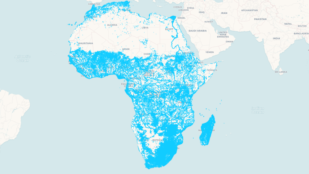
Unique among satellite-based global surface water datasets, the service provides previously unseen levels of access to data that can be used to assess and monitor surface water across the entire African continent.
“The service has been developed to support Africa’s governments, policymakers and key private sector actors in undertaking insightful planning, adopting critical risk mitigation strategies, and proactively managing Africa’s settlements, cities, communities, and livelihood activities which are dependent on, or adjacent to waterbodies,” said Dr Lisa-Maria Rebelo, Digital Earth Africa lead scientist.
The Waterbodies Monitoring Service tracks data from more than 700,000 unique water bodies across Africa, incorporating over forty years of satellite observations.
Updated weekly, the service maps changes in the surface area of waterbodies, including lakes, ponds, man-made reservoirs, wetlands and segments of river systems.
While other datasets provide important information on the presence or absence of surface water, Waterbodies Monitoring Service takes this a step further by providing the actual surface extent, along with the wet surface area, as a time series for each individual waterbody.
Application of the service can help decision-makers with detailed understanding of surface water availability, dry season access to water, changes in water body sizes over time and an understanding of potential flood risks.
Identifying user needs
The Digital Earth Africa science team interrogated what optimal waterbodies datasets might look like in terms of addressing user-defined needs, and delivering the most impact.
The outcome is a robust service, co-designed with Digital Earth Africa users, that provides highly detailed and far-reaching information on the continent’s waterbodies.
API access for all
The Waterbodies Monitoring Service can be accessed via an API, through the Digital Earth Africa interactive maps platform and the sandbox analytical environment.
The API helps service providers and product developers directly integrate the data into their work, allowing them to create customised queries around water body extents, historical wet surface area and changes related to these.
A user could, for example, request data on all waterbodies in a particular area, as well as the wet surface area time series for each of those waterbodies. From this, powerful and highly customised summaries can be created to allow the close monitoring of an individual waterbody, or to understand trends and the latest status of a collection of waterbodies.
Get involved
Over the next few months, the Digital Earth Africa team will be seeking feedback from users engaged in real-world applications of the Waterbodies Monitoring Service.
Click here to obtain an overview of Digital Earth Africa’s Waterbodies Monitoring Service.
To find out more information about the Digital Earth Africa Waterbodies Monitoring Service, please contact communications@digitalearthafrica.org
Digital Earth Africa, the world’s largest operator of the Open Data Cube (ODC) infrastructure, is a free platform for accessing satellite imagery specific to the African continent, which is also hosted on the continent. By packaging Earth observation data into accessible and free data sets, African governments, industry players, and decision-makers, can track changes across the continent in unprecedented detail.