
26-28 May 26
WMO,
Geneva, Switzerland
Statements
Statement Type
Member Type
Armenia
Australia
Canada
Full Statement 

“Canada continues to invest in Earth Observation, from in-situ measurements to satellite systems, in order to better monitor our changing environment, and recognizes the importance of knowledge sharing and international cooperation in achieving common goals for the global benefit of our planet.”
Mr. Neil Carson National Atmospheric Monitoring Directorate, Meteorological Service of Canada, Environment and Climate Change Canada
Over the past six years, GEO BON supported the application of biodiversity monitoring, from national to global scales. GEO BON has contributed to shaping the Kunming-Montréal Global Biodiversity Framework and to building the tools, indicators, and partnerships needed to deliver it. Canada is well positioned to continue playing an important leadership role in GEO BON and supporting countries in turning global commitments into measurable outcomes.
Dr. Andrew Gonzalez Professor McGill University, Liber Ero Chair in Biodiversity Conservation, co-chair of GEO BON, and Quebec Centre for Biodiversity Science Director
China
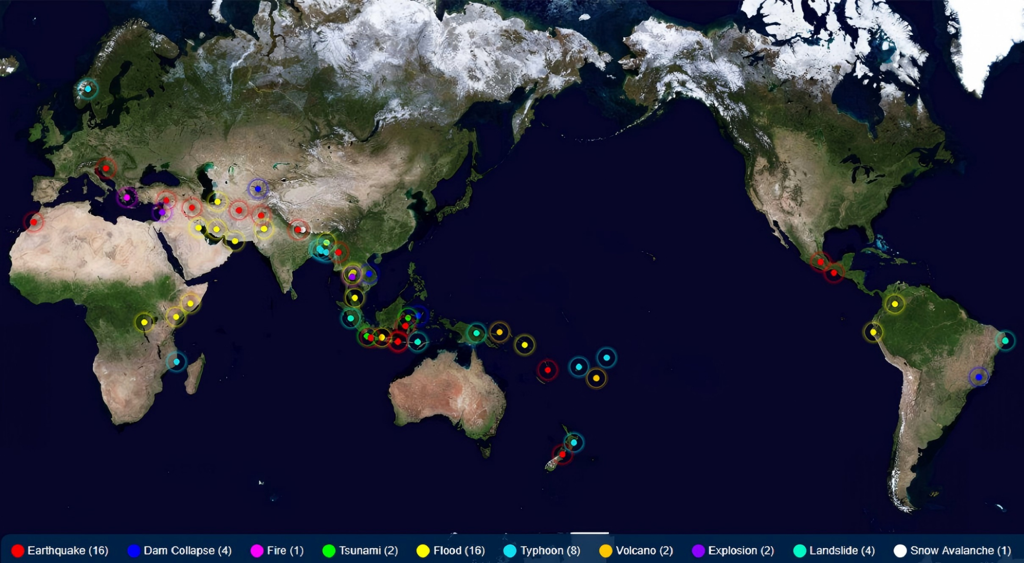
GEO China Secretariat initiated the Collaborative Network of Disaster Data Response (CDDR) in 2016 in response to the GEO’s call for global coordinated disaster risk reduction. The CDDR mechanism has a membership of 34 China’s satellite agencies and 9 international Organizations, which contributes to the implementation of the UN 2030 Sustainable Development Goals. As of 2025, it had integrated 30 high resolution optical, radar, and hyperspectral satellites to cope with 73 major disaster emergency events such as earthquakes, floods, landslides, tsunamis and volcanic eruptions in 38 countries.
GAO Xiang geosec-china@cstec.org.cn
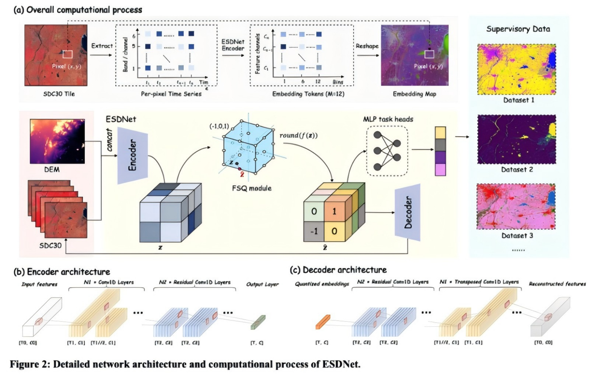
The Pengcheng Laboratory and the University of Hong Kong have jointly developed the world’s first 2000–2024 global 30m resolution low-dimensional embedding dataset (Embedded Seamless Data, ESD), which stands as the current low-dimensional embedding data product with the longest time series, highest level of lightweight design and optimal quality. Integrating multi-source massive observation data, this product achieves 340× efficient data compression and information-dense latent representations, and delivers outstanding performance in tasks such as land cover classification. It greatly reduces computational resource requirements, enabling decades-scale global data analysis to be completed on local workstations. Going forward, we will take a series of AI-Ready data products represented by ESD as the core, and provide high-quality and high-efficiency intelligent customized computing services through the Pengcheng Nebula Data Service Platform.
Wang Jie wangj@pcl.ac.cn
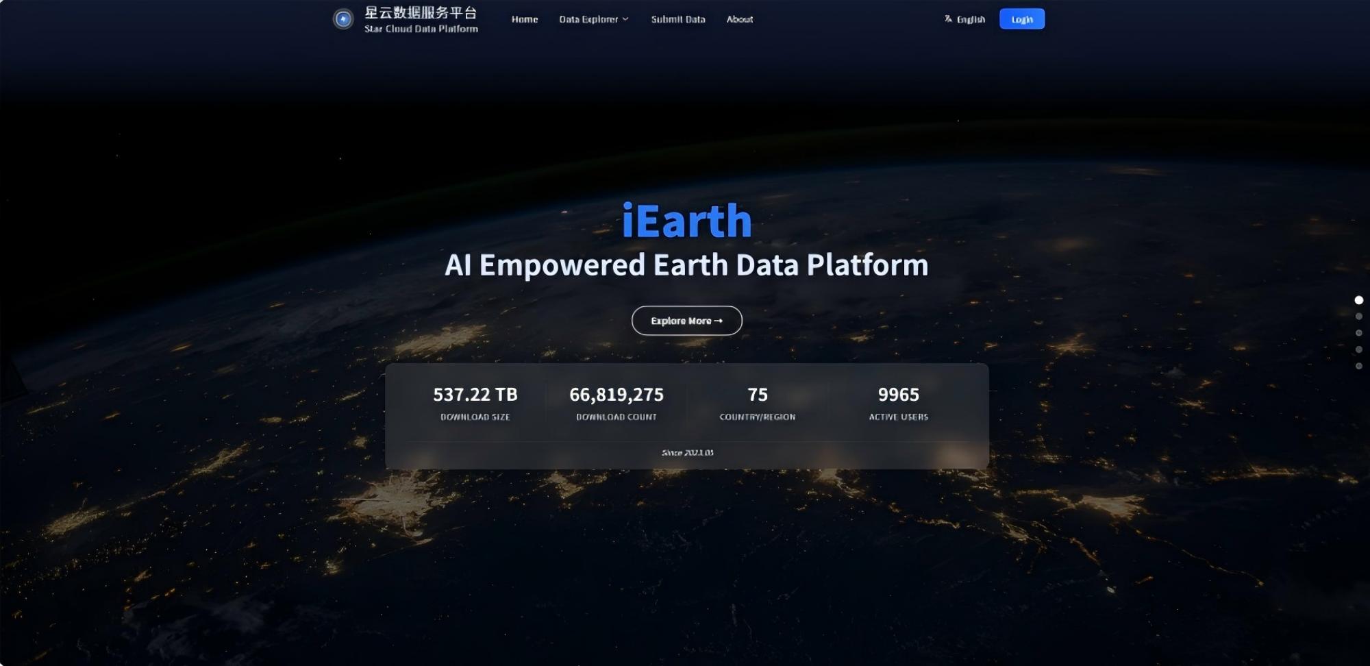
Based on the China Computing Network, we have established the Pengcheng Nebula Data Service Platform to deliver inclusive, efficient, and elastic intelligent customized computing services to GEO members through the World Computing Network Alliance. Centered on self-developed AI-Ready data products, including the ESD low-dimensional embedding dataset, the platform features an integrated system for multi-source information extraction, high-precision spatiotemporal calibration, and intelligent customized computing, significantly lowering the barrier to global-scale long time-series analysis. Over the next decade, the platform will continuously expand its service capabilities, providing a cumulative total of approximately 35 million core-hours of intelligent customized computing. This initiative will empower high-quality development in fields such as global change, ecological monitoring, and land resource management, supporting GEO in achieving its third-decade goal: “Earth Intelligence for All”.
Tian Geng tiang@pcl.ac.cn
Currently, China operates ten FengYun satellites in orbit, delivering real-time data and products to users worldwide. In 2025, FY-3H and FY-4C, both launched successfully. FY-3H enables accurate global greenhouse gas detection and supports climate change monitoring. FY-4C features improved observation frequency and precision, allowing for refined monitoring of weather systems and lightning. To maximize the utility of these satellites, China has established the FengYun Satellite Emergency Support Mechanism (FY_ESM) and developed a suite of web-based satellite application service platforms, including the MAZU-FengYun Satellite AI Box, enabling rapid response and comprehensive utilization of FengYun satellite data for global weather, climate, and disaster monitoring. Over the next two years, China plans to launch several additional FengYun meteorological satellites to further strengthen the global early warning system, support the United Nations "Early Warnings for All" initiative, and align with the four major priorities of the Group on Earth Observations (GEO), thereby providing robust support for informed decision-making and action.
WANG Jingsong nsmc_fy@126.com
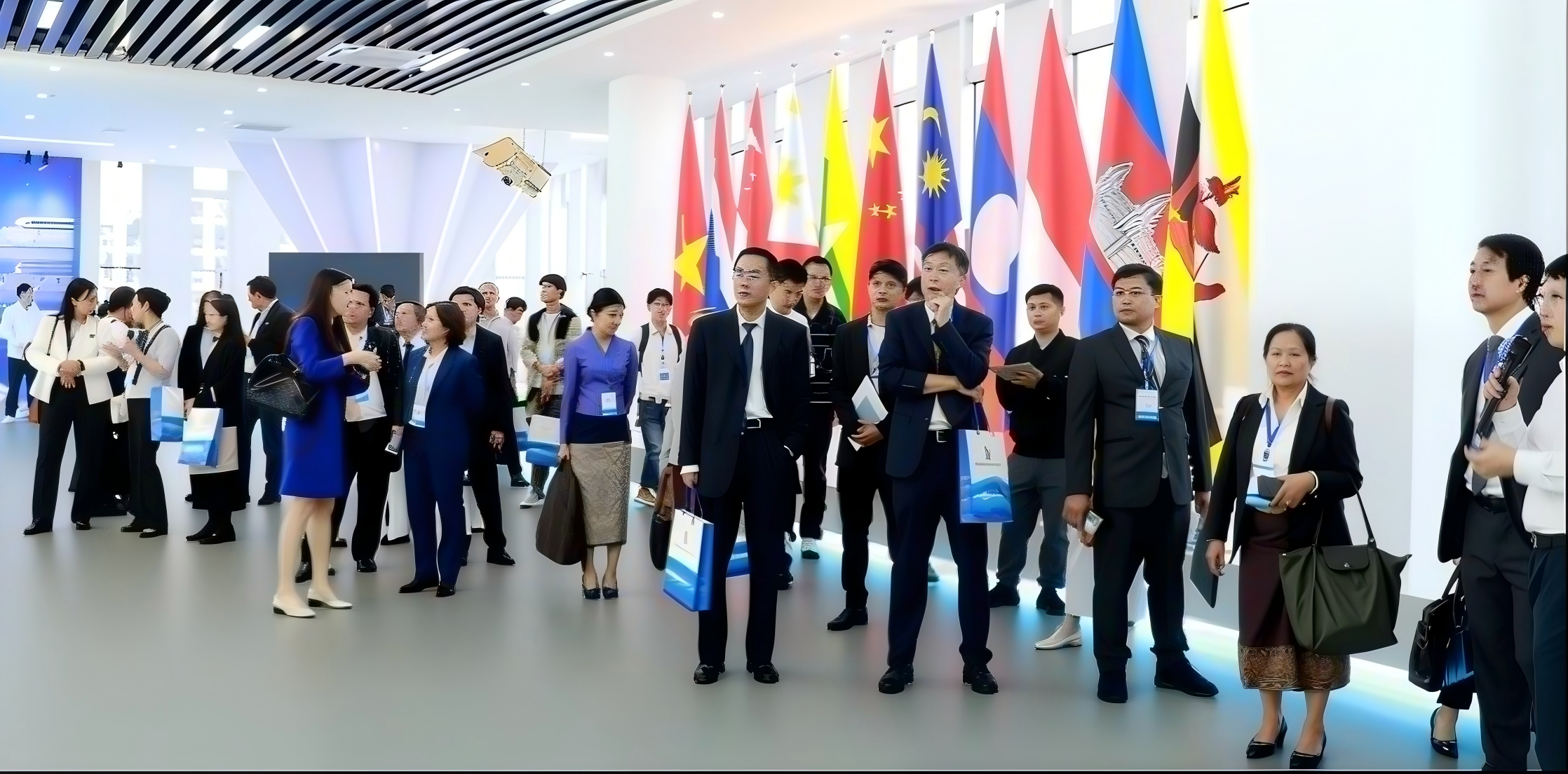
Chinese government in collaboration with relevant EO related authorities of African countries and ASEAN countries jointly build the China-Africa Cooperation Center on Satellite Remote Sensing Application(CACSA) and ASEAN-China Satellite Remote Sensing Application Centre(ACSAC),which uphold data-sharing network, carry out public goods development, satellite remote sensing monitoring and application demonstration, personnel training and exchange, so as to build a hub of knowledge sharing, experience exchange, and innovation in EO field.Moreover,Land Satellite Remote Sensing Application Center,MNR(LASAC) has jointly established 37 oversea nodes with 34 countries and 3 international organizations of Natural Resources Satellite Remote Sensing Cloud Service Platform(SatClouds) worldwide, shared more than 373,363 scenes within 11,599 baths and 480 TB of 2meter-resolution satellite images covering 114 countries and territories. These data have achieved the expected results in various domains of EO in the partner GEO Members.
Gao Xiaoming gaoxm@lasac.cn
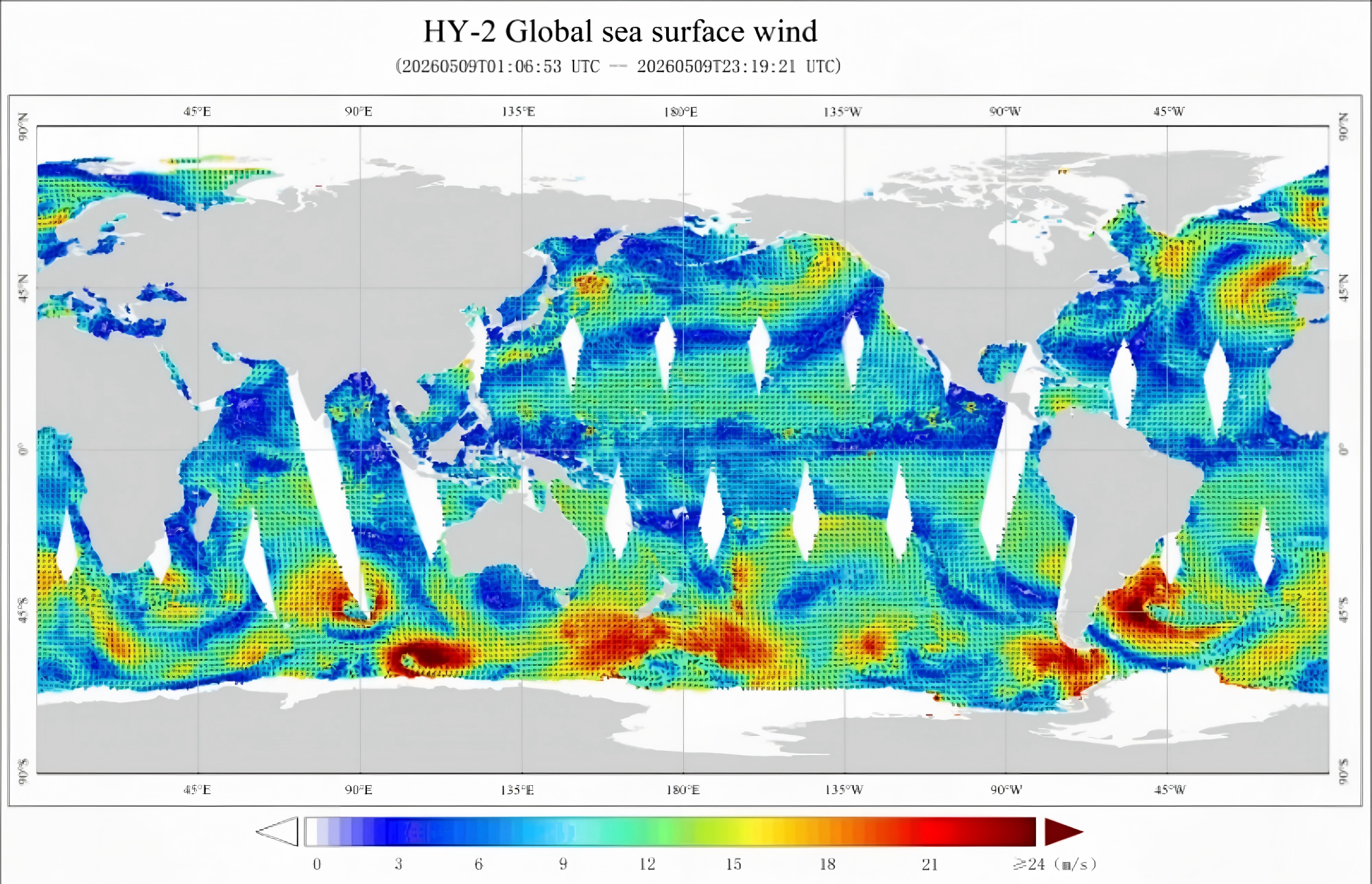
Global sea surface wind field data obtained by China’s ocean satellites can provide accurate evaluation support for the development of offshore wind power as a new energy source. In recent years, China’s ocean dynamic environment satellites equipped with scatterometers and SAR payloads have formed an observation network, enabling global wind resource surveys and local detailed investigations. Wind field products based on multi-payload data fusion have played a significant role in wind farm site selection, turbine model matching decision-making, and post-construction operation and maintenance. They effectively reduce development costs, improve power generation efficiency, and enhance the economic viability and operational stability of offshore wind power development. Furthermore, they provide important support for accelerating the global transition to clean energy, strengthening energy supply resilience, and addressing climate change.
Zhu Haitian zht@mail.nsoas.org.cn
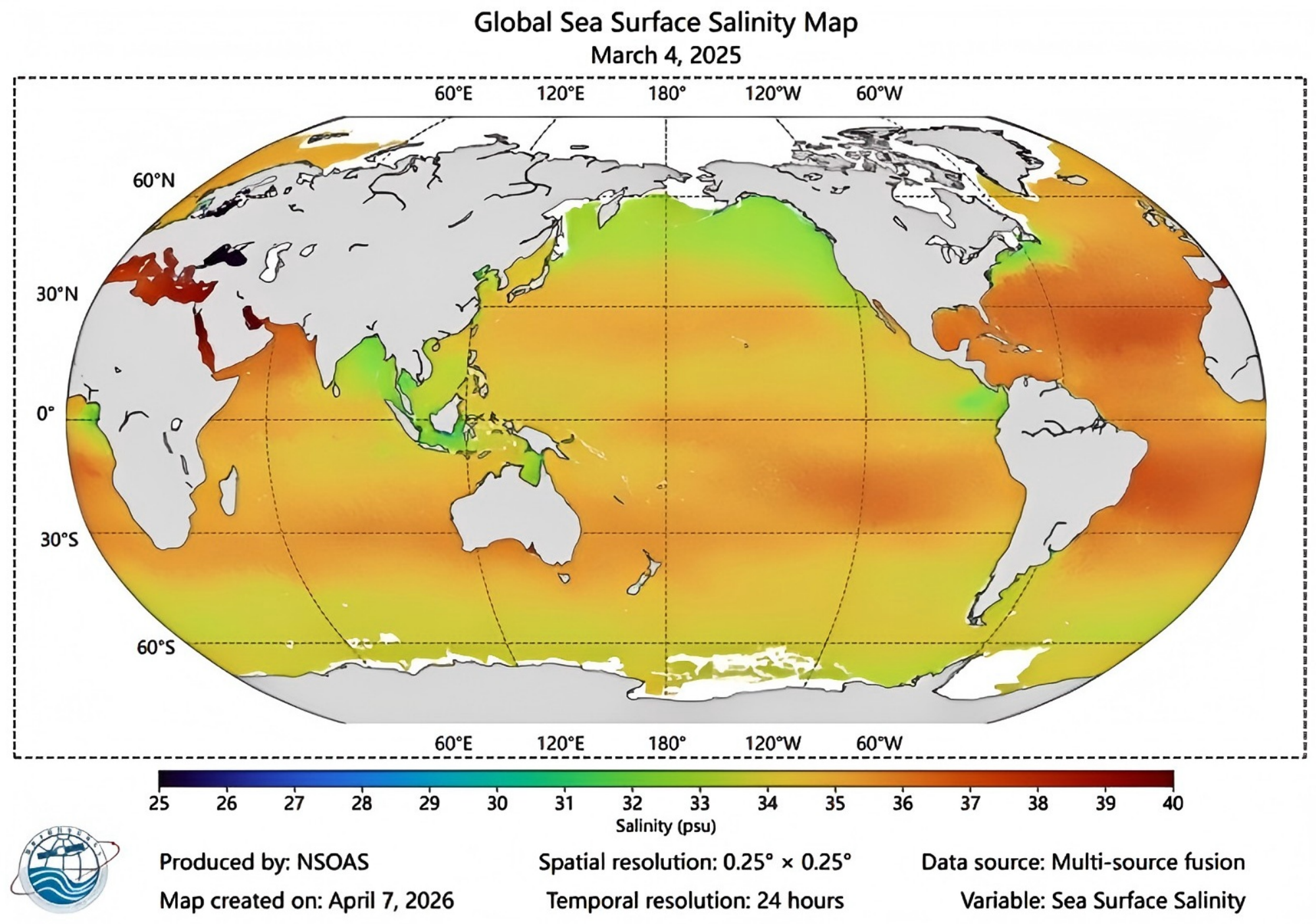
In November 2024, China successfully launched its first global high-precision sea surface salinity detection satellite(HY-4A). With a single salinity observation accuracy of 0.22 psu and a 30-day average accuracy of 0.091 psu, it helps to explore ocean heat storage and thermohaline circulation, improve the prediction level of climate anomalies such as El Niño, and support research on the correlation between sea surface salinity and the water cycle. The satellite also has the ability to detect soil moisture with an accuracy of 0.0374 m³/m³, which can be used for drought monitoring, agricultural environment assessment, and provide data support for regional water resource regulation and food security.
Diao Ninghui diaoninghui@mail.nsoas.org.cn
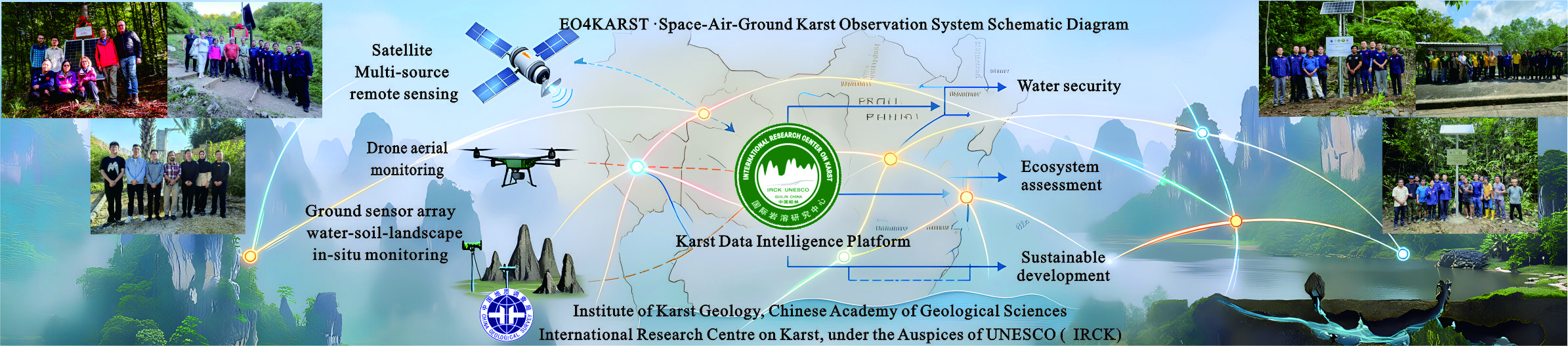
Implementation of the Global Typical Karst Area Observation (EO4KARST) Pilot Project, establishing an integrated "Space-Air-Ground" karst observation network, with monitoring demonstration sites set up in ASEAN, Central and Eastern Europe and other countries, achieving collaborative observation of water-soil-landscape. The project develops sustainable utilization models for karst landscape resources, supporting UN South-South cooperation demonstration cases, sharing karst observation data from 15 countries, and establishing a real-time monitoring data sharing mechanism. The achievements serve water security and ecological well-being for 25% of the global population in karst areas, effectively implementing GEO's vision of "Earth observation for the benefit of all humanity," and providing a Chinese solution for sustainable development in global karst regions.
Luo Qukan luoqukan11@163.com
Supported by the GEO Pilot Project, the UNESCO International Center on Global-Scale Geochemistry is systematically advancing the "Chemical Earth" International Big Science Program. By developing a global in-situ observation network, it fully underpins the core vision of GEO—sharing Earth observation data and driving global sustainable development. The global geochemical baselines network has cumulatively covered an area of over 37 million square kilometers, accounting for approximately 34% of the world’s land area. Joint geochemical mapping has been completed in 12 countries including Turkey, etc; a big data platform for the "Chemical Earth" has been built, which reveals the distribution patterns of key global elements and heavy metals. Multiple achievements have effectively empowered resource and environment assessment as well as green land conservation, and accelerated the application of GEO’s Earth observation outcomes.
Zhang Bimin zhangbimin@unesco-icgg.org
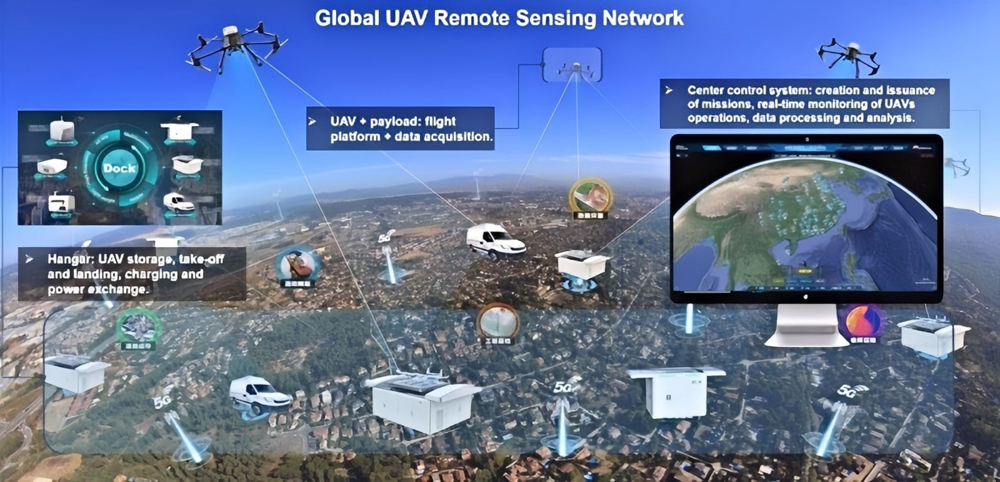
Through the construction of the Global UAV Remote Sensing Network Project, we have promoted China’s UAV remote sensing equipment and systems to bridge the gaps between satellite and ground-based observations within the GEO infrastructure, with a partnership network spanning Asia, Africa, and Europe, covering numerous GEO member states such as Nigeria and Serbia. Simultaneously, by hosting multiple ecological monitoring technical training sessions for the “Belt and Road” regions and co-supervising doctoral students and technical leads from countries like Tajikistan, we have effectively alleviated the shortage of professional talent in these regions. These efforts not only provide decision support for local institutions and governments but also contribute “Chinese Solutions” to global ecological security and international scientific cooperation, thereby supporting the implementation of the GEO Post-2025 Strategy.
YUE Huanyin yuehy@lreis.ac.cn
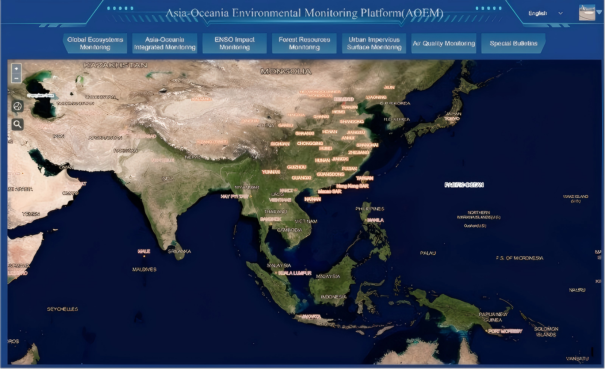
Relying on the GEOARC GWP to continuously promote cooperation in the Asia-Oceania region, built the Asia-Oceania Regional Ecological and Environmental Monitoring Platform (AOEM), successfully held relevant AOGEO meetings and clarified the development direction. By displaying China's high-quality Earth observation and geospatial data, we have improved the level of open sharing and interoperability of ecosystem monitoring data. Joint actions have been carried out for countries such as Cambodia and Pakistan, as well as the Asian Disaster Preparedness Center (ADPC), with the implementation of youth scholar exchanges and technical training to support capacity building in developing countries. We have deeply participated in the compilation of the GEO Ecosystem Atlas, integrated Chinese satellite data to support global ecological monitoring, biodiversity conservation and the implementation of sustainable development goals, and effectively supported the GEO global vision for sustainable development.
Liu Qinhuo liuqh@aircas.ac.cn
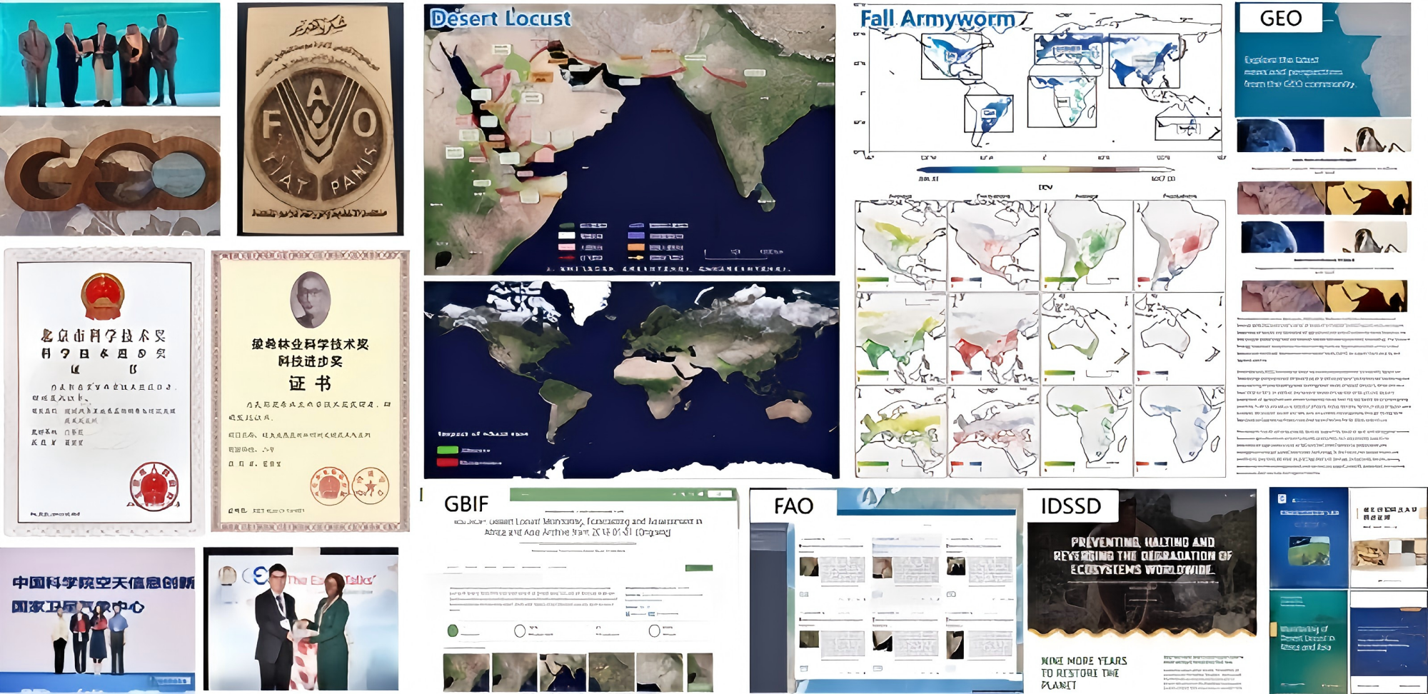
The GEO-PDRS targets major epidemic and migratory vegetation pests and diseases such as wheat rust, desert locust and fall armyworm. Under the GEO framework, it mobilizes international strengths in Earth observation and pest and disease surveillance to establish a global remote sensing-based monitoring and early warning system, and continuously delivers scientific reports and geospatial information products worldwide. The outcomes have been adopted by FAO and are shared and promoted through platforms such as GEO and GBIF to support global risk monitoring and prevention and control decision-making for major pest and disease threats. The initiative has received the FAO Outstanding Contribution Award and the GEO Team Impact Award; key member Linyi Liu received the GEO Emerging Leader Award, and its programme goals and roadmap were included in the first list of endorsed initiatives of the United Nations International Decade of Sciences for Sustainable Development. By strengthening Member countries' risk awareness and cross-border coordinated green management, GEO-PDRS supports food security and the implementation of the UN 2030 Sustainable Development Goals, demonstrating sustained contributions to GEO's vision and actions.
Huang Wenjiang huangwj@aircas.ac.cn
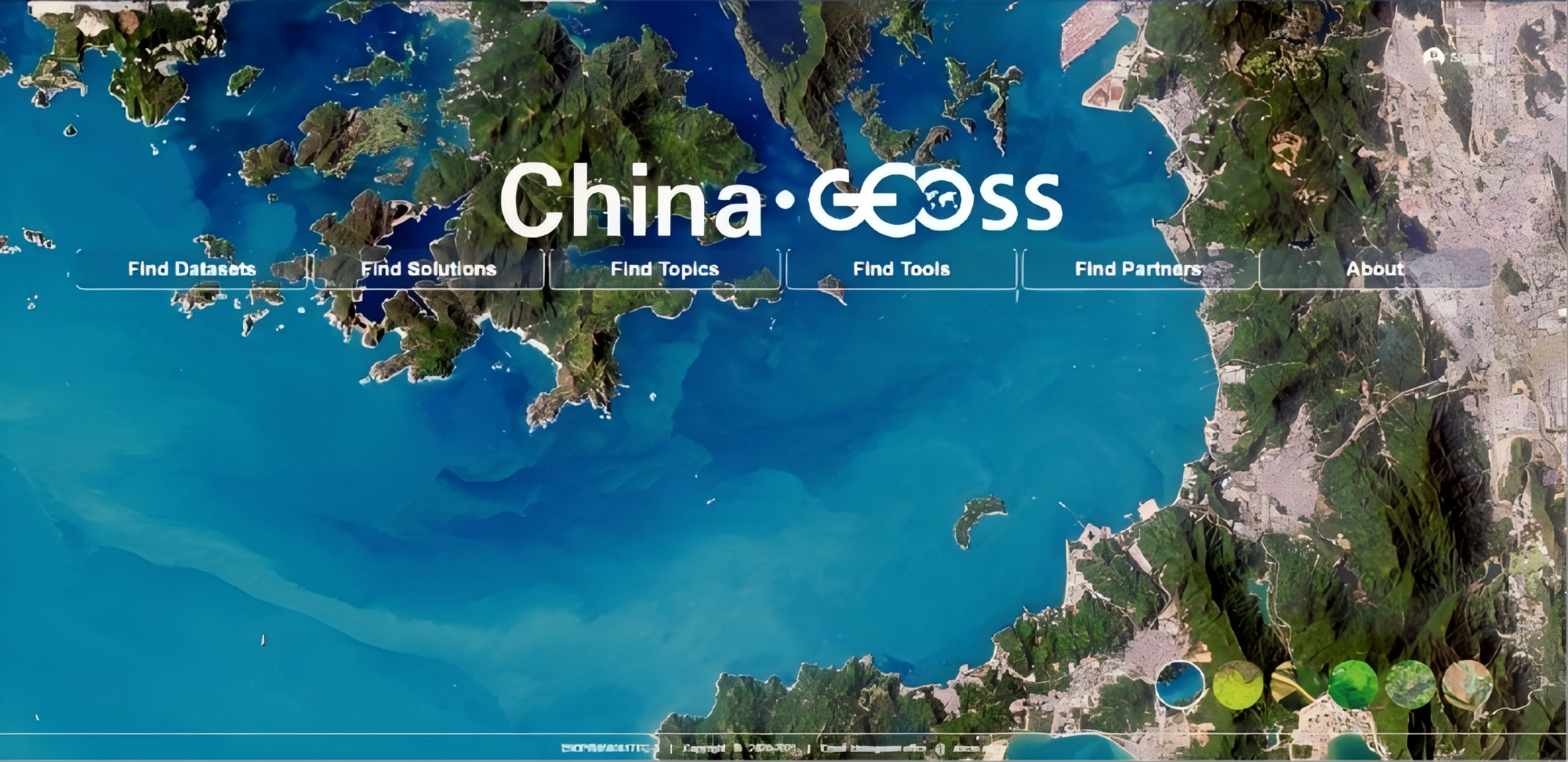
ChinaGEOSS Data Sharing Network has successfully established a national-level GEOSS infrastructures to integrate large number of archived satellite data, AI-ready data, scientific paper data and in-situ data. Facing the GEO engagement priorities, it completely shared 5.68 million data to GEOSS Portal in the past ten years. It has also collaborated with the GEO to establish the China GEO Knowledge Hub, which provides high-quality Earth observation solutions for the world, especially for developing countries, serving global issues such as climate change, disaster prevention and mitigation.
Zhang Lianchong zhanglc@aircas.ac.cn
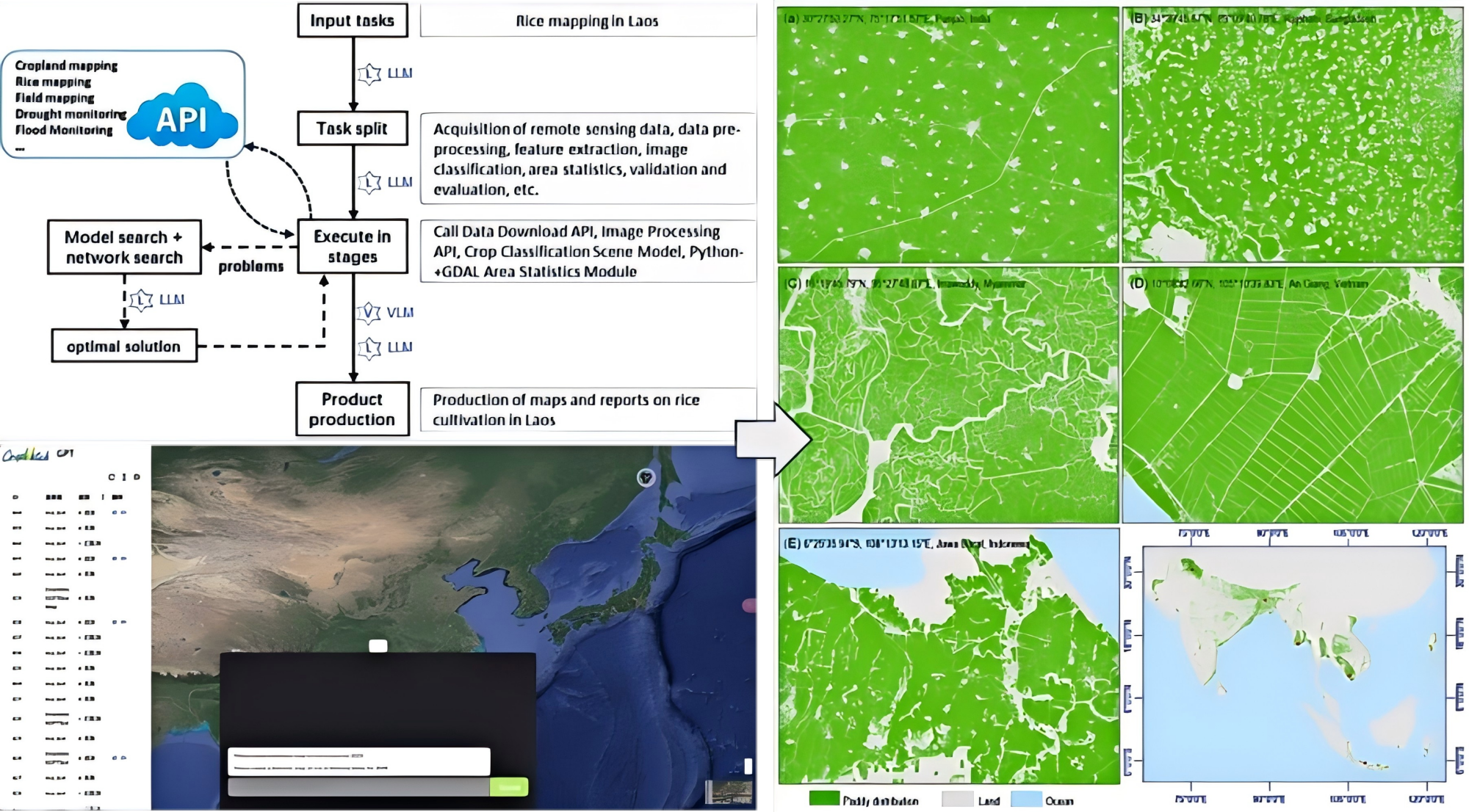
Under the GEOGLAM framework, the CropWatch team enhances global food security through the adoption of the cutting-edge Earth Intelligence strategy. By leveraging an AI-driven pipeline, including CropWatchGPT, a multimodal LLM agent for automatic crop analysis and deep learning model for accurate field boundary delineation, CropWatch has empowered 32 “Global South” countries across Asia, Africa, and Latin America to achieve independent agricultural monitoring. Customized cloud-based platforms and the CropWatch Farmer App have been deployed in Nigeria, Cambodia, Thailand, Mongolia, and Mozambique, transforming sophisticated Chinese solutions into accessible global public goods. This initiative lowers the barriers for accessing critical agricultural information, strengthens developing countries’ resilience against climate change and food fluctuations, and provides robust data support for UN SDG 2.
Zhang Miao zhangmiao@aircas.ac.cn
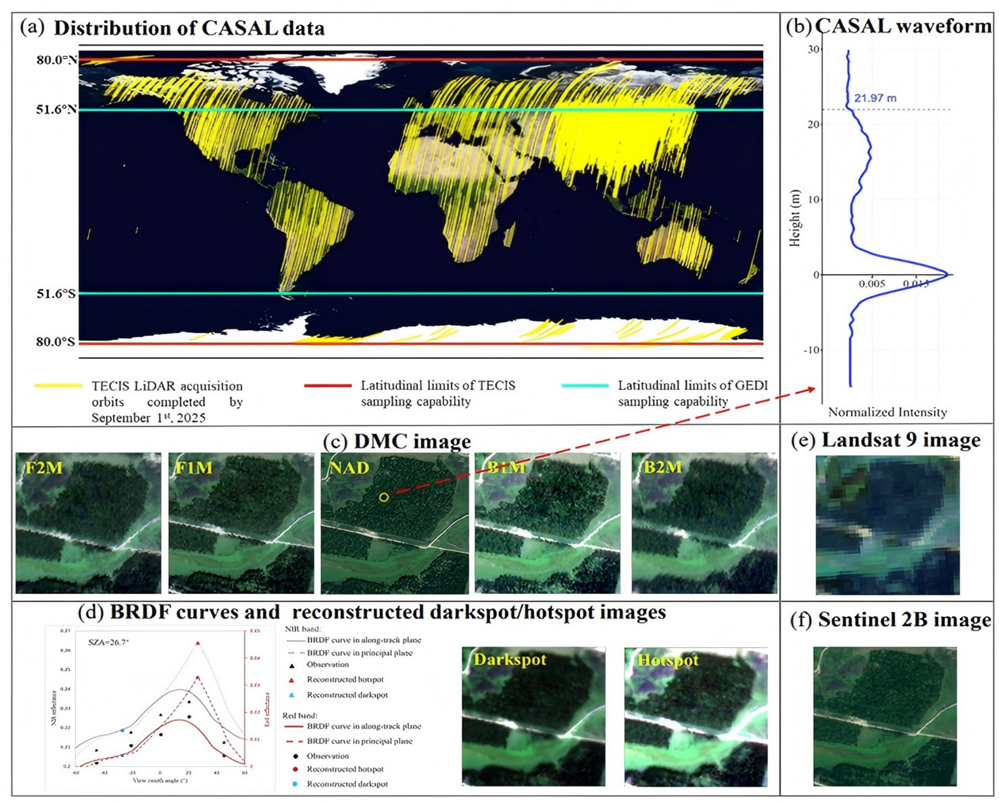
The large-footprint full-waveform LiDAR onboard the Terrestrial Ecosystem Carbon Inventory Satellite (TECIS, also known as "Goumang"), combined with Sentinel-2 multispectral imagery, provides a crucial data source for forest parameter retrieval and large-scale, spatially continuous mapping. This project aims to develop footprint-level forest biomass products and achieve active-passive synergistic continuous mapping across China and Europe using TECIS data. This product demonstrates the substantial potential of the TECIS satellite in generating high-accuracy forest biomass products and enabling the fine-scale mapping of forestry carbon sinks.
Pang Yong pangy@ifrit.ac.cn
The development of the Earth observation system has proceeded steadily and yielded remarkable outcomes.
(1) China has established a national rain attenuation monitoring network covering 13 cities including Beijing, Qingdao and Lanzhou, and revised two international rain attenuation standards, namely ITU-R P.530 and ITU-R P.619. These efforts have effectively supported the improvement of the global rain attenuation monitoring system and promoted the development of wireless communication such as satellite communications in the Ka-band and higher frequency bands, as well as terrestrial line-of-sight(LOS) communications systems.
(2) China has constructed 250 sets of atmospheric monitoring systems, including microwave radiometers and atmospheric temperature-humidity profilers. And developed cutting-edge detection technologies such as X-band phased-array weather radars and precipitation-measuring radars. These achievements have provided contributions to global Earth observation data sharing and disaster prevention.
XU Bin jasur82@163.com

Committee on Earth Observation Satellites
Ecuador
Hugo Aviles Instituto Geografico Militar

European Centre for Medium-Range Weather Forecasts
Full Statement 
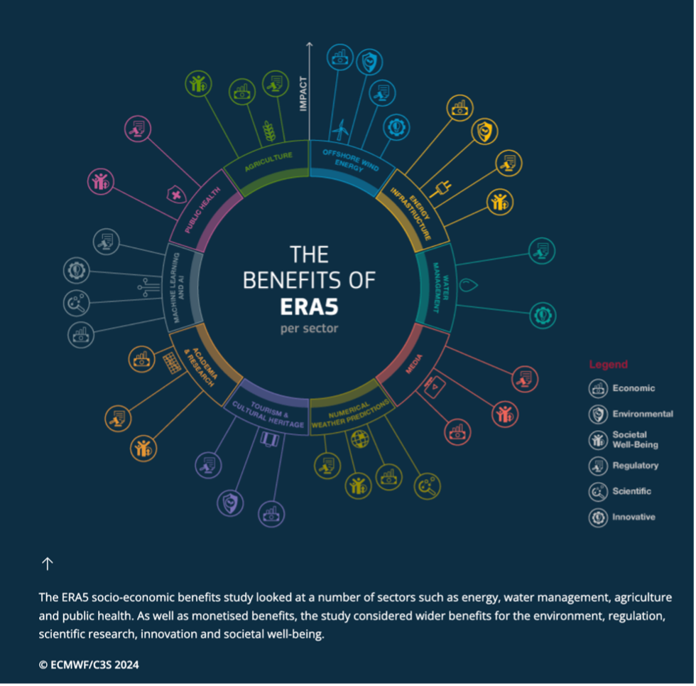
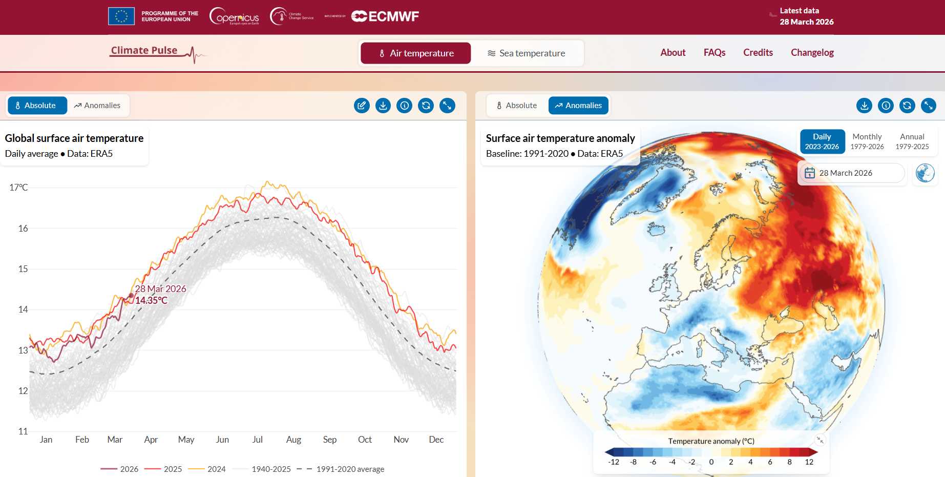
“Continuous investment in Earth Intelligence is essential to build a resilient future. The socio-economic benefits study on Copernicus’ global reanalysis data, ERA5, clearly demonstrates that when high-quality, open data are transformed into actionable insights, every euro invested can return many times its value to society.”
Stijn VermooteECMWF
European Union
Full Statement 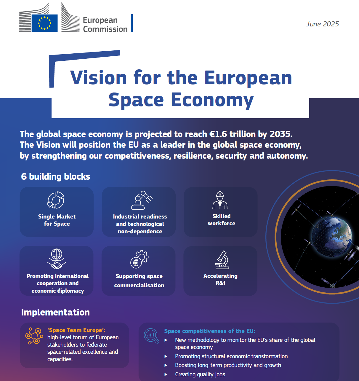

The European Union aims to lead in the space economy by 2050. Central to this vision is Copernicus, which continues to provide free, full, and open access to high-quality data, supporting innovation, sustainable development, competitiveness and global cooperation
Giancarlo Granero European Commission, DG Defence Industry and Space
Copernicus has revolutionized Earth observation, addressing key societal priorities such as environmental monitoring, climate change, and disaster management. Copernicus free, full, and open data foster a culture of innovation and enables policymakers and the public to make informed decisions. As such, Copernicus represents a major contribution to GEO and broader Sustainable Development Goals.
Mauro Facchini European Commission, DG Defence Industry and Space
The European Environment Agency (EEA) recognises the significant value of the GEO community and remains committed to strengthening the sharing and use of Earth observation and in situ data in support of environmental and climate policies. Earth observation is an increasingly key enabler of the core work of the agency and the European Environment Information and Observation Network (Eionet), in contributing to Europe's transition towards sustainability.
EEA's contribution to GEO includes the launch in 2024 of the project “Enhancing the access to in situ Earth observation data in support of climate change adaptation policies and activities”, funded by the European Commission (DG RTD). Now in its second year, the project has already made a strong contribution to GEO, notably through the drafting of the GEO In Situ Data Strategy, endorsed in November 2025, and through ongoing support to its implementation plan.
The project has also contributed to the development of success stories and dialogues showcasing best practices and demonstrating the added value of open data principles. In parallel, the EEA continues to develop the Geospatial In-Situ Requirements Database (Greqs) to document and manage user needs across the GEO Work Programme. Through close engagement with the community, this work supports requirement identification and facilitates matchmaking with data providers. Together, these efforts aim to improve the availability and accessibility of in situ data, thereby advancing the GEO vision of Earth Intelligence for a Resilient Future.
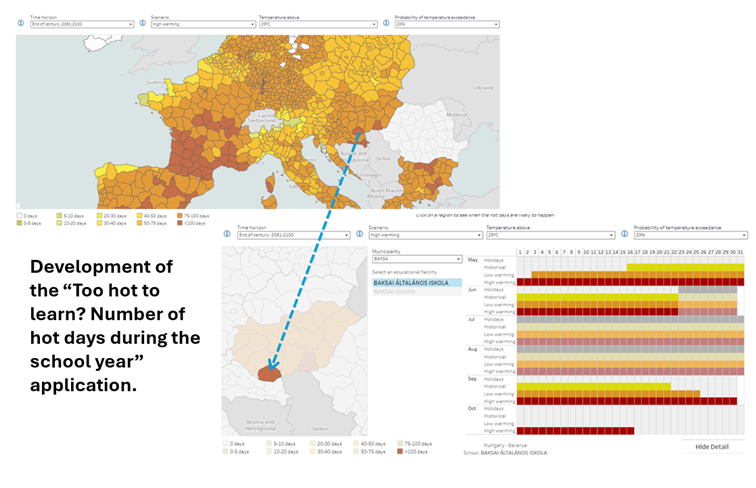
In addition, the project developed practical showcases illustrating how openly available in situ data can inform decision making and promote resilience to climate change. One such example is a tool combining school locations, holiday calendars and localised climate projections to assess potential impacts of rising temperatures and help school develop resilience strategies.
EEA is also proud of its role as Entrusted Entity in charge of the Land component (CLMS) of the Copernicus programme and coordinating the Copernicus In Situ Component and has recently finalised the Copernicus In-Situ Component 2028–2034 strategy. Among the key pilars of this strategy is the cooperation with data providers at national, regional and global level, as well as aspects related to resilience and strategic autonomy, which rely on the diversification of partnerships and in-situ sources for Copernicus. In this context, the EEA sees GEO as a key strategic partner, providing a unique global platform to connect in situ communities, align efforts, and promote open and interoperable Earth observation data worldwide.
Karl Hamilton European Environment Agency (EEA)
Earth Intelligence places the user and their institutional context at the centre of the value chain, from data to societal impact. It requires the conditions for heterogeneous actors to function as a coherent system, capable of continuously learning and adapting to the demands of our time. Through EuroGEOSec, EuroGEO has worked to build the institutional and organizational foundations that make this possible: shared practices, structured co-design, and an enabling ecosystem contributing to the Twin Transition in Europe and supporting the Earth Intelligence transformation within GEO. This is the enabling role a EuroGEO Secretariat can take.
N. Fichaux, T. Ranchin, L. Ménard, M. Reboul MINES Paris PSL
At the JRC, we see Earth Observation and AI not as an end in itself, but as the foundation for Earth intelligence — the capacity to turn satellite data together with other data streams into actionable knowledge that directly serves policy. Our Earth Observation community is increasingly working across disciplinary boundaries, combining Copernicus data with in-situ networks, modelling, and AI to deliver integrated assessments that policymakers can act on. This is also the spirit in which the JRC contributes to GEO flagships such as GEOGLAM — where we hosted a workshop last year to prioritise Essential Agricultural Variables, translating the community's collective expertise into a shared framework for monitoring global agriculture & food security. The GEO partnership remains essential to this mission: no single institution or programme can build Earth intelligence alone.
Alessandra Zampieri European Commission, Joint Research Centre
To tackle today’s challenges, we need access to reliable and relevant information. By supporting the Group on Earth Observation, we turn data into practical tools that help countries anticipate risks, respond to disasters and plan ahead and make them more accessible to those who need it the most. Through Global Gateway, we reinforce these efforts, investing in trusted partnerships that strengthen local capacity and drive innovation. For example, with initiatives like the Africa-EU Space Partnership and our Copernicus hubs in Panama, Chile and the Philippines.
Jozef Síkela European Commission
"At iClimateAction, our work with the GEO Community is to ensure that Essential Climate Variables are not only monitored, but also made accessible and usable across institutions. As the volume of Earth observation data continues to grow, the real challenge is no longer data availability, but its interoperability, coherence, and effective use across systems.
By bringing together GEO, the World Meteorological Organization and the Global Climate Observing System, we are working to harmonise the ECV data chain and address fragmentation in governance, infrastructure and standards - so that data can move more seamlessly from observation to action."
Paolo LajChief, Atmospheric Environment Research, World Meteorological Organisaton (WMO), iClimateAction Project Coordinator
European Union Satellite Centre
Full Statement 
The European Union Satellite Centre supports EU decision-making and actions through geospatial intelligence. Within GEO, it leads the SPACE-SECURITY Convener to connect capabilities across domains and strengthen coordination in addressing evolving global security challenges.
Andrea Patrono European Union Satellite Centre (SatCen)

Germany
Full Statement 
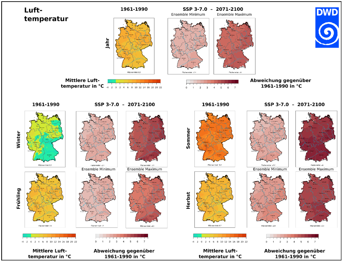

Investing in Earth Intelligence is fundamental to strengthening climate resilience and enabling effective adaptation to climate change impacts. Recent years have shown that extreme weather events – from heatwaves and droughts to heavy precipitation and flooding - are becoming more frequent and impactful, affecting infrastructure and ecosystems as well as human health and lives. The German National Meteorological Service, DWD, provides the scientific foundation to monitor, forecast and project the changing climate risks in support of optimum adaptation to climate change. Our new reference ensembles for instance comprise the latest generation of regional climate projections and undergo a rigorous multi-step evaluation against observations - by disregarding implausible simulations of the past. The resulting ensembles provide a robust and consistent basis for evidence-based adaptation decisions across sectors and regions in Germany. In line with emerging European approaches, such validated data are essential to assess long-term climate variability and trends, anticipate related climate risks, and guide forward-looking adaptation pathways for a resilient future.
Tobias FuchsMember of the DWD Executive Board, Director Climate and Environment Services
EO College makes Earth observation knowledge accessible to a broad community of users – from schools to adult education – and supports the sustainable development of capabilities in working with remote sensing data. The platform offers open educational resources such as online courses, tutorials, and teaching materials under open licenses (https://eo-college.org/). EO College is operated by EO College e.V. and Ruhr University Bochum and funded by the German Space Agency at DLR.
Godela RossnerHead of Department “Earth Observation”, German Space Agency at DLR
GEO-LDN is about turning data into action. We support countries affected by land degradation not only in meeting SDG 15.3.1 reporting requirements, but in using Earth observation data for better, evidence-based land use decisions. At the same time, ongoing efforts focus on improving access to high-resolution geodata, contributing to global geospatial reporting standards, and enhancing synergies across the Rio Conventions.
Antje HecheltjenLead of the GEO-LDN Secretariat, International Cooperation Agency GIZ
Global Climate Observing System

Greece
Integrated Carbon Observation System
Full Statement 
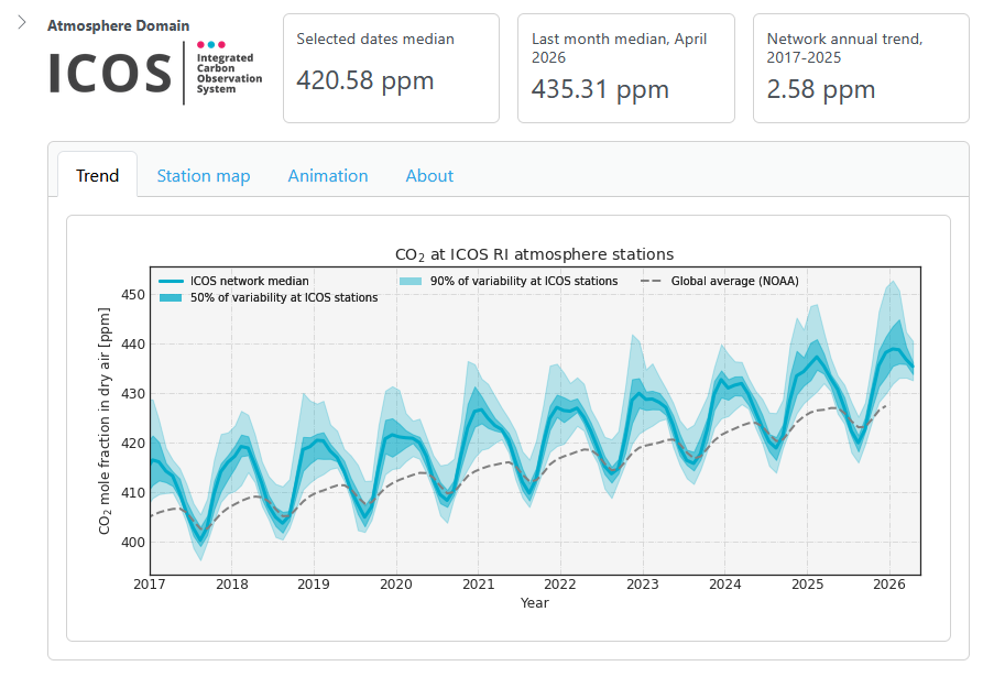
In the autumn of 2025, the Integrated Carbon Observation System (ICOS) launched its “ICOS Curve” to inform the discussions at the Earth Info Day at COP 30 in Brazil. The curve is a new, interactive data visualization tool displaying the near-real-time, long-term changes of CO2, CH4 and N2O greenhouse gases based on open data collected from 38 ICOS atmosphere stations in Europe. It is updated daily, in contrast to similar tools which are usually updated with 4 to 12 months delay.
The ICOS Curve displays the ‘network median’ concentration from ICOS stations, showing the overall trend of the continent, with the seasonal biospheric cycles. It is fully interactive, and users can select specific locations. It is for example possible to compare ‘background’ stations with those in high-emission urban centres, to highlight the impact of human activity on the local atmosphere. This is made possible by the highly standardized measurements performed in ICOS that ensure full comparability of the ICOS data. The annual growth rates for CO2, CH4 and N2O are also calculated for the selected periods and provide a direct metric of the efficacy of climate policies in reducing the concentrations of GHG in the atmosphere.
The ICOS Curve is an important, policy-relevant tool in the present day, as it provides crucial evidence on the state of the atmosphere. As the tool uses 38 separate stations from 16 European countries, it is a resilient, transparent and independent resource for climate monitoring.
The visualisation tool was designed in the ICOS Carbon Portal by Alex Vermeulen, Zhendong Wu and Andrew Debevec, together with the ICOS RI team. Similar curves for the ecosystem and ocean are under development. The ICOS Curve can be found at https://curve.icos-ri.eu.
Sindu Raj ParampilIntegrated Carbon Observation System (ICOS)
International Astronautical Federation
Full Statement 
“In a rapidly changing world, Earth Intelligence needs to go further, delivering real impact, not just access. Inspired by open data, strong collaboration, and landmark events like the IAF Global Space Conference on Climate Change (GLOC 2026), we are growing a dynamic ecosystem where innovation and partnership drive space solutions for a resilient, sustainable future.”
Christian Feichtinger International Astronautical Federation (IAF)

International Institute for Geo-Information Science and Earth Observation
Full Statement 
Being part of the global GEO network assures the sharing of knowledge and provides opportunities for collaboration and co-creation of tools, training/education materials and innovative technologies. We apply earth observation data and geoinformation science in four profiling themes which are closely aligned with GEO’s priorities: GEO AI, Resource Security, Urban Futures and Disaster Resilience.
Freek Van Der MeerITC
ITC-is part of the Open Science network. ITC is actively involved in several GEO flagships and initiatives as participants in regional events, as members of the sub-groups or as co-chairs. Our mission is institutional strengthening in and with partners in the Majority World.
Freek Van Der MeerITC

Italy
Full Statement 


Italy is strengthening the coordination amongst national experts involved in Earth Observation (EO) domains through the GEO-ITALY Group (www.geoitaly.org).
The GEO-ITALY overarching goal is to reinforce the synergies amongst involved institutions in Italy, thus facilitating a broad range of capacity building and outreaching activities to stakeholders and policy makers both at national and international level.
Members of GEO-ITALY are scientists, researchers and managers employed in several Institutes of the National Research Council of Italy, in the National Institute of Geophysics and Volcanology (INGV), in the Italian National Institute for Environmental Protection and Research (ISPRA), in many other public institutions in the Country, such as the Italian Space Agency (ASI) and the Euro-Mediterranean Centre on Climate Change (CMCC), as well as in private companies such as PLANETEK, e-GEOS, MEEO, Latitudo 40 and TEAMDEV.
GEO-ITALY goal is to support the achievement of goals and objectives of the GEO post-2025 Strategic Implementation Plan and its work program for 2025-2030 period, through an active participation to the various GEO initiatives, flagships and incubator programs.
The Global Observing System for Mercury (GOS4M) Flagship main challenge is to foster the sharing of monitoring data and modelling tools to support the policy implementation.
GOS4M (www.gos4m.org) is aimed to federate existing networks, monitoring programmes and observing infrastructures – currently it provides a link to the Global Mercury Observation System (GMOS – www.gmos.eu) and major existing regional networks. During the last year GOS4M developed the Knowledge Hub aimed to support the achievement of the objectives of international programmes and conventions related to mercury pollution which include UNEP, Minamata Convention on Mercury (MCM) Secretariat, UNECE-LRTAP and 2030 UN Agenda on SD. Special attention is paid to support all interested Parties in the implementation of the MCM. To this end global comparable monitoring data, validated models and policy interoperable tools are provided as part of the GOS4M Knowledge Hub designed to evaluate the relationship between cause and impact of mercury contamination, analyse cost-effective strategies aiming at reduce the mercury contamination at regional and global scale and co-design policy scenarios aiming to achieve the target of the MCM.
GOS4M is contributing to the GEO Knowledge Hub enabling open access to core data, tools, and applications, which are essential to delivering on the vision of “Earth Intelligence for All”. The GOS4M implements the GEO’s Open Data Sharing Principles and Open Knowledge framework for delivering actionable information to users, stakeholders and decision makers.
Sergio CinnirellaCNR
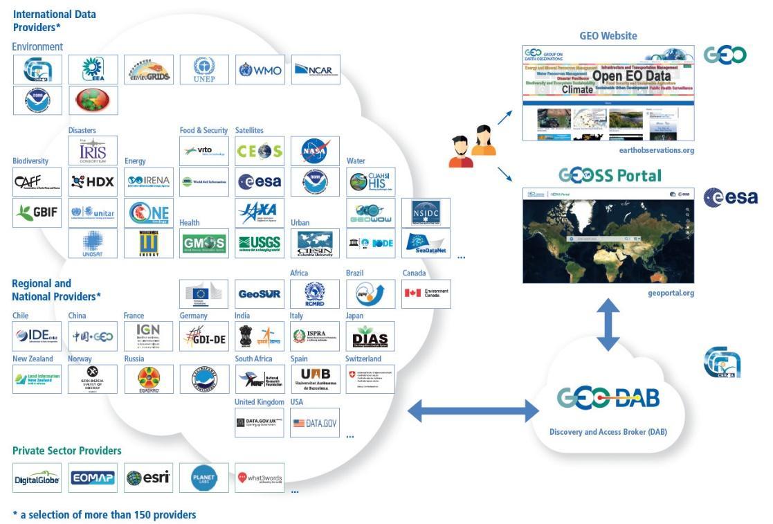
Italy is continuing its longstanding activity to enhance the discovery and accessibility of data, information, and knowledge. It supports the GEO effort for an open and public infrastructure for data sharing and knowledge generation to deliver Earth Intelligence according to the GEO Statement for Open Knowledge. Italy carries out activities for facilitating data sharing, developing the Discovery and Access Broker (DAB), and for knowledge generation and management developing the Virtual Earth Laboratory (VLab), a knowledge platform for model sharing and running in multicloud environments. Italy is co-chair of the GEOSS Platform Operation Team (GPOT) and member of the GEO Infrastructure Development Task Team (GIDTT). It also participates in the activity of the GEO Data Working Group and its sub-groups. For the advancement and evolution of the GEO infrastructure, collaborations are ongoing with ESA, EC-JRC, USA (USGS), Germany (DWD), Switzerland (University of Geneva), China (Ministry of Science and Technology).
Paolo MazzettiCNR
A further contribution of Italy to the many GEOSS Ecosystems tasks is offered by the GEO ECO (GEO Global Ecosystem) Community Activity and Action Group, co-lead by CNR. GEO ECO builds up and extends the approach used in the European Horizon 2020 ECOPOTENTIAL project, led by CNR, and from a few other initiatives, to other protected areas in Europe and in other continents.
GEO ECO aims to use available Earth Observation data, research results and tools on a global scale for enhancing knowledge on natural ecosystems, identifying protected areas (PAs) of international relevance as focus areas for its activities, as they are aimed to preserve natural ecosystems, and thus have a high intrinsic value for human societies. In Italy, a key PA will be the Gran Paradiso and the Alta Murgia National Parks, also involved in ECOPOTENTIAL, the former H2020 project on Earth Observation data for ecosystems in protected areas supporting GEO (2015-2019). The detection and modelling of the state and development of natural ecosystems in PAs is a priority for monitoring the advancement of the SDG 14 and 15. It also extends its analysis to unprotected areas.
GEO ECO is adopting the view of ecosystems as "one physical system" with their environment, characterized by strong geosphere-biosphere-anthroposphere interactions across multiple space and time scales. The GEO ECO implementation plan can be downloaded here: www.earthobservations.org/documents/gwp20_22/GEO-ECO.pdf
Antonello ProvenzaleCNR
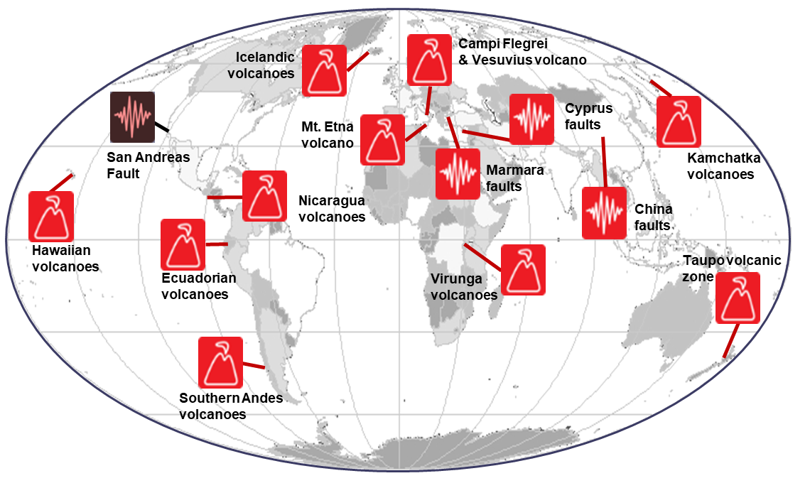
The Italian Space Agency (ASI) actively supports GEO Initiatives related to Disasters Risk Reduction (DRR) like GEO Geohazard Supersites and Natural Laboratory initiative (GSNL), a voluntary international partnership aiming to improve, through an Open Science approach, geophysical scientific research and geohazard assessment in support of DRR. ASI regularly provides thousands of products from its national assets (mainly COSMO-SkyMed but also PRISMA and SAOCOM, in the latter case over ASI Zone of Exclusivity (ZoE)) to all the 13 Supersites and Natural laboratories all over the world, which represent multi-hazards pilot projects aiming at demonstrating the value of earth observation data for DRR as well as to build regional capacity in this sector.
Antonio Montuori ASI
Italy, through the Istituto Nazionale di Geofisica and Vulcanologia, supports with important in-kind resources, the Geohazard Supersites and Natural Laboratories GEO flagship (GEO-GSNL), established in 2010 under the Disaster SBA. GSNL is a network of 14 Supersites where a large community of scientists works to generate products for science-based decision making in Disaster Risk Management. The initiative is supported by CEOS space agencies and local monitoring organizations, which provide critical satellite imagery and in situ data. By championing an Open Science approach, GSNL promotes the sharing of knowledge, technological innovation, and capacity building. Furthermore, because Supersite coordinators are key figures in national disaster prevention frameworks, they ensure that scientific findings are delivered directly to decision-makers for immediate societal benefit.
The Italian Space Agency (ASI) further bolsters this mission by providing over 2,500 COSMO-SkyMed products annually, a vital resource for achieving GSNL’s objectives.
Stefano Salvi INGV
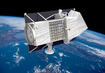
The Italian Space Agency (ASI) has launched on 22 March 2019 the PRISMA satellite carrying an hyperspectral sensor with a Ground Sampling Distance (GSD) of 30 m and covering the wavelength range from 400 nm to 2500 nm, with 10 nm spectral sampling. The launch was successful and the in-orbit commissioning has been completed, allowing PRISMA data to be accessible since May 2020 through the dedicated portal https://prisma.asi.it/. Data policy is based on a quasi-open and free access, with limitations on products per user quantities and on priorities for acquisition requests conflicts solving, to cope with the operational capabilities of the mission. Data policy allows commercial exploitation of value added product/services still delivering free of charge but forbids PRISMA original data redistribution. PRISMA catalog is now visible through GEOSS.
Ettore LopintoASI
Italy has supported the GEO and UN-Habitat “Earth Observation Toolkit for Sustainable Cities and Human Settlements” Programme, contributing to EO4SDG Initiative by the integration of Earth Observation (EO) and geospatial information into urban monitoring and reporting processes for SDG targets and indicators.
Within this framework, and through the contribution to the EuroGEO Urban Action Group, the Italian activities currently focus on strengthening the role of EO in supporting urban policy implementation. This includes the development of high-resolution EO-based products and services, integration of satellite and in situ data, and the use of advanced modelling and AI approaches to generate actionable environmental intelligence addressing key urban challenges such as air pollution and urban heat islands.
In particular, ongoing efforts such as the APEMAIA project contribute to improving air quality assessment at urban scale, while previous initiatives like ERA-PLANET (e.g. GEOEssential and SMURBS) have supported co-design approaches and demonstrated the societal value of EO applications. Building on this experience, a key priority is to enhance awareness, capacity building, and knowledge transfer towards policy and decision-makers, fostering the uptake of EO-based solutions in governance processes and supporting evidence-based strategies for sustainable and inclusive urban development.
Mariella AquilinoCNR
Italy contributes to the GEO-LDN initiative for monitoring by RS data the conditions prone to Land Degradation and Desertification. CNR-IIA led the LIFE Preparatory Project NewLife4Drylands (www.newlife4drylands.eu) (2021-2024) and now coordinates the Earth Observation Work Package of the HE MONALISA (www.monalisa4land.eu) project (2024-2028), working on the computation of the SDG 15.3.1 indicator of the UN 2030 Agenda. Such an estimate, integrated at a local scale with additional sub-indicators related to the local pressures and threats, can support decision-making processes within the framework of preserving soil health and reversing land degradation and desertification.
CRISTINA TARANTINOCNR
The Italian National Copernicus User Forum is an instrument of the Presidency of the Council of Ministers aimed at fostering interaction among different user communities (Institutions, Research, and the Private Sector) for the sharing of information related to the Copernicus programme and the collection of user needs. The Forum's goal is to systematize the requirements expressed by users in order to maximize the development and use of Earth Observation products and to identify development priorities by defining a coordinated national position having a significant impact on the expansion of the Copernicus programme.
The National Forum is composed of representatives from various user communities, including public institutions and bodies, organizations dedicated to research and education, private and commercial entities, charities, non-governmental organizations, and international organizations that benefit from Copernicus data and information. The Forum take advantage also of thematic user consultation groups. Each representative coordinates and gathers the needs and contributions of their respective communities in order to influence the development of the European Programme. ISPRA (Italian Institute for Environmental Protection and Research) ensures the technical secretariat activities and provides technical support for coordination.
Coordinated by the national delegate to the Copernicus Committee and alternate to the European User Forum, the Italian Forum serves as the information and communication tool of the Presidency of the Council of Ministers on the European and national developments of the Programme. It is the venue where the needs of national users for the use of Copernicus products are coordinated, and where a harmonized and agreed position is ensured at the European level.
Andrrea TaramelliIUSS - PAVIA
The Euro-Mediterranean Center on Climate Change (CMCC Foundation) actively supports GEO initiatives throughout different activities and projects. The SDGs-EYES platform developed in the frame of the Horizon Europe SDGs-EYES project is a use case under an operational pipeline (“Data infrastructure”) to support sustainability of EUROGEOSec. This activity aligns with the GEO’s Research-to-Operation pipeline and the Operational Pipelines framework, helping bridge the gap between research outputs and operational. The SDGs-EYES platform provides a portfolio of services for monitoring the Sustainable Development Goal (SDG 13 ‘Climate Action’, SDG 14 ‘Life below Water’ and SDG 15 ‘Life on Land’) and through the EO4SDG initiative is contributing to discussion on the Post-2025 GEO Work Program development.
CMCC has led the GEO Carbon Task from 2010 to 2017 and co-led the GEO Carbon and GHG initiative. By hosting the ICOS Ecosystem Thematic Centre, CMCC plays a key role in linking existing coordinated EO networks with the science and technology communities, the industry sector and the GEOSS and Copernicus stakeholders. Thanks to the coordination of the CONCERTO project funded in the EC-ESA Earth System Science Initiative (ESSI) and to the participation in ESA FuturEO programme and Climate Change initiative (CCI), CMCC is contributing to the GEO Carbon task.
Manuela Balzarolo CMCC
Italy is contributing to AfriGEOSS, by the EC Project PanAfGeo+ - Support to Geological Science and Technology.
PanAfGeo+ is the 3rd phase of a long-term PanAfGeo programme, a unique pan-African geosciences training project, based on cooperation between the African Union and the European Union.
Co-funded by the European Union and a consortium of European geological surveys since 2016, PanAfGeo is helping to strengthen collaboration between the associations of European geological surveys (EuroGeoSurveys) and African geological surveys (OAGS), as well as contributing to the Africa-EU partnership.
PanAfGeo+, with a 4-years duration (2025-2029), represents a follow-up of the previous two phases, the first between 2016 and 2019 and the second between 2021 and 2024. Overall, the PanAfGeo programme represents an investment of around €45 million.
The project supports the training of over 800 young geoscientists from African Geological Surveys through the development of 40 basic and advanced training sessionsaiming at increasing African-owned geological knowledge and skills for sustainable mineral exploitation and related infrastructures, and natural disaster prevention and mitigation. Specifically, the PanAfGeo programme enhances the capacity and role of African national Geological Surveys;
● Contributing to mineral resource assessments by national Geological Surveys in Africa;
● Increasing the activity of national Geological Surveys in regional mapping and exploration to upgrade their geoscientific information base and mineral inventories;
● Strengthening the level of geological knowledge and skills in national Geological Surveys through training;
● Strengthening OAGS’ potential to meet the needs of the African continent.
Since 2016, capacity building has been so far addressed to over 1,750 geoscientists from the 54 African countries with the organization of 72 short- and medium-term trainings in 22 African host countries. The training sessions focused on a wide range of geosciences topics such as satellite imagery analysis, geological mapping through GIS techniques, geo-hazards geochemistry and analytical chemistry, economic geology, mineral exploration.
ISPRA is currently involved in PanAfGeo+ in the following WPs: Geoscientific Mapping, Mineral Resources Assessment, Geohazards and Environmental Management of Mines, Geoheritage
More details of the project in: https:// panafgeo.eurogeosurveys.org
Giuseppe Delmonaco ISPRA
Italy is part of the e-GENESIS project, which is aimed to operationalise Earth Intelligence by transforming Earth Observation, Artificial Intelligence and emerging digital technologies into actionable insights that support EU policy implementation and strategic decision-making. It develops, scales, and demonstrates integrated solutions that strengthen the resilience of ecosystems, biodiversity, water resources, urban systems, and energy sectors, while also contributing to public health and climate adaptation. These services address climate and anthropogenic anomalies through spatially detailed, temporally updated, and territorially scalable intelligence, fully aligned with the strategic objectives of GEO, EuroGEO, Copernicus, and EC KCEO. e-GENESIS evolves through a phased approach beginning with a co-design process that actively engages stakeholders from Entrusted Entities, the Copernicus User Forum, EuroGEO Action Groups, KCEO, and private sector. This ensures that the services are user-driven, policy-relevant, and designed for real-world uptake. Subsequent phases deliver prototyping, validation, and operational deployment, while systematic societal benefit assessments ensure measurable impact. Methodologically, e-GENESIS leverages Copernicus Core Services, European Data Spaces, ESFRIs, and federated cloud infrastructures, combined with modular AI/GenAI pipelines to deliver three interconnected pillars: (i) biodiversity and ecosystem resilience, (ii) water resource foresight and sustainability, and (iii) the urban-energy-health nexus under climate extremes. By aligning with major EU policy frameworks (e.g. Biodiversity Strategy 2030, Water Resilience Strategy, Zero Pollution Action Plan), and supporting EuroGEO and GEO post-2025 priorities, e-GENESIS accelerates the green and digital transition. Its co-design, training, and exploitation strategies ensure scalability, commercialisation, and long-term sustainability, reinforcing Europe’s leadership in operationalising EO-based Earth Intelligence for societal benefit.
Italy is participating to the construction of the EIRENE RI (Research Infrastructure for EnvIRonmental Exposure assessmeNt in Europe), an ESFRI (European Strategy Forum on Research Infrastructures) infrastructure that is part of the national ESFRI roadmap since 2021, considered among the high-priority national RIs (PNIR 2021-2027 report). EIRENE aims to establish a sustainable research infrastructure enabling the advancement of exposome research in Europe by integrating the complementary capacities of European Member States, harmonizing and upgrading them to effectively address current scientific and societal challenges in the areas of chemical exposures and population health. EIRENE RI includes 21 national hubs and more than 50 individual partners. The contribution of Italy to EIRENE RI is through the National Node EIRENE RI – ITALY which is a Joint Research Unit (JRU) between the National Research Council of Italy (CNR), the Italian Space Agency (ASI), the Italian National Institute of Health (ISS) and the University of Calabria (UNICAL). The EIRENE-ITALY node integrates members’ competencies in various domains of Earth Observation data and technologies, Global Observing Systems, Forecasting Air Quality DSS (KHs, DTs), Near-surface Air Quality Validation, Bio-monitoring data, Epidemiology & Toxicology research, Exposome studies and Risk assessment. The overarching goal of EIRENE-ITALY is to foster a change of paradigm in linking environmental research with human exposure studies through a ONE HEALTH approach, where all major anthropogenic-related drivers are accounted for, that may lead to elaborate cost-effective strategies able to mitigate the risk associated to human exposure to major persistent contaminants.
Italy is part of the EIRENE Implementation (EIRENE-IMP) project. EIRENE, the European InfrastRucturE for humaN Exposome, fills this gap and enables challenge-driven research advancing frontier knowledge and innovation in human exposome by providing open access to complementary high-end infrastructures, integrated services and harmonised data. The EIRENE’s ambition to operationalize the exposome by advancing measurement and modelling technologies extends beyond Europe. The development of global infrastructural capacities supporting the integration of functional exposomics into biomedical and clinical research, innovation, and practice planned in the EIRENE Implementation Phase Project will transform the entire biomedical and public health enterprise, enable agnostic studies and the discovery of unforeseen links between environmental exposures and health outcomes.
Italy is part of the SIRENE (Services for envIRonmental Exposure and health assessmeNt in Europe) project. The ambition of the SIRENE is to increase the problem-solving capacity of European society in the Environmental and Public Health and improve capabilities to find and understand disease causations not explained by genetics. While the One Health framework is increasingly recognised as a critical approach to addressing planetary health risks, its practical implementation is limited by disciplinary silos. The SIRENE project brings together 11 ESFRI landmarks and projects to enable challenge-driven research linking environmental factors to human health and advance frontier knowledge and innovation in human exposome by providing open access to complementary high-end infrastructures, integrated services and harmonised data.
The initiative will foster the GEO Health CoP and is part of GEO Flagship GOS4M and GEO Initiative GOS4POPs.
Francesca SprovieriCNR
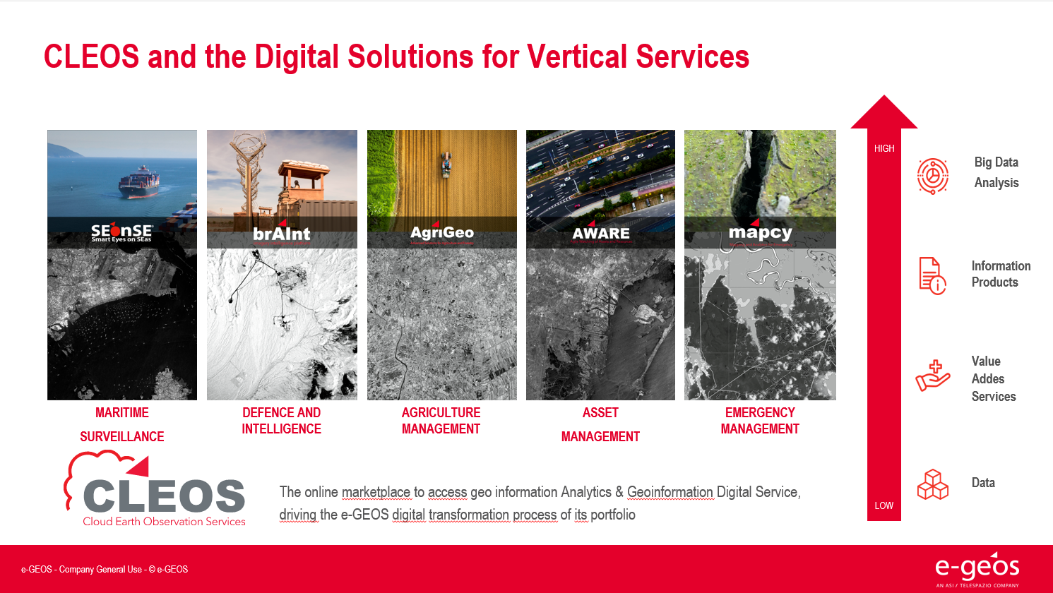
e-GEOS, a company owned by the Italian Space Agency (20%) and Telespazio (80%), part of Leonardo’s Space Division, is a global leader in advanced Geoinformation services and platforms, leveraging artificial intelligence and cloud technologies to deliver fast, digital and customized solutions across the geospatial domain. The company offers a unique range of application services, from data acquisition to the generation of analytics reports, thanks to its extensive satellite data portfolio and to the fast access to the superior monitoring capabilities of the COSMO-SkyMed SAR constellation. The e-GEOS geospatial solutions offering is accessible through CLEOS, a cloud-based information platform designed to unlock the value of geoinformation in AI-powered applications, providing an enhanced user experience and direct access to a marketplace for customized products.
The e-GEOS application platforms include experienced and solid services for environmental protection, rush mapping in support to natural disaster management, specialized products for defence and intelligence, oil spill and ship detection, maritime surveillance and security, assets and critical infrastructures monitoring, landslides and ground subsidence analysis, thematic mapping for agriculture and forestry, climate change phenomena monitoring. e-GEOS has established a prominent role in major international Earth Observation programmes, including the European Copernicus Programme within which it leads multiple core activities, such as the Emergency Management Service – Rapid Mapping and the European Ground Motion Service
Fabio Volpee-GEOS
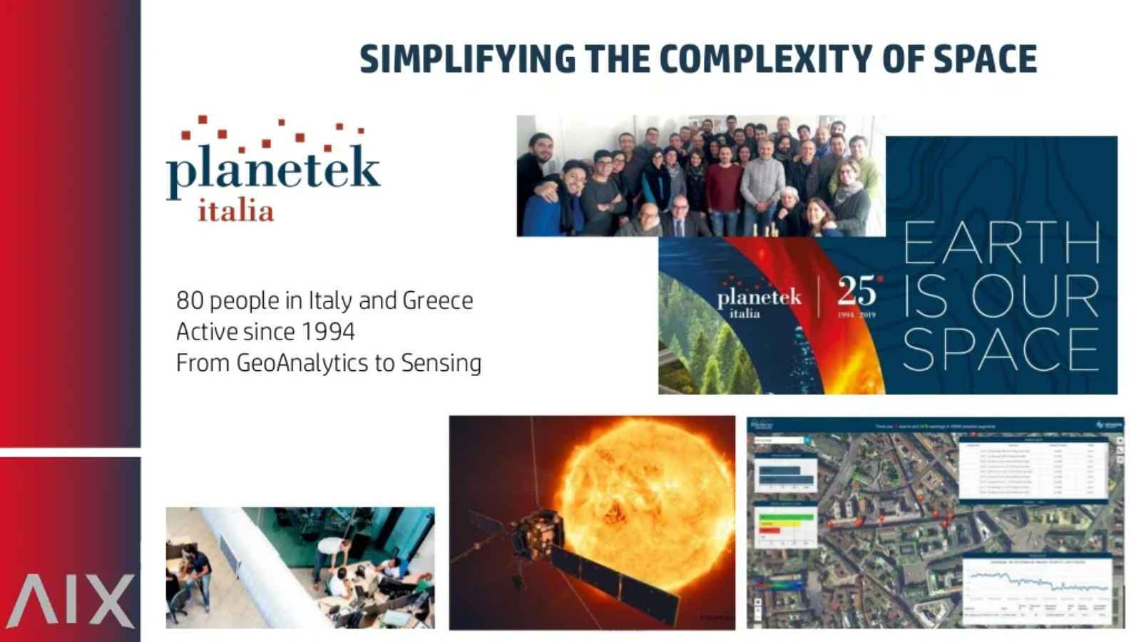
Planetek Italia is an Italian Benefit Company established in 1994, which employs 100+ women and men, passionate and skilled in Geoinformatics, Space solutions, and Earth science. Planetek provides solutions to exploit the value of geospatial data through all phases of data life cycle from acquisition, storage, management up to analysis and sharing. The company operates in many application areas ranging from environmental and land monitoring to open-government and smart cities, and including defence and security, as well as Space exploration and EO satellite missions.
Among its main activity areas, the development of software for the satellite on-board data and image processing leads to the creation of a new business model called SpaceEdgeTM. SpaceEdgeTM is a new concept of satellite as-a-service powered by an Artificial Intelligence (AI) enhanced processing framework embarked on satellites, which makes available in-orbit payloads, resources, and services on-demand: services include EO data acquisition, processing, actionable information extraction, downlink, and distribution. Information detected in Space is then transferred back to the Ground as notifications and alerts or directly exploited on-board in autonomous decision workflows. Useless data and information non-relevant to the application’s workflow can be discarded, saving memory, bandwidth and thus increasing the efficiency and quality of automated pipelines too.
The fields of application of on-board processing to reduce information latency are numerous, and will address GEO's priority engagement areas including the United Nations 2030 Agenda for Sustainable Development, the Paris Agreement, and the Sendai Framework for Disaster Risk Reduction.
Giovanni Sylos LabiniPlanetek Italia s.r.l.
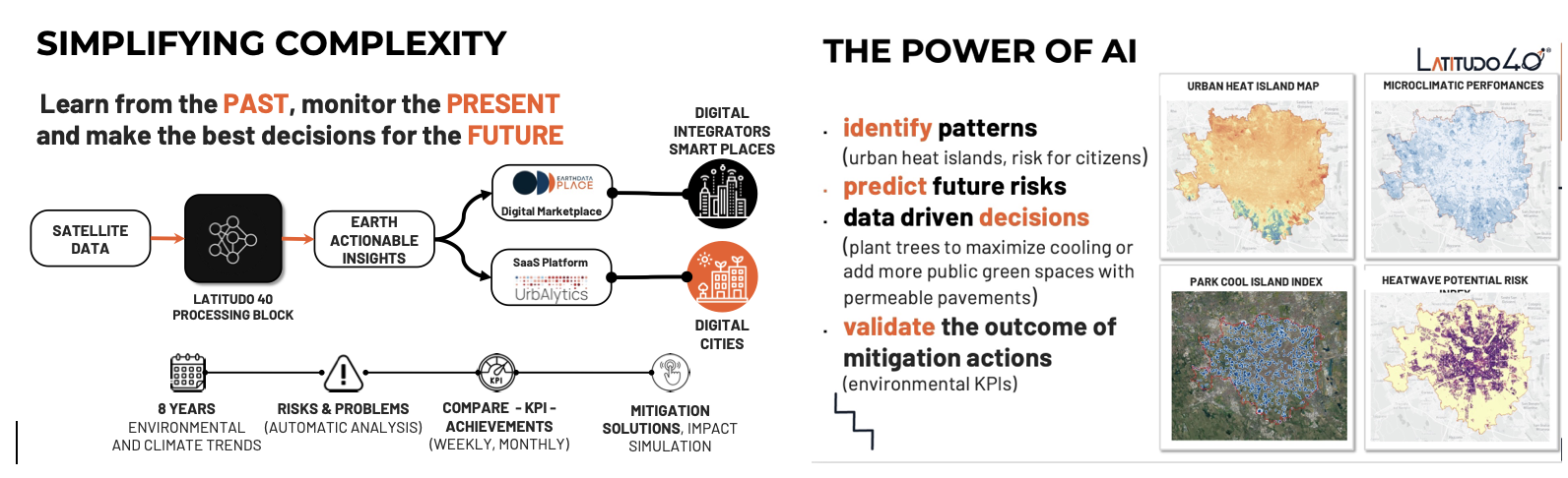
Latitudo 40 is a startup founded by four deep tech and space experts in 2017, which now employs a team of more than 15 people, with a predominance of Data Science experts for the development of new algorithms based on AI/ML and generative AI applied to the analysis and understanding of multi-spectral and hyperspectral satellite imagery. Latitudo 40, to make the most of the value of geospatial data, has invested in the development of a cloud-based platform to be used in SaaS mode for the analysis and monitoring of urban environments, with particular reference to the issue of planning sustainable and resilient cities of the future, identifying the main risks for the population and infrastructures (urban heat islands, urban heat risks, floods) and creating a map of intervention priorities for public decision-makers and urban planners, indicating possible mitigation actions using Nature Base Solutions. In addition, Latitudo 40 has developed a dataspace from space to foster the adoption of Geospatial solutions. In this space, system integrators and developers can find always-available datasets to understand urban risks better and create new applications in city monitoring, precision agriculture and infrastructure monitoring.
EarthDataPlace makes spatial datasets available to everyone easily, quickly and inexpensively.
Latitudo 40 supports the market with a vision of "learning from the past, monitoring the present and designing the sustainable place of the future", and to pursue this strategy, it has launched its Place Simulator. This environmental scenario simulator takes as "input" the different options for modifying the environmental scenario (changes in land cover/land use, new trees or green areas, etc.). It generates as "output" synthetic satellite images obtained with Generative AI to assess the impact of the different scenarios and identify the best solution for the environment.
The application areas of Latitudo 40 solutions provide a better and more detailed understanding of the variables that affect our environment and predominantly impact GEO's priority areas of endeavour, including the UN 2030 Agenda for Sustainable Development, the Paris Agreement and the Sendai Framework for Disaster Risk Reduction.
Gaetano VolpeLatitudo 40
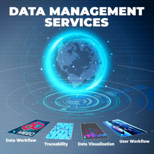
MEEO, as a pioneer in remote sensing and environmental data services since 2004, focuses on transforming raw satellite data into actionable insights. MEEO’s expertise extends to AI-powered geospatial analytics, enabling the development of sophisticated products and services for environmental monitoring, land management, and disaster management. The ADAM platform, a key offering from MEEO, provides user-friendly access to a wealth of geospatial data, underscoring their commitment to democratizing access to environmental information derived from Earth observations. The long-standing partnership with the European Space Agency (ESA) further fuels the innovation in EO data exploitation, confirming the significant role within Multi-Mission Algorithm and Analysis Platform (MAAP), Destination Earth (DestinE) Platform, Global Development Assistance Analytics and Processing Platform (GDA APP), and many other initiatives.
Marco Folegani MEEO
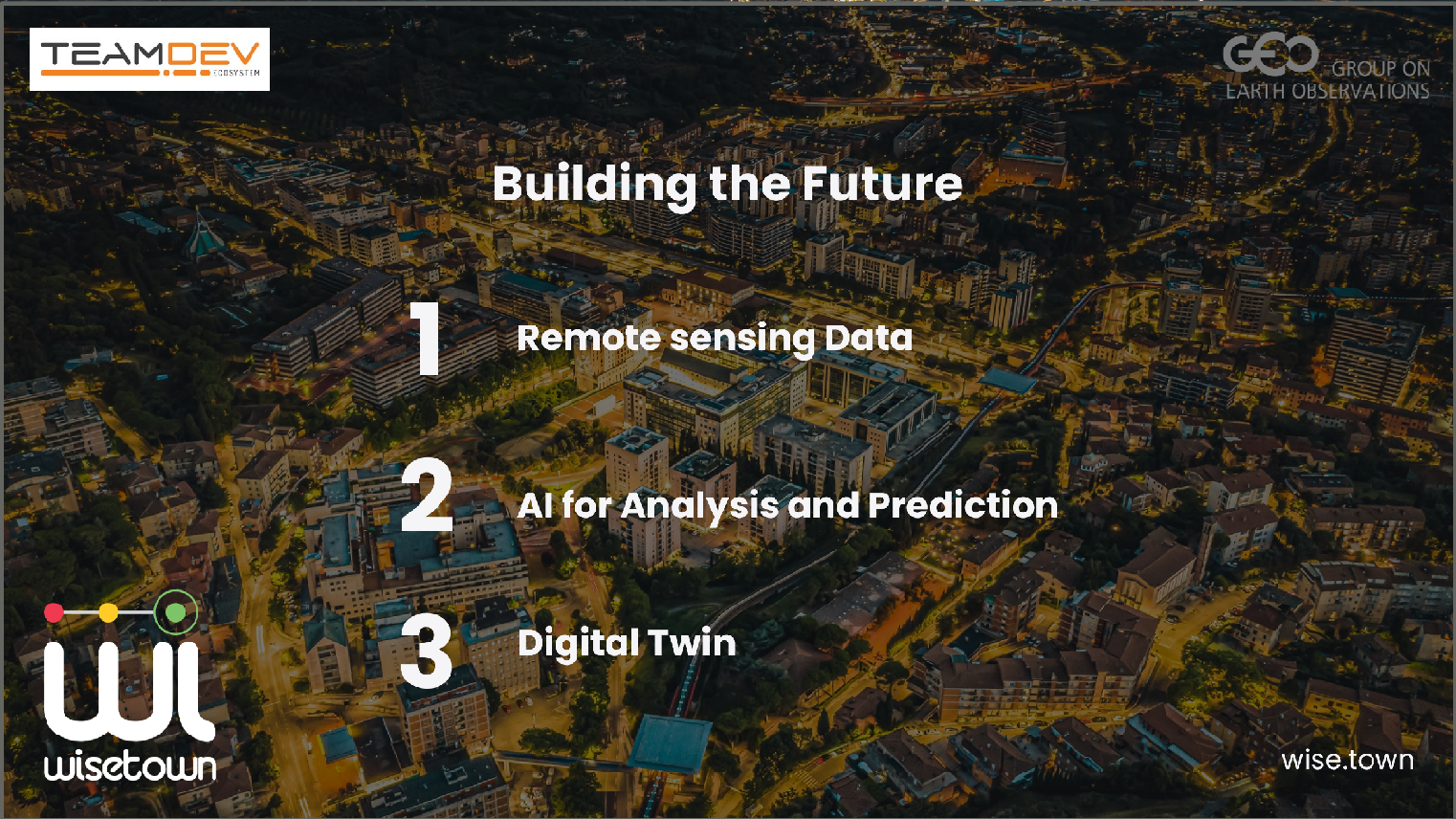
TeamDev S.r.l. is an Innovative SME established in Perugia, Italy in 2008 specializing in information and communication technologies (ICT) with a strong focus on technological innovation, user interaction, and systems integration with third-party products. TeamDev has developed innovative solutions over the years at the national and international level in different application domains, from Artificial Intelligence (AI) to Earth Observation (OT) to Big Data, using a mix of technological skills such as: Development, Geographic Information Systems (GIS) and data modeling and analysis. With these characteristics the company has acquired a wide portfolio of clients, including: large companies (GOPA, ...), public administration (Umbria Region, Independence Oregon, ...), NGOs (Legambiente, Save The Children, ...) and international institutions (NATO, WMO, ...). The areas of relevance are numerous: Smart City (https://wise.town/en/), agriculture, development of complex systems for public administration and private companies, development of human-machine interfaces in the industrial field, and others. TeamDev is a Silver Partner of Esri (https://www.esri.com/partners/teamdev-srl-a2T70000000TWcWEAW) and Gold Partner of Microsoft and with advanced experience in using Microsoft Azure services. In addition, it is a FIWARE Gold Partner (https://www.fiware.org/), a founding member of the European Space coop. (https://spacecoop.eu/), a BDVA-DARIO partner (https://www.bdva.eu/), and participates in the faculty board and co-funds the 39th & 40th cycle National Doctoral Fellowships on Earth Observation (DNOT – Università degli studi di Roma “La Sapienza” coordinator).
WiseTown is our Smart City Platform able to develop a monitoring and predictive What if - Decision Support System for urban planning that improves citizens' quality of life, and increases the resilience and sustainability of cities. WiseTown provides an EO-based technological suite to monitor, predict, and optimize the effects of planned urban interventions.
Luciano ConcezziTeamDEV srl

Japan
Full Statement .jpg)
.png)
.jpg)
The upgraded ‘Today’s Earth’ system demonstrates how Earth observation data, when combined with advanced hydrological modeling, can deliver actionable intelligence for flood forecasting and water management across borders.
Osamu Ochiai Japan Aerospace Exploration Agency (JAXA)
The National Research Institute for Earth Science and Disaster Resilience (NIED) operates MOWLAS, an integrated observation network of approximately 2,200 stations that monitors earthquakes, tsunamis, and volcanic activity across Japan. By integrating the newly completed Nankai Trough Seafloor Observation Network (N-net), NIED has enhanced real-time monitoring capabilities, enabling earlier detection of offshore earthquakes and tsunamis and contributing to improved early warning and disaster risk reduction.
NIED National Research Institute for Earth Science and Disaster Resilience
JICA, together with the WCO, is making GEOINT operational for customs—training Master Trainers to translate satellite imagery and spatial analysis into actionable targeting, patrol planning, and border risk management.
JICA Japan International Cooperation Agency

Netherlands
Full Statement 


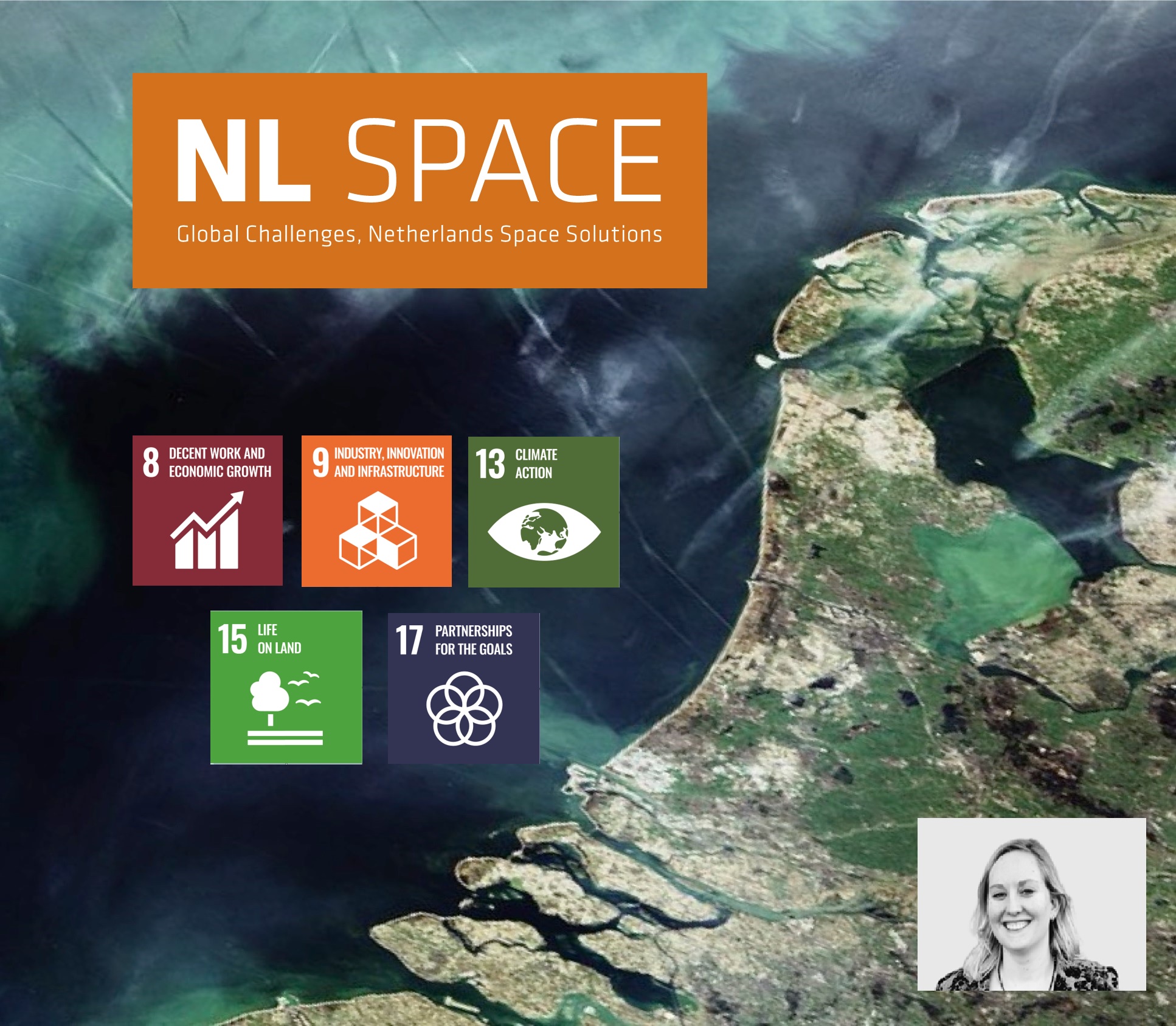
Space for global development: education and capacity building
We are here to identify and understand vulnerability – and to convert it into resilience by developing, applying and sharing geospatial impact-driven solutions. We educate our students to be professionals, capable of acquiring knowledge and translating this into practical applications for solving real-world problems. Via our Geoversity platform we provide high-quality geospatial content and cutting-edge education.
Prof. dr. Freek van der Meer University of Twente/ITC
The role of Citizen Science
Our Action Research on Citizen Science helps GEO achieve impact related to sustainable development, elevating the value of citizen science communities and data from local to global scales. E.g. via empowering citizens in collaborative environmental compliance assurance in the EC More4Nature project.
Prof. dr. Uta Wehn IHE Delft Institute for Water Education Leiden University
Space applications for society, science and economy
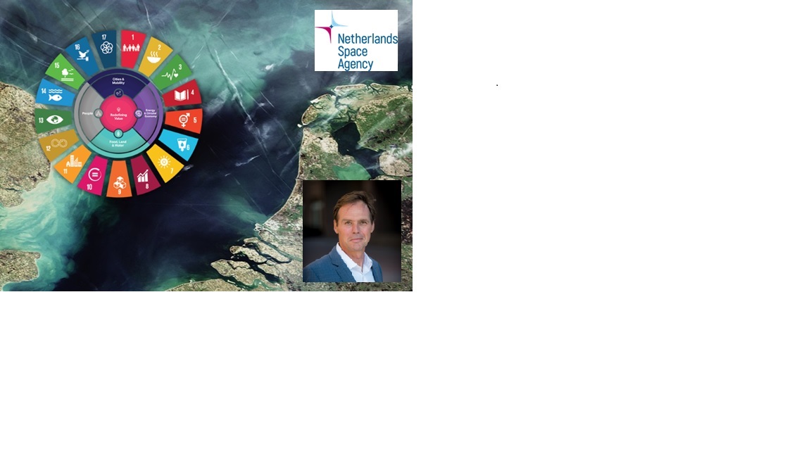
Space for climate and living environment is one of the missions of the long term the Netherlands Strategic Agenda for Space (January 2024). The Netherlands actively stimulates the development and use of services based on satellite data, to bring the benefits of space to society, science and economy.
Harm van de WeteringNetherlands Space Agency (NLSA)
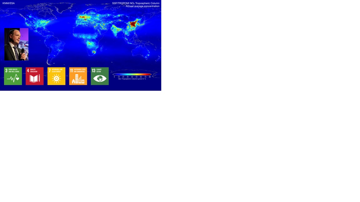
Ten years global view on air pollution and greenhouse gasses
The TROPOMI instrument (on Copernicus Sentinel-5P) provides timely images of air quality and climate parameters for every place of the Earth. TROPOMI data is used for air quality forecasts and to monitor which policy measures are effective for improving the air quality. TROPOMI has also been very successful in tracing methane emissions from oil and gas industry, urban hotspots (garbage dumps) and landfills. For instance, TROPOMI data is included in the International Methane Emissions Observatory (IMEO).
Pepijn Veefkind Royal Netherlands Meteorological Institute (KNMI)
Towards a better food security
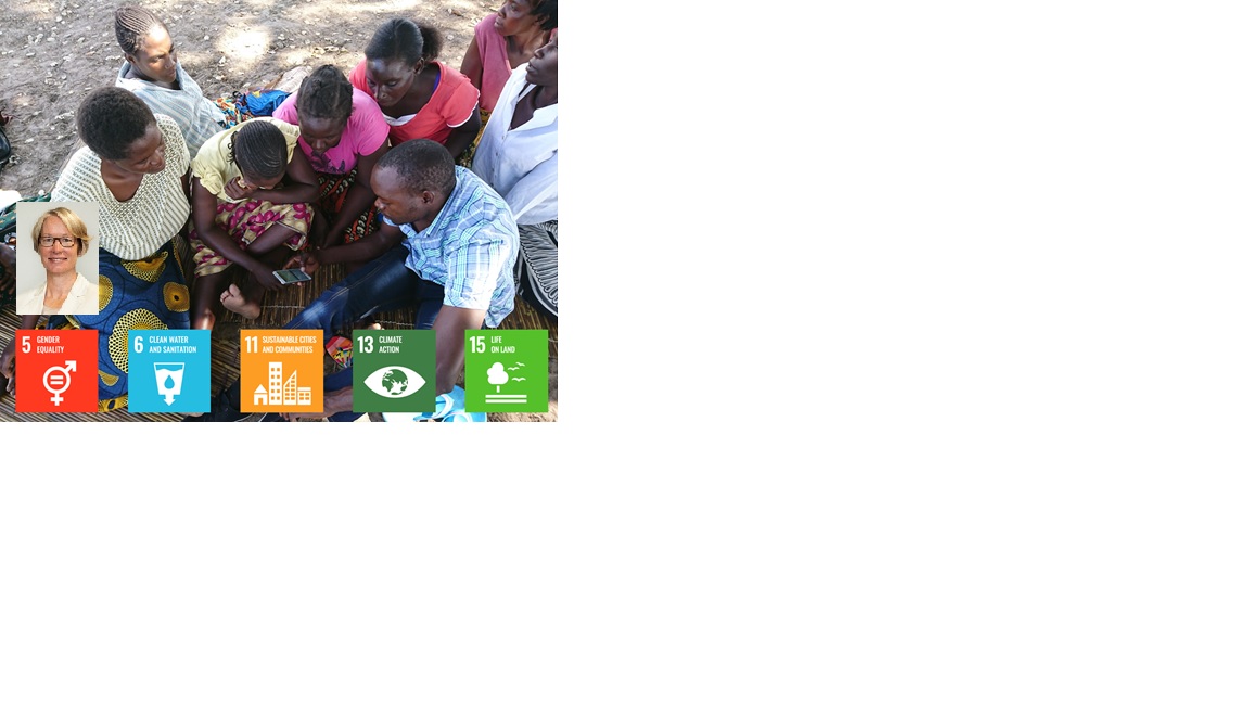
Over 4.5 million smallholder farmers in Africa and Asia have benefitted from products and services based on open and free satellite data in the Geodata for Agriculture and Water (G4AW) programme. Geodata-based advisory and financial services assist farmers and pastoralists in increasing their productivity and adapting to climate change. The successes, challenges and lessons learned of the 25 initiatives of G4AW are shared on the G4AW website. Several G4AW services are introduced and scaled in new countries after the end of the program.
Thijs Woudstra Ministry of Foreign Affairs, The Netherlands - Department of Inclusive Green Growth
The time for climate action is now
We can turn the tide if we take fast, decisive action. The world needs to adapt to what is coming and do everything possible to immediately reduce emissions. Availability and accessibility of reliable data is crucial in this endeavor. Earth observation plays an important role. It increases our understanding of the consequences of climate change, and can thereby be a powerful tool for policymakers across the world.
Jaime de Bourbon de Parme Kingdom of the Netherlands
More effective use of water in agriculture on a global scale
An increasing number of countries does not have enough water to grow food for their growing population. More crop per drop is needed. This is why the Netherlands supports the FAO WaPOR program since 2014. WaPOR has the aim to improve land and water productivity in the face of climate change. Since October 6 2023 FAO WaPOR data are available at a global scale. Almost hunderd use cases are documented by FAO.
Aart van der Horst Ministry of Foreign Affairs, the Netherlands - Department of Inclusive Green Growth
Netherlands Space Solutions for Climate Adaption and Mitigation
Netherlands Space Agency supports education, science and innovation. Dutch companies and institutions develop new EO instruments and innovative solutions using satellite data that contribute to the provision of information to facilitate climate adaptation and mitigation.
Kathelijne Beenen Netherlands Space Agency (NLSA)
Space solutions contribute to peace and security
The Dutch initiated the Water, Peace and Security initiative - a broad coalition of international partners coordinated by IHE Delft Institute for Water Education - designed innovative tools and services identifying water-related security risks to help mobilize stakeholders, build capacity and facilitate action. Understand - mobilize - learn - facilitate - act!
Eva Schreuder Ministry of Foreign Affairs - Department of Inclusive Green Growth
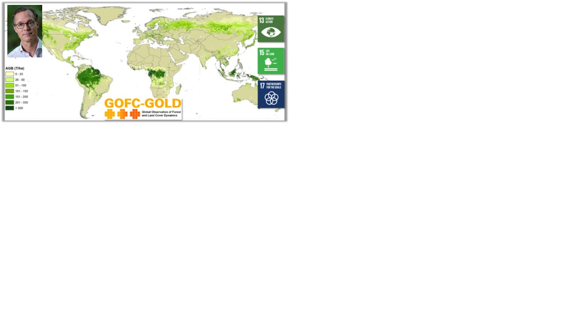
Objective information in support of sustainable sourcing landscapes
Geodata are used in decision making in agriculture, landscape, climate, and water for planning, monitoring and reporting of localized interventions. Geodata are used in support of the EUDR regulation and by the Verified Sourcing Areas (VSA) of the Sustainable Trade Initiative (IDH) and partners to verify outcomes at landscape level. Doing this, spatial data are used by local stakeholders, including government and private sector, driving sustainable production and international partners, like retailers and brands, for sustainable sourcing.
Albert Schenk Ministry of Foreign Affairs, the Netherlands - Department of Inclusive Green Growth

Plan4all
Full Statement 
Through the BioClima project, Plan4all and its members are contributing to GEO’s efforts by bridging advanced AI and Earth Observation. Our work focuses on transforming complex environmental data into actionable insights and supporting the global collaboration needed to protect biodiversity and address climate challenges.
Tomas Mildorf Plan4all / University of West Bohemia
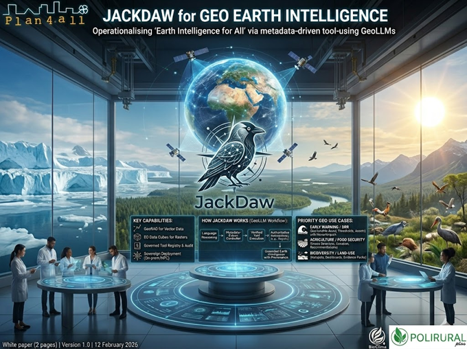
JackDaw was initially developed within PoliRuralPlus as a GeoLLM orchestration layer for authoritative geospatial data and analytical services. It has evolved into a catalogue-driven, tool-using framework for evidence-grounded Earth Intelligence workflows.
Karel Charvat Plan4all
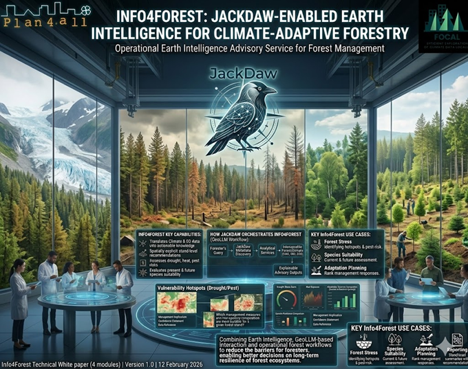
FOCAL provides the scientific and technical foundation for translating climate and Earth Observation data into practical forest-management intelligence. Info4Forest can build on FOCAL forest-use-case results and extend them through JackDaw as a GeoLLM-based advisory layer.
This creates a direct pathway from FOCAL workflows to operational support for climate-adaptive forestry and resilient species-composition planning.
Karel Charvat Plan4all

South Africa

Switzerland
EuroGeoSurveys - the Geological Surveys of Europe
Full Statement
EuroGeoSurveys

Ukraine

United Kingdom

United Nations Office for Outer Space Affairs
Full Statement 
Space-based Earth observation is a vital tool for building resilience against disasters. Through UN-SPIDER, UNOOSA is committed to ensuring that countries everywhere — especially the most vulnerable — can access and effectively use satellite data to protect lives and communities. We are proud to contribute to the GEO community's mission of investing in Earth Intelligence for a resilient future.
Aarti Holla-MainiUnited Nations Office for Outer Space Affairs