“Through sustained collaboration with the GEO community, Ghana is deepening its commitment to leveraging Earth observation for national development. From launching our National Space Policy to applying EO tools in areas such as flood management, illegal mining, and green energy planning, we are steadily turning our GEO vision into action. By sharing our national GEO document with key stakeholders and scaling up pilot initiatives, we are laying the groundwork for a future driven by data, resilience, and sustainable growth.”
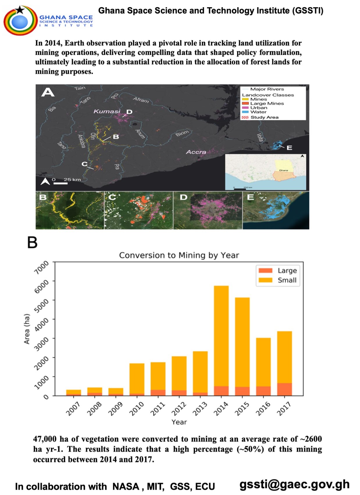
As part of Ghana’s contribution to the GEO community, the Ghana Space Science and Technology Institute (GSSTI) has undertaken satellite-based monitoring to estimate vegetation loss linked to environmental degradation and illegal mining. Between 2008 and 2024, Ghana recorded a total vegetation loss of approximately 59,841 hectares averaging 3,520 hectares per year. This Earth observation effort provides critical data to inform land use planning, guide restoration initiatives, and support sustainable policy enforcement. It also underscores Ghana’s commitment to leveraging EO data for environmental resilience and contributes valuable insights to the global GEO ecosystem.
The successful launch of the National Space Policy in 2024 marks a major milestone in establishing a unified national ecosystem for innovation, Earth observation, and international collaboration. This policy provides a strategic framework for integrating space-based technologies into national development, focusing on optimizing limited resources for maximum impact. It lays the groundwork for coordinated efforts in EO data utilization across sectors such as agriculture, disaster response, and climate resilience. The inclusive and forward-looking nature of the policy reflects Ghana’s commitment to building a data-driven, sustainable future aligned with GEO’s global vision.
Joseph Bremang TandohDirector, Ghana Space Science and Technology Institute (GSSTI)