Why Esri is betting on GEOGLOWS for global river forecasting
Environmental Systems Research Institute, Inc (Esri) has elevated GEO Global Water Sustainability (GEOGLOWS) to its global river forecast layer in ArcGIS Living Atlas of the World. This means daily, curated, multiscale streamflow forecasts are now available to anyone through an open, time-series map experience.
Esri chose GEOGLOWS because it delivers a consistently available, scientifically robust, global source of streamflow intelligence.
The demand is already clear. In the past 18 months, the Living Atlas layer has been viewed more than 120,000 times, signaling a rapidly growing interest in GEOGLOWS data across the ArcGIS user community.
No-code GEOGLOWS Instant Apps: Turning interest into action
To turn that interest into action, Esri lowered the barrier to operational use. The company has invested in engineering, clou, and training resources to build and maintain a no-code Instant App template that enables governments, universities, NGOs, and commercial teams to launch and share their own GEOGLOWS forecast applications in minutes, without requiring additional licenses.
Adoption has been swift: more than 500 GEOGLOWS apps were created in the last year alone, generating thousands of recorded views (with actual usage believed to be at least double what’s captured in analytics).
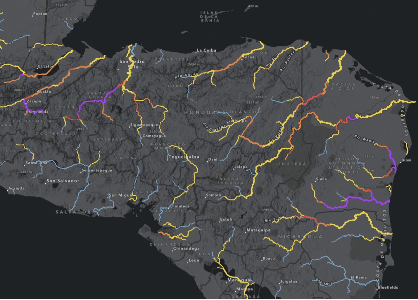
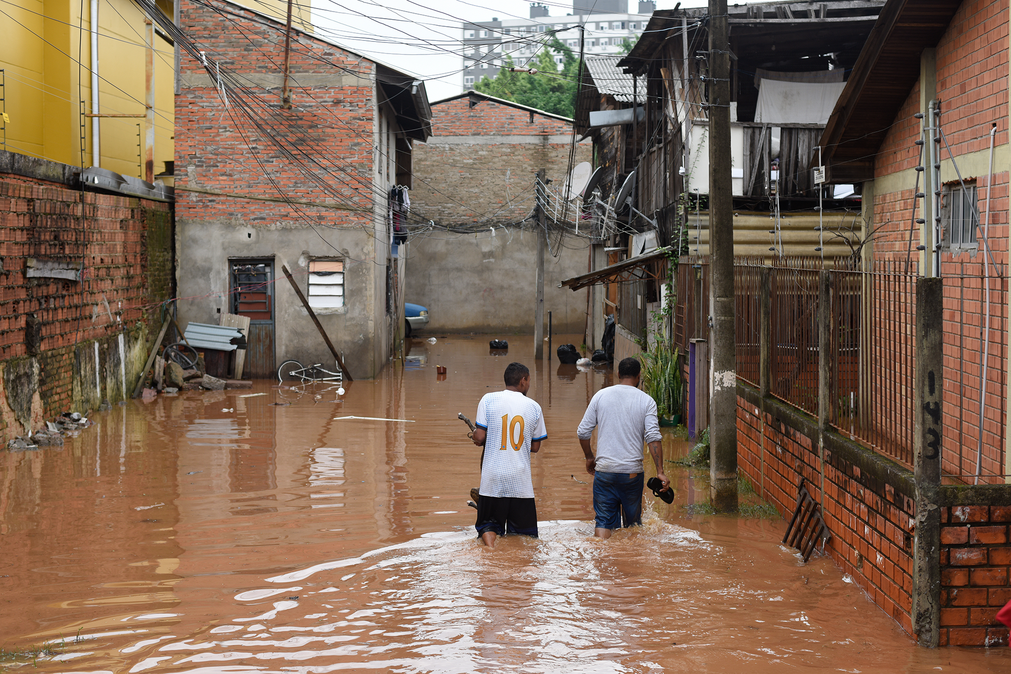
The impact becomes most visible during crises. When severe flooding hit Rio Grande do Sul, Brazil (April–May 2024), a custom GEOGLOWS app for the state was configured and shared within minutes. It drew more than 15,000 views in its first four days, helping teams track evolving flood risk and supporting response and public communication.
A global river forecast service for insurance, infrastructure and security
Embedding GEOGLOWS inside ArcGIS strengthens Esri’s climate- and water-risk portfolio while reducing cost and complexity for commercial users. especially insurance and reinsurance firms*, infrastructure operators, utilities, and defense and security organisations. These groups need global river forecasts in their decision-support systems.
Instead of building and maintaining expensive global hydrologic models, users can move faster by creating value-added analytics, dashboards and digital twins directly on top of a trusted, operational GEOGLOWS service.
Through this long-standing collaboration, Esri and GEOGLOWS bring high-quality streamflow forecasting into the day-to-day workflows of thousands of organisations worldwide.
Esri has praised the GEOGLOWS team for being scientifically rigorous, responsive and easy to work with. The partnership is seen as a meaningful pillar of Esri's broader commitment to climate resilience and disaster risk management.
---
Related reading: Why Google.org’s $3.5 million philanthropic investment in GEOGLOWS is a bet on the world’s water future
* For more information about GEOGLOWS’ use in the insurance sector, please see page 17 of the World Economic Forum’s white paper on EO: The Executive’s Playbook on Earth Observation (Jan 2025).