Mapping the plastic crisis from space
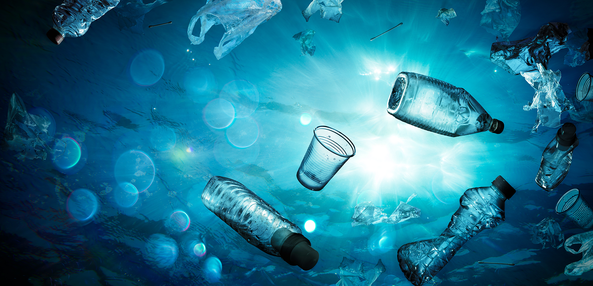
Up to 14 million metric tons of plastic waste enters our ocean each year. Without intervention, this number could nearly triple by 2040. While plastic pollution is often framed as an environmental issue, its impact extends far beyond marine ecosystems, posing serious risks to human health as microplastics make their way into our water, food and even bodies.
But how do we track a crisis that spans the vast and shifting landscapes of the oceans?
Seeing the invisible: The power of satellite imagery
Plastic pollution can be difficult to track. Ocean currents disperse waste across vast distances, microplastics sink beneath the surface, can be hidden by natural sediment in coastal waters, and accumulation points shift with changing weather patterns. Traditional methods, like ship-based surveys, cover small areas at a time, making large-scale tracking a major challenge.
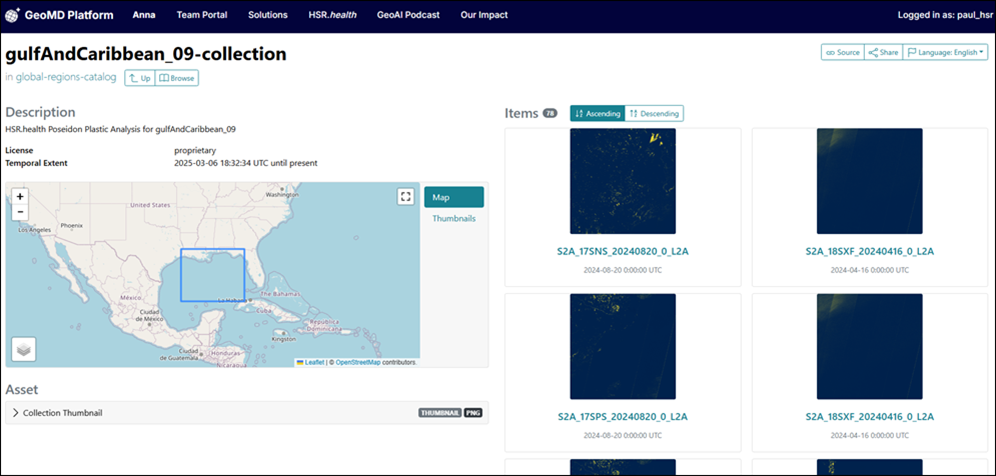
The Poseidon Plastic Tracking System, an initiative from GEO participating organisation HSR.health, addresses this by leveraging satellite imagery and geospatial AI to detect, map, and predict the movement of plastic pollution in real time. Using Earth observation data, ocean current models and AI-driven analysis, Poseidon identifies:
- Where plastics are accumulating now
- How they move across the ocean
- Which communities are at greatest risk from exposure
To facilitate collaboration, data from Poseidon on plastic presence in oceans will be made publicly available through a STAC catalogue.
This geospatial intelligence allows governments, conservationists and public health agencies to act before the problem escalates further, whether through targeted cleanup efforts, stricter regulations, or proactive public health education and interventions.
More than an environmental issue: The human health crisis of plastics
Microplastics – fragments smaller than 5mm – have been found in human blood, lungs and even placentas. Their presence in the food chain raises concerns about long-term health effects, including:
- Endocrine disruption, affecting hormone balance
- Increased cardiovascular risks, as plastics enter the bloodstream
- Toxic chemical exposure, from plastics absorbing harmful pollutants
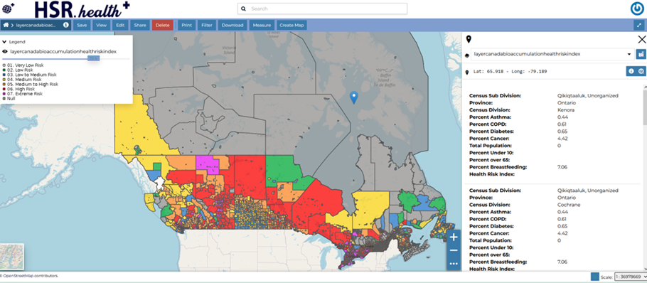
Mapping plastics isn’t enough. It’s important to identify human exposure. Poseidon analyses the impact for plastic exposure on human health, identifying which populations are most at risk based on factors like proximity to contaminated waters, reliance on seafood, and existing public health vulnerabilities.
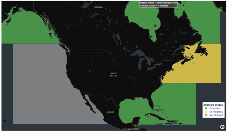
Poseidon's journey: From the Arctic to the Pacific
Poseidon began as a pilot project funded by Natural Resources Canada (NRCan) and US National Oceanic & Atmospheric Administration (NOAA), where it was first demonstrated in the Foxe River Basin in the Canadian Arctic.
Since then, it has expanded into the Atlantic and Caribbean, providing critical insights into how plastics move across ocean systems and where they pose the greatest threats to marine life and human populations.
Currently, the initiative is scaling into the Pacific, where some of the most severe plastic pollution problems exist – from the Great Pacific Garbage Patch to microplastic hotspots near coastal communities.
Scaling Poseidon: A call for support
Poseidon is not just a mapping tool, it is a predictive system, capable of guiding interventions before plastic pollution worsens. As we expand into new ocean regions, we need partners who recognize that tackling plastic pollution is as much about data as it is about cleanup.
A fundraising campaign has been launched to scale Poseidon globally, ensuring that this vital technology reaches the areas that need it most.
Plastic pollution is not an unsolvable problem – but we must act now to prevent irreversible damage to our oceans, our ecosystems, and our health. With Poseidon, we have the technology, the data, and the insights to make a difference.
Let’s turn the tide together.