Launch of GEO Survey on the use of VHR Earth Observation Imagery – a youth perspective
GEO is launching a survey on Very High Resolution (VHR) Earth Observation imagery – and I want to tell you why it matters from a youth perspective.
As a member of GEO Youth Community of Practice working with Earth observation data, I’ve seen how much the quality of imagery can change the way we work.
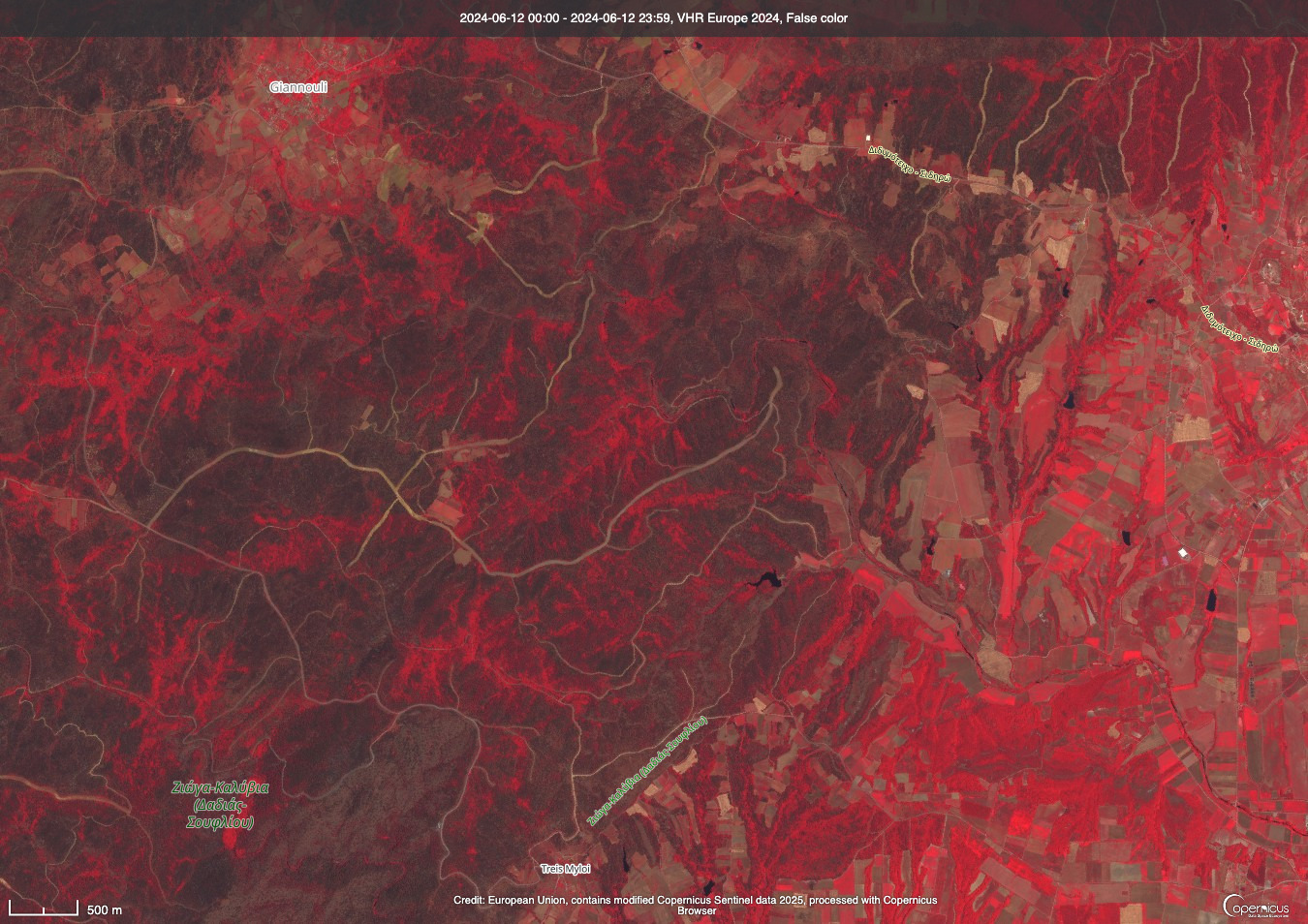
I’ve used VHR imagery twice, and both experiences stayed with me. I remember using it during a disaster analysis project in Tanzania, mapping flooding damage and validating features. With VHR, things are just clearer. You’re not guessing. Instead of saying, “maybe this is a tree,” you can tell exactly what's there. There's confidence in the analysis that low-resolution data simply doesn't give you.
When I have VHR imagery, I love it. I can't wait to get started, and once I'm in, I want to keep going, try other analyses, push further. There's an excitement and confidence that low-resolution data simply doesn't give you. The work still gets done, but the energy is not the same.
VHR imagery matters most when in situ data are limited or hard to access. That's precisely where better access could make the biggest difference for practitioners like me.
That's what this survey is about
GEO is inviting the community to share experiences and perspectives on VHR imagery: how it's being used, what challenges exist around access, usability and integration, and what the community needs going forward. It should take no more than 10 minutes.
The results will help GEO strengthen engagement with VHR data providers, with the aim of improving access, reducing costs and supporting better outcomes across GEO activities.
Deadline: 30 April
As a young practitioner, for me this is about the future. If we can increase access to VHR imagery, we’re improving how confidently and effectively we can respond to real-world challenges.
This blog is part of the GEO Youth Blog Series, a new initiative dedicated to amplifying youth voices, perspectives and contributions across the Earth observation community.