From narrow alleys to urban insights: 3D mapping slums for climate action
Tall buildings affect urban temperatures in competing ways. They can block airflow, limit ventilation and trap heat – but they can also cast shadows that reduce direct solar exposure beneath, lowering reflected radiation and making the spaces below more comfortable. This makes building height the key to understanding urban microclimates.
In many sub-Saharan African cities, this data doesn’t exist, especially in slums, as they rarely appear in official government plans and spatial databases. Satellite-based mapping is also limited in these areas as narrow alleys and dense rooftops make them difficult to map from space. Yet these are the neighbourhoods most exposed to adverse climate stresses. Without detailed 3D data, it's almost impossible to model local temperatures accurately and plan adaptation strategies.
Co-creating climate data with youth
Through my work within Onekana Project, where we focus on understanding climate risks in disadvantaged communities, I’ve explored how climate research often overlooks slum communities. Discussions around community collaboration at the recent Early Warnings for All Multi-Stakeholder Forum and Global Platform for Disaster Risk Reduction solidified my interest in co-creating climate data with communities.
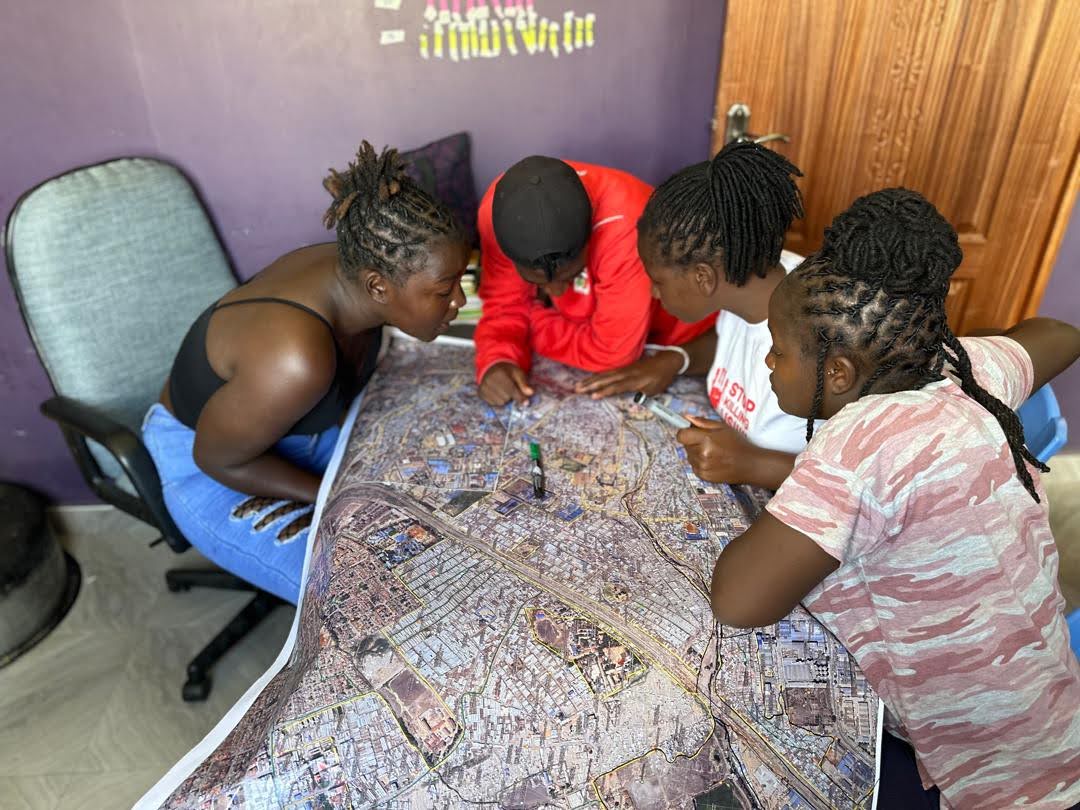
Together with young members of Community Mappers, a citizen-initiated grassroots activist group based in the slums of Nairobi, Kenya, we explored a simple idea: using street-level methods to produce accurate local building height data.
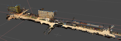
We designed walking routes across five slums, shaped by local knowledge to ensure we captured the diversity of buildings and street layouts. Using a GoPro Max 360° camera mounted on a surveyor's helmet, we walked through narrow alleys and dense blocks, capturing high-resolution street imagery in spaces that vehicles, drones and satellites cannot reach.
The images were used to generate elevation and terrain models, as well as building-level height estimates. We were able to reveal complexities of slum communities. In Mukuru for example, we captured a mix of low and high-rise buildings between 3m up to 28m, showing detailed characterisation of slum environments that is often missed.
.png)
Looking ahead
I am excited to be part of this effort, co-producing data with local youth and giving visibility to communities that are often overlooked in maps and models, ensuring that their realities shape how climate risks are understood.
Next, we plan to validate our estimates and explore machine learning pipelines to predict building-level heights across the entire urban extent of surveyed slums. This is a step towards providing accurate baseline datasets that improve climate models and adaptation planning strategies.
This work contributes to the implementation of the GEO In-Situ Data Strategy.
This blog is part of the GEO Youth Blog Series, a new initiative dedicated to amplifying youth voices, perspectives and contributions across the Earth observation community.