Earth intelligence for resilience: partnerships and insights from the Pacific
As the second post in GEO’s four-part blog series of reflections from this year's Global Platform for Disaster Risk Reduction (GPDRR), this piece brings together three moments from Geneva: a high-level session on risk understanding, a powerful exchange with the President of Palau about Digital Earth Pacific, and the energy of our joint presence on the exhibition floor with the Pacific Community.
High-level session: harnessing risk understanding
I was part of the organising committee for High-Level Dialogue 1: Harnessing risk understanding for a safer future: Are we keeping up? (watch here). The message was clear: quality, inclusive data is essential for understanding risk. Speakers stressed that collaborative approaches lead to better decisions and action. They also emphasised strong data governance so risk information remains open and accessible as a global public good, for today’s youth and future generations.
These messages validate GEO’s ongoing work and align with the heart of our Post-2025 Strategy.
A President’s call for Earth data as a public good
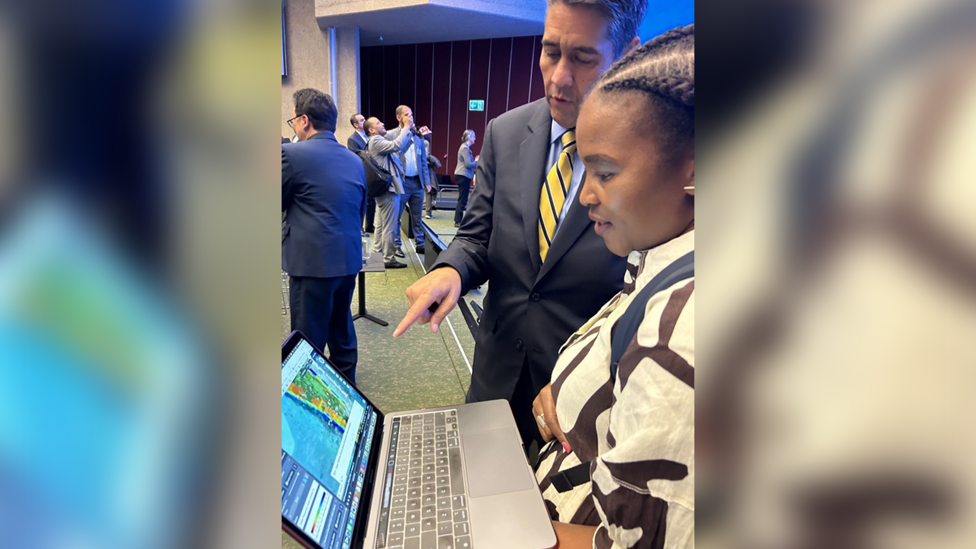
The high-level session’s keynote speaker, H.E. Surangel Samuel Whipps Jr, President of Palau, spoke about the devastating impacts of three disasters, including Super Typhoon Haiyan in November 2013.
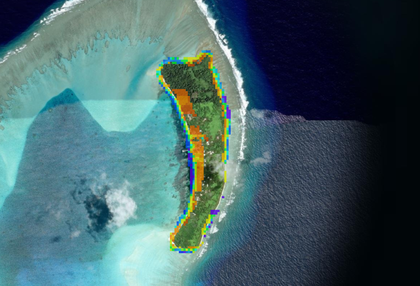
While no lives were lost, homes and infrastructure suffered heavily; a seawall helped reduce the worst impacts. After the dialogue, Andiswa Mlisa, Programme Manager for Digital Earth Pacific at the Pacific Community (SPC) and co-lead of Digital Earth Pacific, showed the President Water Observations from Space (WOfS), a product that visualises water presence over time, illustrating flooding in Kayangel island following Typhoon Haiyan.
Impressed, the President urged that such tools be public goods. Andiswa replied: they already are.
Renewed commitment
As Andiswa followed up with the President’s team to share links, we both felt the urgency to accelerate how leaders discover and use Earth intelligence.
Digital Earth Pacific leverages decades of analysis-ready satellite data, cloud-native platforms and Artificial Intelligence and machine learning to provide decision ready products to enable Pacific countries and territories to strengthen climate and disaster resilience.
These technologies are transforming how vast geospatial data is handled, putting timely insights directly into the hands of policymakers and communities across the Pacific. We will keep working to make these technologies and products widely available.
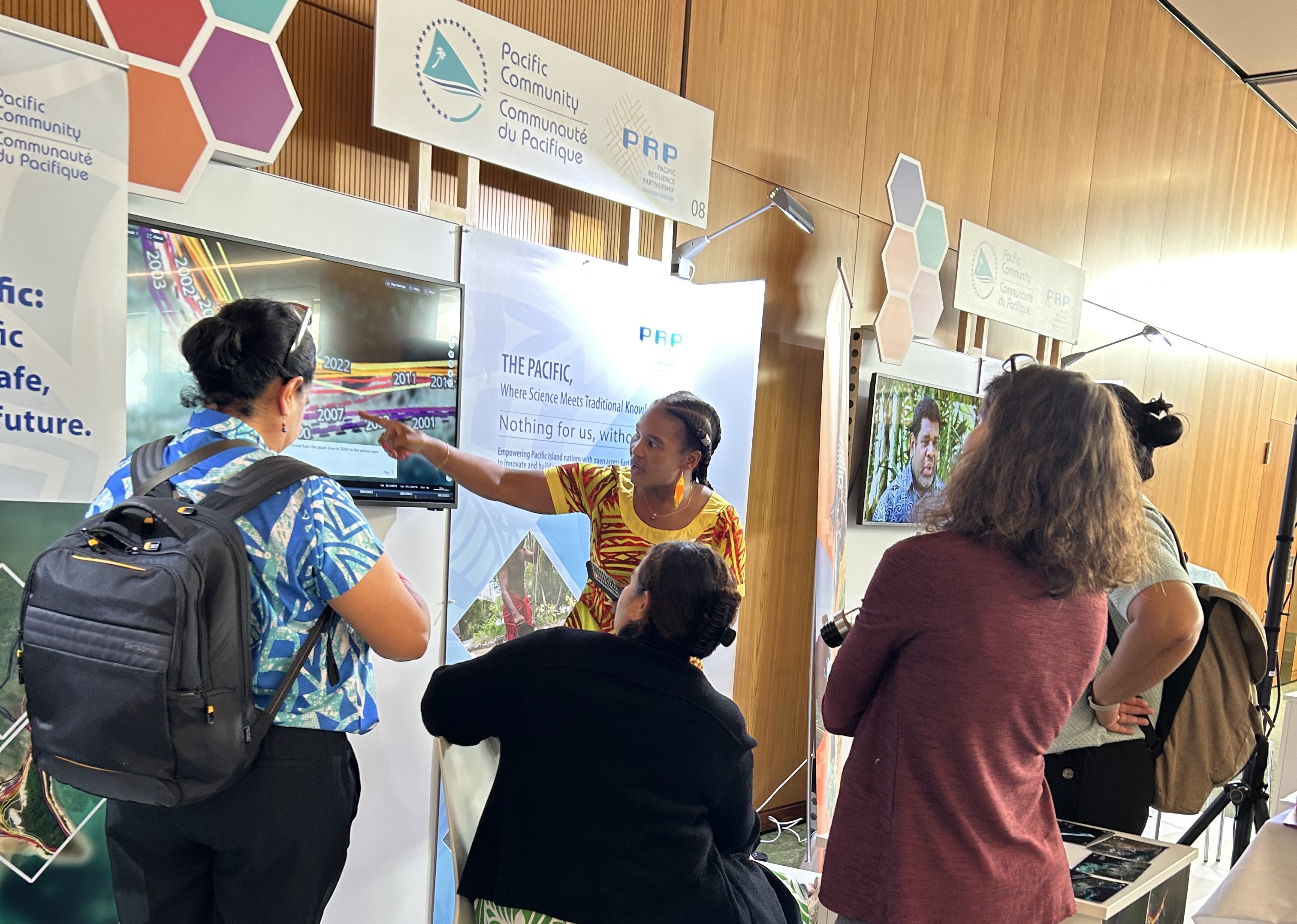
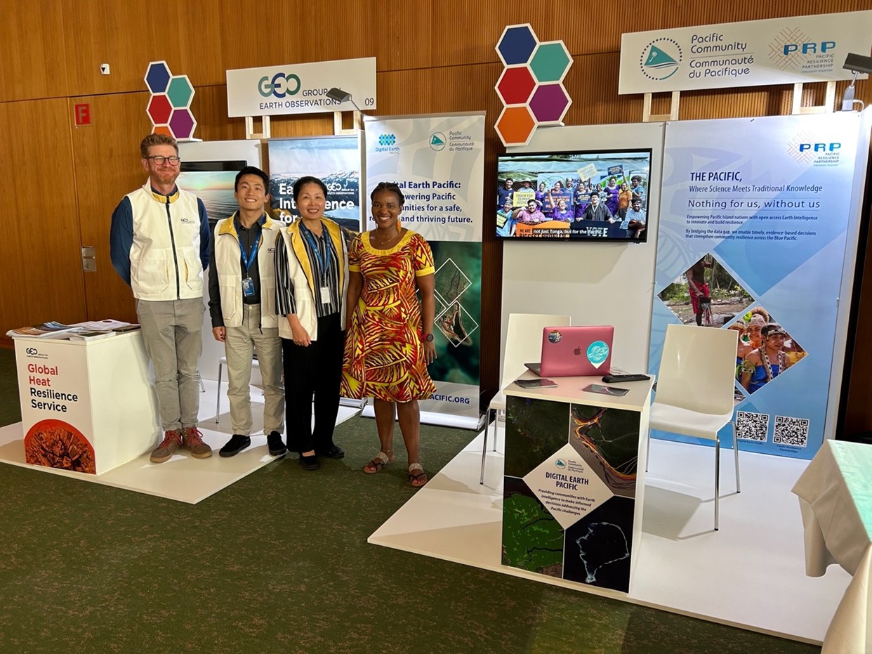
Joint booths: GEO and the Pacific Community
Throughout GPDRR, GEO’s Innovation Platform booth and the Pacific Community’s exhibition stood side by side. The setup made visible how GEO Work Programme activities, like Digital Earth Pacific, are led and implemented by the GEO community. This joint presence served as an innovation hub, welcoming people new to GEO and bringing together the wider GEO family.
Read about the GEO-convened Global Heat Resilience Service at GPDRR and stay tuned for two additional blogs.