Mexico
- Home/
- Partners/
- Member Governments/
- Mexico


Digital Earth Americas is an initiative that aims to bring together users from the Americas region to create an open and operational experience in countries for the analysis, use, and management of data to develop evidence-based public policies for decision-making. We are working to strengthen geospatial capabilities in the Caribbean. To this end, 8 webinars were scheduled, which began in April and will conclude next November. The project 'Strengthening Geospatial Capacities in the Caribbean' is currently underway and will contribute to the development of spatial sciences and geospatial technology applications in this region.

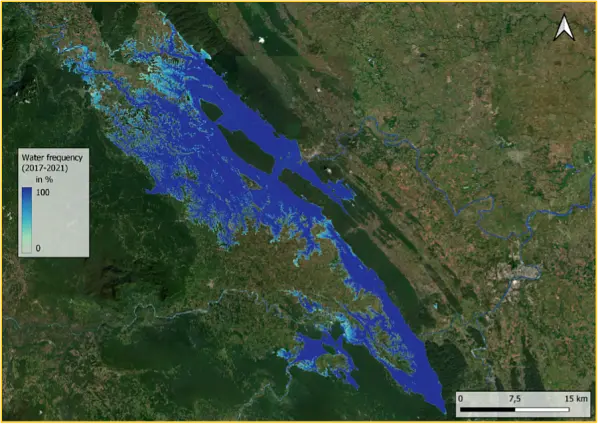
It has been relevant to be part of the World Water project, funded by the ESA, which aims to demonstrate how global EO data can be used to systematically and accurately measure inland surface water resources. This alliance allowed us to carry out the 'Seminar and technical training workshop on using EO for monitoring surface water dynamics' in Mexico City, with the participation of representatives of the State Units of the National Subsystem of Geographic Information, Environment, Land and Urban Planning.
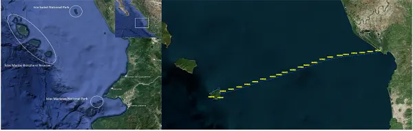
The Mexican Space Agency (AEM) and the National Natural Protected Areas Commission (CONANP) carried out the project “Vessels Monitoring of Fishing for the Control of Protected Natural Areas”, which was financed by the ESA. This project was implemented in Islas Marietas National Park, Isla Isabel National Park and the Islas Marías Biosphere Reserve. The system provides data and detailed information to the CONANP and allows monitoring of the activities carried out by ships, tourist boat operators and fishermen in the ANPs, and therefore, contributes to the protection of maritime ecosystems.
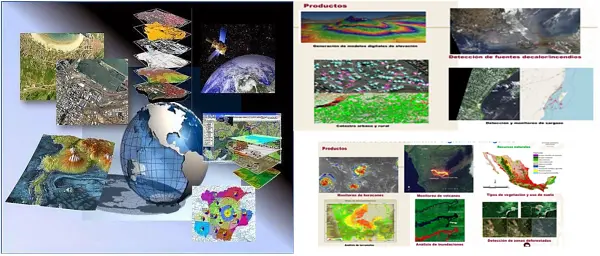
The Digital Image Processing Laboratory provides services to government and private institutions, both national and international. Generates products with high added value from satellite images, as well as advisory and training services. Free images of the satellites LANDSAT, SENTINEL, MODIS, GOES. Commercial images of the GEOSAT and GEOEYE satellites.
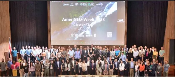
Mexico is an active member of AmeriGEO. In the organization of the annual events, we promote innovative sessions and side events related to the integration of statistical and geospatial data, as well as the use of spatial data infrastructure. During the last AmeriGEO week 2023 we organized a side event related to the use of artificial intelligence-based methods to map and characterize slums from Earth observation. Inter-institutional coordination mechanisms will allow us to develop regional projects to advance together in the use of Earth observations towards sustainable development in the region.