Japan
- Home/
- Partners/
- Member Governments/
- Japan


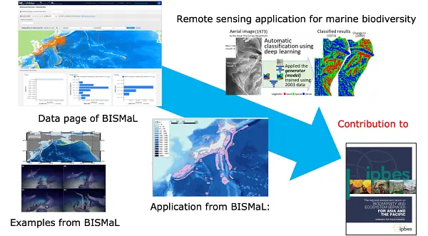
The Biological Information System for Marine Life (BISMaL) , which has been developed by the Japan Agency for Marine‐Earth Science and Technology (JAMSTEC),has published 48 datasets (total of 2.3 million biological observations) from scientific researches by JAMSTEC, universities, research institutes and citizen science. Integrated into the Ocean Biographic Information System(OBIS), it plays a key role as the primary information source in the Northwest Pacific region, and has been used in the Asia Pacific Marine Biodiversity Observation Network(AP-MBON) and contributed to the Intergovernmental Science-Policy Platform on Biology and Ecosystem Services(IPBES).


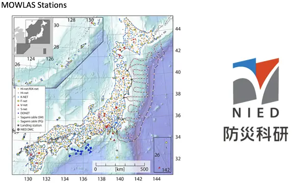
National Research Institute for Earth Science and Disaster Resilience (NIED) has integrated observation networks, The Monitoring of Waves on Land and Seafloor (MOWLAS), which consist of 2,100 stations to provide comprehensive, accurate, and rapid observation and monitoring of earthquake, tsunami, and volcano activity throughout Japan and its offshore areas. The application of real-time observations and processing of MOWLAS data has contributed to disaster mitigation through its earthquake early warning and tsunami warning.

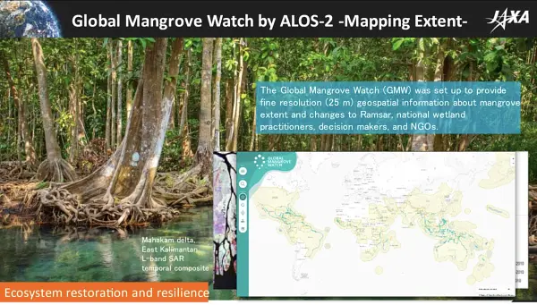
JAXA is fully committed with addressing GEO priorities by sharing datasets and analyzed products to promote utilization for understanding, planning and decision making. In collaboration with UNEP, the Global Mangrove Watch Dataset provides evidence to respond to mitigation of the Climate Change and preservation of Biodiversity.


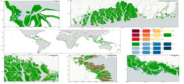
The Global Mangrove Watch is a multi-collaboration project that demonstrates the usefulness of Earth observation data –including L-band Synthetic Aperture Radar provided by JAXA – for mapping of globally significant ecosystem types. It provides public open, geospatially explicit data of global mangrove extent and annual changes relevant to international reporting frameworks such as the UNFCCC Paris Agreement, the UN Sustainable Development Goals, the Global Biodiversity Framework, and the Ramsar Convention.

The Biological Information System for Marine Life (BISMaL), which has been developed by the Japan Agency for Marine Earth Science and Technology (JAMSTEC), has published 59 datasets (total 3.8 million biological observations) from scientific researches conducted by JAMSTEC, universities, research institutes and citizen science, in accordance with the FAIR (Findable, Accessible, Interoperable, Reusable) data principle. Integrated into the Ocean Biographic Information System (OBIS), it plays a key role as the primary information source in the Northwest Pacific region, and has been used in the Asia Pacific Marine Biodiversity Observation Network (AP-MBON) and contributed to the Intergovernmental Science-Policy Platform on Biology and Ecosystem Services (IPBES).

National Research Institute for Earth Science and Disaster Resilience (NIED) has an integrated observation network, The Monitoring of Waves on Land and Seafloor (MOWLAS), which consists of 2,100 stations to provide comprehensive, accurate, and rapid observation and monitoring of earthquake, tsunami, and volcano activity throughout Japan and its offshore areas. The application of real-time observations and processing of MOWLAS data has contributed to disaster mitigation through its earthquake early warning and tsunami warning.
