The Challenge
Security of citizens and societies can be threatened by several issues at local scale, and in the recent years also at global scale, as climate change-derived effects. Earth Observation is a key tool to support practitioners and authorities to make the right decisions. However, there is a continuous challenge to ensure that geospatial products and services incorporate the most updated information considering all the variety of data sources.
The Solution
SPACE-SECURITY aims to maintain a forum to find synergies and develop solutions to improve the safety and security of citizens and societies by exploiting EO data, collateral data and associated technologies. The Community Activity works towards raising awareness and adoption of open data, citizen science, in-situ data and advanced technologies in the Space and Security domain. In addition, SPACE-SECURITY contributes to the implementation of relevant projects in the framework of R&I initiatives and builds synergies with relevant GEO and any other significant activities.
Our Impact
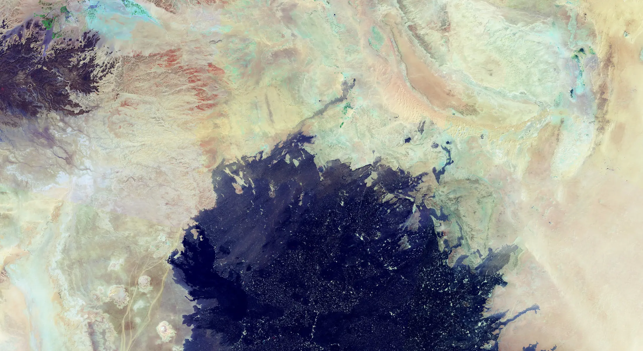
Use of Sentinel-1 and Sentinel-2 imagery to analyse security issues affecting Rohingya refugees accommodated in Bangladesh Char-Piya island Char-Piya.
SatCen used Sentinel-1 and Sentinel-2 imagery acquired between 2017 and 2020 to assess the potential risks of environmental issues affecting Rohingya refugees accommodated in Bangladesh Char-Piya Island. Automatic change detection algorithms were applied on Sentinel-1 images to clearly see the situation in the island along time and detect the changes due to human activity. In particular, the timeline in the camp development was reconstructed. Sentinel-1 images were very useful during the monsoon period, were clouds covered the entire areas, as the SAR observations allowed to define the flooded areas of the island. The analysis was complemented with optical images from Sentinel-2 and Very-High Resolution satellites, to assess the evolution of built areas in the island.
InSAR for underground water extraction impact on subsidence in vulnerable regions
SPACE-SECURITY entered in contact with Pakistani local authorities, who highlighted the importance of assessing potential land subsidence in the region of the twin cities of Islamabad and Rawalpindi. The pilot applied SAR interferometric techniques on more than 180 Sentinel-1 images, ranged from October 2016 until September 2022. In particular, the Parallel Small Baseline Subset (P-SBAS) processing was the technique selected for the analysis. The images, acquired in descending orbit (reference orbit 107), were processed and the results showed land deformation up to 38 centimetres.
GEO-DAMP
The Geospatial Data Management Platform is made available by SatCen for Space and Security partners. It is a geospatial platform which enables users to discover, access, process and exploit EO and collateral data.
GEO-DAMP makes use of innovative IT architectures to constitute an advanced environment where EO final users and EO application developers can interact, thus facilitating the enhancement of monitoring capabilities in a final user-centric approach. The platform covers the different steps of the data value chain (e.g., data discovery and access, processing and exploitation of EO and collateral data).
Policy Drivers
SPACE-SECURITY partners are engaged with GEO priorities, and in particular in supporting the achievements of the SDGs defined in the 2030 Agenda for Sustainable Development of the United Nations with EO-derived products related to security issues. Currently, specific focus on SDG 11 (Sustainable Cities and Communities), SDG 13 (Climate Action) and SDG 15 (Life on Land) is put through the Horizon Europe project SDGs-EYES (https://sdgs-eyes.eu/).
Our Donors
Research and Innovation - European Commission
Our Partners
Participating Organizations
Non-affiliated