About
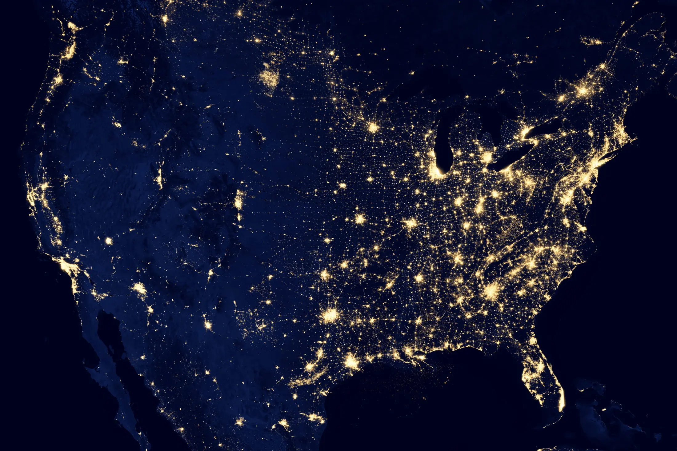
The United Nations 2030 Agenda for Sustainable Development Goals (SDGs) provides the world a bright path for a more sustainable future. The SDGs aim to solve a number of key issues, such as extreme poverty, income inequality, and disaster risk reduction. Evaluating the implementation progress toward the SDGs is critically important since the international community can focus on the unsolved issues far behind the 2030 Agenda. Night-time light remote sensing images have been widely applied in socioeconomic research and have shown great potential for monitoring some SDG indicators. Although a number of international organizations have noticed the great value of night-time light for SDGs, a shortage of skills and knowledge on night-time light has limited its use.
This Community Activity aims to produce high quality night-time light products, and derive a variety of night-time light-based thematic products including poverty maps, electrification maps, regional inequality maps and regional growth maps as well as disaster evaluation maps. These products will map the implementation progress of SDGs from both spatial and temporal perspectives. In addition, several application cases for monitoring SDGs at regional scales (e.g. disaster-affected and war-torn regions) will also be carried out based on the products. The data products and application reports will be delivered to international users, including inter-governmental organizations, aid groups, and investment agencies to fill the gap between the night-time light remote sensing community and potential users the night-time light products for SDGs.
Planned Activities
- Develop high resolution night-time light products for sustainable development. The existing coarse resolution night-time light remote sensing imagery can help monitor human settlements at large scales but cannot provide sufficient spatial details at the street level. Finer resolution images are very useful in mapping human settlements details but their application to large scales is often limited. The purpose of this community activity is to highlight human settlements by integrating 30 m resolution Landsat and the coarse resolution night-time light remote sensing data. Considering that both Landsat and night-time light remote sensing have long historical archives, we expect our investigation on combining them together will also enable tracking human settlements expansion over time.
- Develop standard night-time light products, including poverty maps, regional inequality maps and urban growth trajectory, for general applications of sustainable development based on the high-resolution night-time light products. Develop special night-time light products, such as humanitarian disaster maps, for hotspot areas such as extremely poor countries and conflict regions.
- Build a data sharing network. Exchange research ideas between different data providers and product developers. Advocate building a data sharing platform (e.g. website interface and contact information lists) from different night-time light data provider and product developers.
- Develop a user network. Contact current and potential users, from the social science community, the natural science community, the banking system, governmental departments as well as non-governmental organizations, of night-time light products. Summarize the users’ requirement on the night-time light products.
- Collaborate with regional and global organizations. Provide the night-time light products to the United Nations, non-governmental organizations and investment agencies. Train these organizations to analyze the issues of sustainable development such as poverty, humanitarian disasters and impact of aid projects by use of night-time light products.
- Disseminate research results. Participate in international conferences, workshops and sessions. Publish scientific articles.
