The Challenge
The current state of information on seismic and volcanic phenomena and the delayed uptake of scientific results from decision-makers increases the consequences of eruptions and earthquakes, largely in developing countries. This incomplete knowledge is a result of lack of Earth observations, local capacities, technologies and resources, as well as difficult access to existing data and reusable scientific results.
The Solution
The Geohazard Supersites and Natural Laboratory initiative (GSNL) is a voluntary international partnership that uses an Open-Source approach to improve geophysical scientific research and geohazard assessment and promote rapid and effective uptake of the new scientific results for enhanced societal benefits in Disaster Risk Reduction (DRR). The focus of the GSNL initiative are areas that have scientific problems and high-risk levels:
- Supersites: are single sites or extended areas of high priority to the geohazard community, in which single or multiple geological hazards pose a threat to human population and/or critical facilities.
- Natural Laboratories: are geographic regions in one or several countries characterized by relevant geohazards and a coherent tectonic setting.
Our Impact
Success stories – GSNL (geo-gsnl.org)
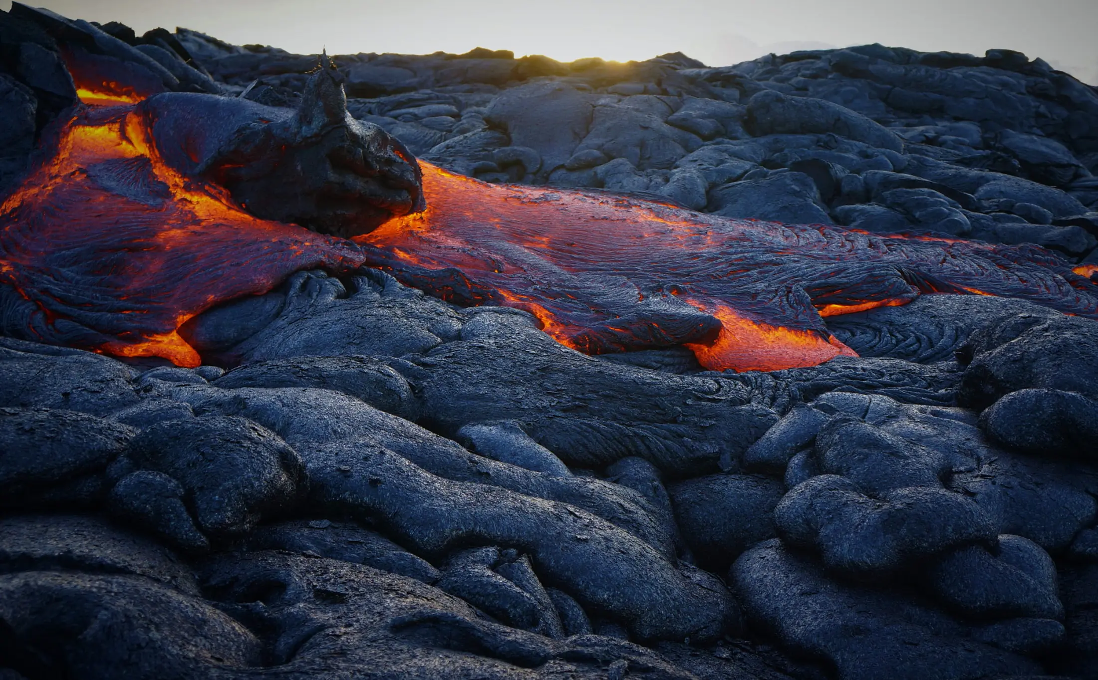
Supporting the Emergency response to the 2018 lower East Rift Zone and summit collapse at Kīlauea Volcano, Hawaiʻi
- In 2018, the Hawaiʻi Supersite was affected by a crisis at Kīlauea volcano, where a lava flow destroyed over 700 homes. Starting in late May, the Kīlauea caldera began to rapidly subside as magma drained from here to feed the lava flow 40 km away. In two months, parts of the ground had dropped by 400 meters, an amount never observed in a volcano eruption. High-resolution InSAR monitoring with COSMO-SkyMed and TerraSAR X images granted through the Supersite provided unprecedented views of the collapse and have been critical for understanding how the subsidence was evolving over time.
Support to Emergency Management during the Bardabunga, Iceland, 2014 eruption
- The eruption of the Bardabunga volcano started in August 2014, in the area covered by the Iceland Supersite. The worst scenario prompted for strong magma/water interaction, important explosive activity and emission of >10-km high volcanic ash cloud. The Supersite community analyzed satellite and in situ data to monitor the evolution of the eruption and observed migration of magma from the Bardabunga caldera to a location outside of the ice cap, 40 km to the north. The scientific products helped take many decisions during the emergency, eventually lowering the red alert to orange when the data showed that the eruption was not going to happen under the ice cap but well outside of it, in Holuhraun.
Policy Drivers
The GSNL initiative is compliant with the new the GEO Strategic Plan, and with the role of science envisioned in the Sendai Framework for Disaster Risk Reduction 2015-2030.
Our Donors
Our Partners
Participating Organizations
Non-affiliated
Icelandic Meteorological Office