The Challenge
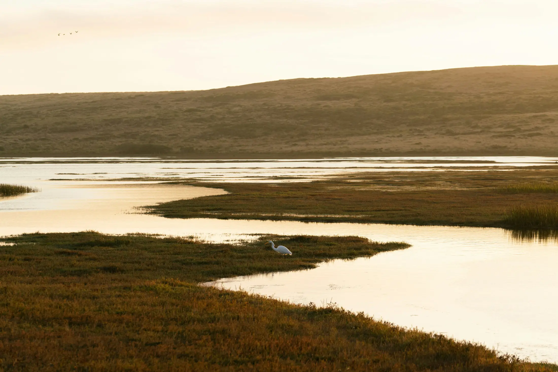
Wetlands protect against storms and store more carbon than the world's forests. Wetland inventory, assessment, and monitoring are essential tools for countries to conserve and wisely use their ecosystems. However, information on wetlands and their human services (e.g., Nature-based Solutions) is frequently dispersed, and challenging to locate and incorporate into decision making.
The Solution
The primary goal of the GEO Wetlands Initiative is to provide robust and cost-effective EO solutions for wetland inventory, assessment, and monitoring, including Wetlands-based solutions. The initiative also promotes the monitoring and reporting of SDG targets and indicators pertaining to wetlands.
Latest Developments
Wetlands inventory, monitoring and assessment constitute essential instruments for Ramsar Contracting Parties (CP) in ensuring the wise use of all their wetlands and an effective conservation and management of wetland sites of international importance. From November 10th, 2022 to November 10th, 2022. Location: Geneva, Switzerland. The 14th Meeting of the Conference of the Contracting Parties to the Ramsar Convention on Wetlands (COP14) will take place in a hybrid format in Wuhan, China, at East Lake International Conference Center (ELICC), and in Geneva, Switzerland, at the International Conference Centre Geneva (CICG). From November 5th, 2022 to November 13th, 2022.
More
Our Impact
Assessment of land transformation in the Kilombero Valley, Tanzania: Kilombero is the largest seasonal wetland in East Africa. It was chosen as a test-site in the SWOS project and different methods were applied to assess the changes that took place in the area from the 1990’s to now. Tanzanian customers received all products and conclusions. SWOS products were used as information products in the Ramsar Advisory Mission Report on Kilombero's status. In turn, authorities use these reports to estimate the ecosystem's ability to transition from traditional (and inefficient) to more modern agricultural practices. SWOS products are also used to resolve property rights disputes by determining what areas are being cultivated and when. Certain areas identified as not yet cultivated or not suitable for agriculture are being considered for protection regimes based on these products.
Satellite-based characterization of Rwandan wetlands: Remote sensing in support of sustainable wetland management: The East African country of Rwanda is also called ‘Land of the Thousand Hills’ – with just as many wetlands. The project Copernicus-based Detection and Monitoring of tropical wetlands in Rwanda (DeMo-Wetlands) was conducted at the University of Bonn and Remote Sensing Solutions GmbH from 2016 to 2019. DeMo-Wetlands adopted and successfully applied a comprehensive, flexible, and applicable approach to wetland characterization at the national scale of Rwanda. The layers formed, reflecting the complexity of wetland ecosystems, can support a variety of management issues and thus foster sustainable wetland management. A detailed wetland inventory was created, which can be used as a baseline for future wetland monitoring. Transfer of project results to other countries is desirable and is expected to be facilitated by the complementarity of wetland-related projects across the continent.
Wetlands Monitoring with Earth Observation Data in Uganda: The objective of this project is to explore the potential of Earth observation (EO) satellite data for taking stock of, and monitoring, wetlands, a vital component of the global water resources ecosystem. The final deliverables from the project include:
- Toolbox for wetland inventory mapping, based on the GlobWetland Toolbox, with extended functionality for reporting on SDG 6.6.1
- Baseline wetland inventory map for Uganda based on Sentinel-1 and Sentinel-2 data for 2016 and 2017. Validation has been performed incorporating in situ data collected by the Ministry of Water and Environment and RAMCEA.
- Online portal for SDG reporting on SDG indicator 6.6.1 on Wetland extent http://uganda-wetlands.dhigroup.com/
- Training of national stakeholders in Uganda, as well as from the other RAMCEA countries
- A “lessons learned”-document and a “Roadmap”-document for roll-out of method, toolbox and online platform to the other RAMCEA countries.
Policy Drivers
GEO-Wetlands initiative will support several international commitments to protect and restore wetlands, including the Ramsar Convention on Wetlands, the Sustainable Development Goals, specifically SDG Target 6.6 on water-related ecosystems, the Convention on Biological Diversity (CBD), and the UN Framework Convention on Climate Change (UNFCCC).
Our Partners
Participating Organizations
Non-affiliated
Governance
GEO-Wetlands has a bottom-up governance and management structure. Top-down guidance derived from interactions with key stakeholders and user networks supplements the bottom-up approach. The GEO-Wetlands secretariat, which currently exists as a virtual secretariat led by the University of Bonn, Wetlands International, and ESA, oversees the overall coordination of the initiative.
Working Groups:
- Capacity building: Capacity building is at the heart of the GEO-Wetlands initiative because it will be critical to achieving the main objectives of engaging, advocating, and delivering.
- Mangroves: Mangrove Working Group brings together experts in mangrove remote sensing to support mangrove conservation and restoration around the world.
One goal for the next years is to strengthen these structures e.g. by establishing a formalized advisory committee and by acquiring resources for setting up a more permanent secretariat.