In 2015, the World Economic Forum identified a lack of freshwater resources as the most significant global risk for the next decade. There is a scarcity of accurate streamflow indicators and forecasts, which are critical in disaster preparedness and response, as well as cloud computing for governments in developing countries with limited budgets.
The Solution
The Global Water Sustainability Initiative (GEOGloWS) is an International Effort and user-driven initiative that aims to assist scientists and organizations in addressing the multidisciplinary challenges associated with achieving global water sustainability. The combination of modern computing technologies with hydrologic sciences and satellite enabled by web services and cloud computing is the key innovation.
Services:
streamflow forecast
water fraction maps using in-situ streamflow data
VIIRS-generated water fraction map
Our Impact
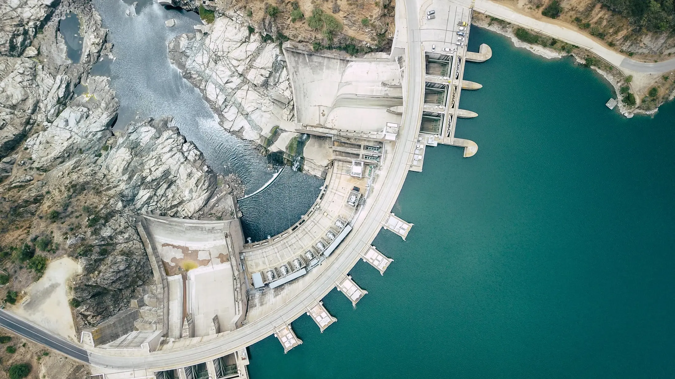
In 2020, the National Electric Energy Company of Honduras (Empresa Nacional de Energía Eléctrica: ENEE) used data from the GEOGloWS ECMWF streamflow forecast service to reduce loss and damage in the Sulla Valley. Equipped with forecasts, ENEE made controlled water discharges from a reservoir between two significant hurricanes: category 4 Hurricane Eta on 2 November 2020 and Category 5 Hurricane Iota on 16 November 2020. The Earth observation-based analysis was also shared with the country’s National Disaster Risk Reduction agencies, informing decisions on community evacuations. The damage to Sula Valley was considerably reduced by the decisions made by ENEE based on its EO enhanced analysis. Compared to the estimated economic losses caused by Hurricane Mitch (Category 5) in 1998 (US $3,793.6 million), the combined losses of Hurricanes Eta and Iota (US $2,171 million) were reduced by 40%.
In January 2022, Cyclone Ana hit Malawi, which caused severe flooding across the country. Through resources that included the GEOGloWS-ECMWF streamflow forecast service deployment and cooperation with local authorities and international partners, losses and damages were limited.
GEOGloWS is governed by a Steering Committee, which provides the vision, strategy, policy, and guidance for GEOGloWS. The management structure of GEOGloWS relies on two primary management components: An Executive Board/Steering Committee, and a Leadership Team. The work is carried out by members of Working Groups, who have representation on the Leadership Team.
Contacts
For more information about the GEO Global Water Sustainability explore the website