
Moderator,Programme Board
The objective of this presentation is to show how advances in Earth observation, hydrological modeling and machine learning enable the operational scaling of parametric flood insurance. While parametric solutions are widely used for several natural hazards, flood risk remains challenging due to its spatial complexity and strong local variability. This session aims to demonstrate how these challenges can be addressed through an integrated scientific and insurance driven approach.

The specific measures of China's FengYun meteorological satellites supporting UN's Early Warning for All initiative will be introduced. FengYun satellites serve for global meteorological disaster prevention and mitigation, using systemic coordinated observations to detect meteorological elements and extreme weathers efficiently . Powered by AI, FengYun satellites develop the full-chain operational solution, offering near real-time monitoring and emergency response service for the international community.
Do you need rapid access to current and historic satellite imagery anywhere in the world? This showcase presents a free, open-source web application. It provides intuitive exploration and dynamic analysis of global Earth observation data—including Landsat 4–9, Sentinel-1 and 2, and annual land cover products. With no login or credentials required, users can visualize and analyze decades of imagery in seconds.
Whether you want to compare flood extents across years, analyze 40 years of wildfire history, create urban change videos for African cities, explore crop history, or investigate current events like Caribbean oil spills, this platform empowers you to find answers quickly.
Features include:
The presentation will feature live demonstrations, and share QR codes to access the apps and tutorials for hands-on exploration. Join us to discover how easy it is to extract actionable Earth intelligence — no technical barriers, just insight.

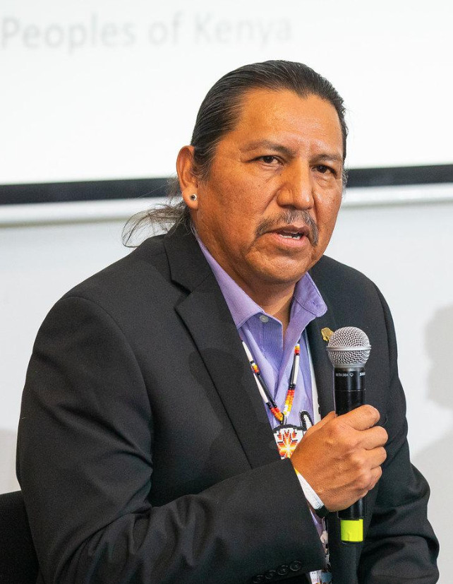
The GEO Indigenous Alliance, in collaboration with Space4Innovation and with support from Environment and Climate Change Canada, will showcase complementary work on relational ecological values and ethical AI governance for biodiversity monitoring. Presented by James Rattling Leaf Sr., the showcase will introduce a pilot methodology for identifying relational values within biodiversity observation systems, alongside practical elements from the Indigenous-led Ethical AI Biodiversity Toolkit. Together, these resources explore how Indigenous knowledge, governance, consent, accountability, and interpretation can inform EO and AI-enabled biodiversity systems without reducing Indigenous relationships with land, species, and ecosystems to extractive data points. The showcase will highlight how these tools can support GEO priorities in ecosystems, biodiversity, carbon management, and open knowledge infrastructure, while opening pathways for responsible testing, adaptation, and collaboration with GEO partners.
As a GEO Work Programme pilot, GEOARC Showcase will report recent progress and achievements of GEOARC, including its 16m global LULC products, the Asia-Oceania Environmental Monitoring (AOEM) platform, successful TG7 session of AOGEO, and future development priorities.
It will promote the openness and interoperability of shared data for ecosystem monitoring, mapping, and assessment by showcasing high-quality Chinese Earth observation and geospatial datasets, supporting data integration, and improving data accessibility and sharing.
The showcase will strengthen capacity building for developing countries in ecosystem mapping and data application by presenting joint activities with Cambodia, Pakistan, Ghana, and the Asian Disaster Preparedness Center (ADPC), as well as the Young Scholars Exchange Program and technical training initiatives.
It will also support the development of the GEO Ecosystem Atlas through strengthened collaboration on data contribution, alignment with the IUCN Global Ecosystem Typology, joint map validation, and Chinese satellite data integration, to advance global ecosystem monitoring, reporting under the Global Biodiversity Framework, and the achievement of SDGs.
