12 innovative Earth observation applications for health in the Americas
At the cutting edge of science, breakthroughs happen when disciplines connect. Earth and health sciences are coming together like never before, using the power of satellites, models, algorithms, cloud platforms and artificial intelligence to tackle today’s most pressing health risks.
In a series of flash talks during the fifth Special Edition: Focus on AmeriGEO webinar, the GEO Health Community of Practice (CoP) and AmeriGEO leadership highlighted pioneering research applications that are transforming how we detect, monitor and respond to threats ranging from disease outbreaks and heat extremes to air pollution.
Visit the GEO Health CoP event website for more information about all the projects mentioned in this article.
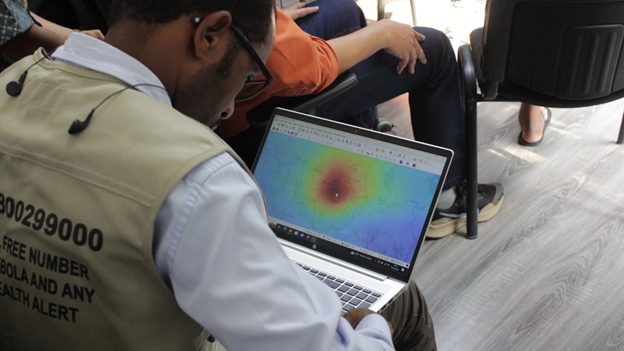
1. Developing a malaria early warning system in Panama and Honduras
Harnessing satellite data, researchers are building predictive models for malaria in data-scarce regions, supporting timely preparation and response.
Presented by William Pan, Duke University
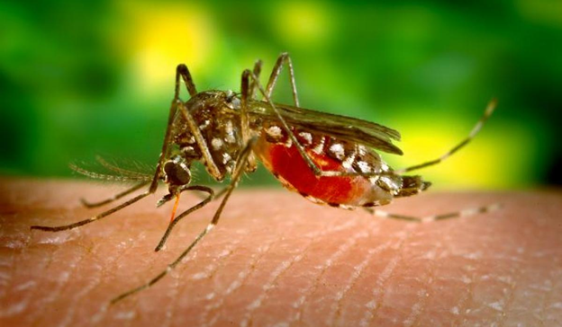
2. West Nile virus forecasting in Louisiana and South Dakota
Researchers are exploring wind as a crucial environmental driver in developing regionally tailored early-warning systems and public health strategies to reduce West Nile virus risk.
Presented by Eric Bump, University of Oklahoma
3. Analyzing humid heatwaves in Mississippi
By analysing emerging heatwave hotspots, researchers can increase precision in identifying geographic regions with increased risk of heat-related illness, which can aid in targeted interventions.
Presented by Salit Chakma, University of Mississippi Medical Center
4. Turning ocean intelligence into global health protection
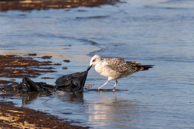
The Poseidon Plastic Tracking System uses geospatial AI analytics based on satellite data, ocean current modelling, health outcomes, social data, and population dynamics, offering a blueprint for turning ocean intelligence into real protection for people worldwide.
Presented by Ajay K. Gupta, HSR.health
5. Fostering collaboration with Earth observation training and tools
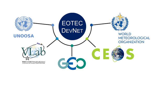
EOTEC DevNet’s network of networks model connects nearly 2,000 capacity builders and subject matter experts to develop and share training resources, including a flood tools tracker, global use case analysis, and a communications platform.
Presented by Yasha Moz, NASA Headquarters (Booz Allen Hamilton)
6. Empowering Geohealth with an open-source platform
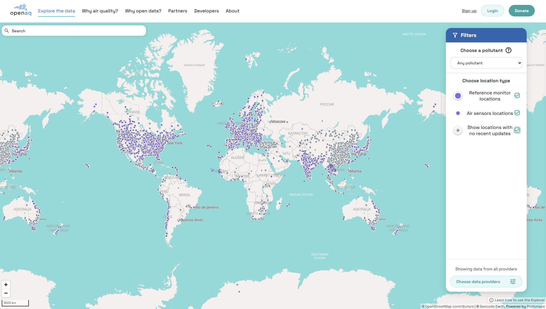
OpenAQ is an open-source platform that provides ground-level air quality data collected from reference monitors and air sensors accessible through the OpenAQ Explorer, API, R Client, and Python SDK, supplemented by Geohealth use cases and examples.
Presented by Colleen Rosales, OpenAQ
7. Measuring air pollution burden and health impacts in Texas
Researchers, in partnership with the Texas Harris County Public Health Department, evaluated the feasibility of using Earth observation data to measure air pollution and incorporated social vulnerability data and local health outcomes to identify communities at higher risk of air pollution exposures worsening respiratory health.
Presented by Caroline Crystal & Chanmi Lee, NASA DEVELOP at NASA Ames Research Center)
8. Quantifying methane concentrations produced by landfills in New Hampshire
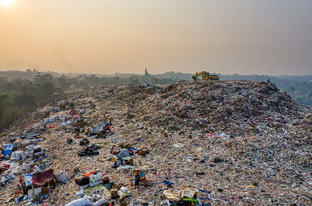
Researchers, working with the New Hampshire Department of Environmental Services’ Air Resources Division, assessed whether Earth observation data (Sentinel-5P TROPOMI and ISS EMIT) could be used to improve methane monitoring at landfills across the state.
Presented by Chloe Alimurong and Ana Chavez, NASA DEVELOP at Massachusetts-Boston Node
9. Examining the impacts of greenspace on children’s sleep

Researchers in Rhode Island are studying how exposure to green space relates to children’s sleep, while also considering the effects of weather and air quality.
Presented by Jue Yang, Brown University
10. Air quality forecasting to produce localized early warnings for Brazil

Using the Google Earth Engine cloud computing platform with satellite data and models, researchers are developing a sub-city-scale air quality forecasting system tailored for Rio de Janeiro’s health and air quality managers.
Presented by Carl Malings, NASA Goddard Space Flight Center & Morgan State University, and Nathan Pavlovic, Sonoma Technology
11. Enabling access to air quality forecasts in the Americas
Led by the World Resources Institute in collaboration with NASA Global Modeling and Assimilation Office (GMAO), CanAIRy Alert provides a web application that provides 21 cities across the Global South with access to a bias-corrected Goddard Earth Observing System Composition Forecast (GEOS-CF).
Presented by Beatriz Cárdenas, World Resources Institute
12. Examining air quality in Mexico

Researchers are using remote sensing and epidemiological data to determine geographic areas in Mexico that lack air monitoring network coverage.
Presented by Xanat Antonio-Némiga & Angelica Neria-Hernández, Autonomous University of the State of Mexico
Understanding the environmental factors that increase exposure to harmful pollutants or pathogens is essential to mitigate public health risk.
Scalable, data-driven solutions offer valuable information for air quality, environmental, and health scientists and managers to make prompt, cost-effective decisions for their communities.
Learn more about how you can become involved, contribute your expertise, and expand your professional networks in the GEO Health CoP.